Beni River
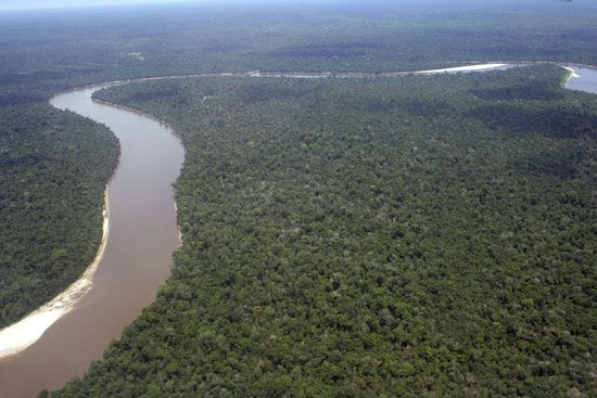
The Beni River is a major waterway in Bolivia that originates from various confluents in the northern Cordillera Real, located north of La Paz.
What is Beni River?
The Beni River is a major waterway in Bolivia that originates from various confluents in the northern Cordillera Real, located north of La Paz.1
Spanning approximately 1,000 miles (1,600 km), the river flows northeast through the dense forests of the Yungas and across the plains. Key features of its course include:1
- Confluence: It is joined by the Madre de Dios River at Riberalta.1
- Junction: It meets the Mamoré River at Villa Bella on the Brazilian border.1
- Formation: Together, the Beni and Mamoré rivers form the Madeira River, which marks Bolivia’s extreme northeastern border.1
The river supports steam navigation during high-water periods (December to May) between Rurrenabaque and the Esperanza rapids, as well as into the upper Amazonian plain.1
What is the role of the Madeira River in the Amazon basin?
The Madeira River serves as a vital artery within the Amazon basin, functioning as the second-largest affluent of the Amazon River.23
Its primary roles and characteristics include:
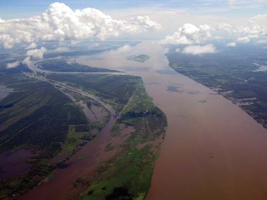
- Sediment Transport: Originating in the tectonically active Andes, the Madeira is classified as a “whitewater” river. It carries heavy loads of silt, which have significantly shaped the landscape, including the formation of the 200-mile-long island of Tupinambarana at its confluence with the Amazon.3
- Hydrological Contribution: It provides a substantial discharge, estimated at approximately two-thirds that of the Negro River.3
- Transportation and Access: The river is navigable by seagoing vessels for over 800 miles from its mouth. Historically, its upper reaches—fed by the Beni, Mamoré, and Madre de Dios rivers—provided essential access to the rubber-rich forests of the Bolivian Oriente.23
- Economic and Human Geography: The river valley has long supported traditional inhabitants, including indigenous peoples and mestizos, and has seen increased settlement by farmers and ranchers in the 20th century.2
How does the geography of the Andes affect rivers in Bolivia?
The geography of the Andes is the primary driver of Bolivia’s complex drainage patterns, dictating where water flows and how the landscape is shaped.45
Amazonian Headwaters
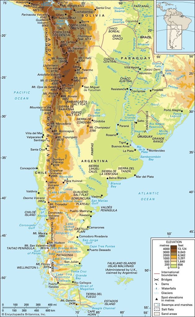
In the north and northeast, the Andes act as a massive water source. Rivers such as the Beni and Mamoré originate in the high, snowcapped slopes of the Cordillera Real and the Apolobamba range. The descent from these peaks to the eastern plains is extremely precipitous, plunging through the rugged, forested Yungas region. These headwaters cut deeply into the mountains, carrying immense quantities of sediment that have filled the Amazon basin with alluvial depositsAmazon basin](https://www.britannica.com/place/Amazon-Basin) with alluvial deposits.456
Inland Drainage
In the west, the Andes create a high-altitude barrier that traps water within the Altiplano. This region features an isolated, inland-draining system centered on Lake Titicaca and Lake Poopó. Because the surrounding land is exceptionally flat, these lakes are highly sensitive to climate fluctuations, with their shorelines and existence shifting significantly based on rainfall cycles and global warming.4
Southern Systems
In the south, the Andes transition into the Puna, a high, tilted block. Rivers like the Pilcomayo originate near Sucre and Potosí, cutting southeastward across the Puna before entering the Gran Chaco plains.4
What are the main ecosystems found in the Yungas region?
The Yungas region, located on the eastern slopes of the Bolivian Andes, is characterized by a humid, subtropical climate that supports diverse and lush ecosystems. The primary ecosystems found in this region include:
- Mountain Rainforest: The region is famously clad in luxuriant mountain rainforests. These forests are home to an enormous variety of tropical hardwoods, fruit trees, and medicinal or aromatic plants. Characteristic vegetation includes cedar, laurel, and the tarco tree, which is known for its masses of yellow-white flowers.9
- Cloud Forest: At elevations starting around 6,000 feet (1,800 meters), the humid conditions created by rising air from the Amazon basin foster the development of dense cloud forests. These ecosystems are defined by thick undergrowth and an abundance of epiphytes, which thrive in the constant moisture.10
- Biodiverse Flora: The region hosts a wide array of specialized plant life, including the coca shrub and the cinchona (or quina) tree, which is the source of quinine. Other notable species include the saúco, used for medicinal syrups, and the aliso, a shrublike tree.9
These ecosystems are highly sensitive to human activity, as logging and agricultural expansion continue to place significant strain on the forested areas of the Yungas.9
Sources
- Beni River — Encyclopædia Britannica
- Madeira River — Encyclopædia Britannica
- Amazon River - Physiography of the river course — Encyclopædia Britannica
- Bolivia - Drainage of Bolivia — Encyclopædia Britannica
- Peru - Lakes and rivers — Encyclopædia Britannica
- Bolivia - Climate of Bolivia — Encyclopædia Britannica
- Amazon River - Landforms and drainage patterns — Encyclopædia Britannica
- Bolivia - Relief — Encyclopædia Britannica
- Andes Mountains - Plant and animal life — Encyclopædia Britannica
- Bolivia - Plant life — Encyclopædia Britannica
- Yungas — Encyclopædia Britannica
- South America - Mountain vegetation — Encyclopædia Britannica
- Exploring 7 of Earth’s Great Mountain Ranges - Andes — Encyclopædia Britannica
- Andes Mountains - Climate — Encyclopædia Britannica
Published on · 3 min read