Ca River
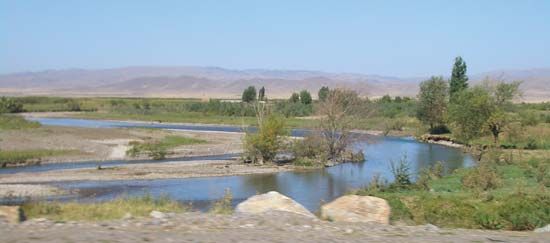
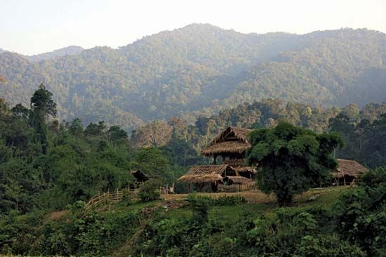
The Ca River is a 380-mile (612-km) waterway that originates in the Loi Mountains of Laos. It flows southeast through northern Vietnam, eventually emptying…
What is Ca River?
The Ca River is a 380-mile (612-km) waterway that originates in the Loi Mountains of Laos. It flows southeast through northern Vietnam, eventually emptying into the Gulf of Tonkin near the city of Vinh.1
The river’s coastal lowlands are characterized by wide, level stretches of alluvium, similar to the geography of the Red River. The delta region is notable for its high population density, and the area is geographically distinct from the nearby Ma and Chu river deltas due to a range of basaltic hills to the north.1
What is the significance of the Gulf of Tonkin?
The Gulf of Tonkin is a northwest arm of the South China Sea, bounded by China, Hainan Island, and northern Vietnam. Beyond its role as a vital shipping route and a site for modern oil exploration, the gulf holds significant historical weight due to the 1964 Gulf of Tonkin incident.2
Following reports of alleged North Vietnamese attacks on U.S. destroyers, the U.S. Congress passed the Gulf of Tonkin Resolution in August 1964. This resolution provided the constitutional authorization for the massive escalation of U.S. military involvement in the Vietnam War. military involvement in the Vietnam War. It is now widely recognized that the resolution was based on a misinterpretation of events, as evidence for the second reported attack was inconclusive and the context of U.S.-sponsored raids was largely obscured from the public and Congress. The resolution was eventually repealed in 1970 as public disillusionment with the war grew.23
How do river deltas support high population densities?
River deltas have historically supported high population densities primarily due to their exceptional agricultural productivity. Since prehistoric times, the sands, silts, and clays deposited by floodwaters have created fertile soils that allow for intensive cultivation.6
The significance of these regions is rooted in several key factors:
- Agricultural Fertility: The deposition of nutrient-rich silt by river floodwaters maintains soil fertility, which is essential for sustaining large populations of farmers. Historically, major civilizations flourished in the deltaic plains of rivers like the Nile and the Tigris-Euphrates because of this natural replenishment.76
- Resource Access: Deltaic plains provide abundant water for irrigation and other human needs. In regions like the Nile floodplain, the relationship between the people and the river is intense, with high population densities—sometimes exceeding 3,320 people per square mile—relying on careful management of these water and land resources.7
- Economic Potential: Beyond agriculture, modern geological exploration has revealed that many of the world’s petroleum resources are located in ancient deltaic rocks, further increasing the economic importance of these regions.6
What are the main geographical features of Vietnam?
Vietnam’s geography is defined by a diverse landscape of mountains, plateaus, and extensive river deltas. The country’s primary physiographic features include:
- The Annamese Cordillera: This principal mountain range dominates the interior, extending northwest to southeast and acting as a drainage divide between the Mekong River and the South China Sea. It features rugged terrain, deep valleys, and several plateaus, such as the Kontum and Dac Lac plateaus in the south.1112
- River Deltas: Two major alluvial deltas serve as the agricultural heartlands of the country. The Red River delta in the north is a densely populated, triangular region formed by heavy silt deposits. In the south, the Mekong River delta covers approximately 15,400 square miles, forming an expansive, low-lying alluvial plain.111314
- Coastal Plains: A long, relatively narrow coastal plain stretches between the northern and southern deltas, separating the Annamese Cordillera from the sea.1115
- Northern Uplands: North of the Red River, the terrain is characterized by moderate relief, limestone terraces, and low hills, with the northeast coast featuring hundreds of limestone islands.11
Sources
- Ca River — Encyclopædia Britannica
- Gulf of Tonkin — Encyclopædia Britannica
- Gulf of Tonkin Resolution — Encyclopædia Britannica
- Tonkin, Gulf of — Merriam-Webster
- Vietnam War - The Gulf of Tonkin — Encyclopædia Britannica
- river - Morphology of deltas — Encyclopædia Britannica
- delta — Encyclopædia Britannica
- pollution in India - Pollutant buildup in rivers — Encyclopædia Britannica
- river - Deltas — Encyclopædia Britannica
- Nile River - People — Encyclopædia Britannica
- Vietnam - Relief — Encyclopædia Britannica
- Vietnam - Drainage — Encyclopædia Britannica
- Vietnam: Top Questions — Encyclopædia Britannica
- Red River — Encyclopædia Britannica
- Annamese Cordillera — Encyclopædia Britannica
Published on · 3 min read