Concepción Volcano
Concepción Volcano is a prominent volcanic cone located in southwestern Nicaragua. It forms the northern half of Ometepe Island, which is situated within…
What is Concepción Volcano?
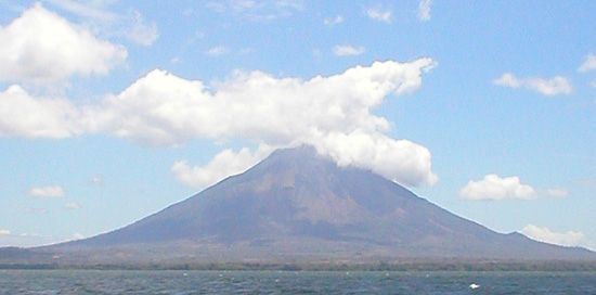
Concepción Volcano is a prominent volcanic cone located in southwestern Nicaragua. It forms the northern half of Ometepe Island, which is situated within Lake Nicaragua.12
Rising to an elevation of 5,282 feet (1,610 meters), Concepción is recognized as one of the most active volcanoes in the country. It is characterized by frequent eruptions, with its first recorded volcanic activity dating back to 1883. Together with the Madera volcano, which forms the southern portion of the island, Concepción contributes to the unique landscape that makes Ometepe a significant destination for tourism and archaeological interest.12
How does Madera Volcano differ from Concepción?
Madera and Concepción are the two volcanic cones that form Ometepe Island in Lake Nicaragua, but they differ significantly in their activity and physical dimensions:
- Activity Status: While Concepción is one of the most active volcanoes in Nicaragua with frequent eruptions, the Madera Volcano is dormant.31
- Elevation: Concepción is the taller of the two, rising to 5,282 feet (1,610 meters), whereas Madera reaches an elevation of 4,573 feet (1,394 meters).31
- Location: Concepción comprises the northern half of Ometepe Island, while Madera forms the southern half.31
What is the significance of Lake Nicaragua?
Lake Nicaragua, also known as Cocibolca, is the largest lake in Central America and a dominant physical feature of Nicaragua. Its significance stems from several unique characteristics:
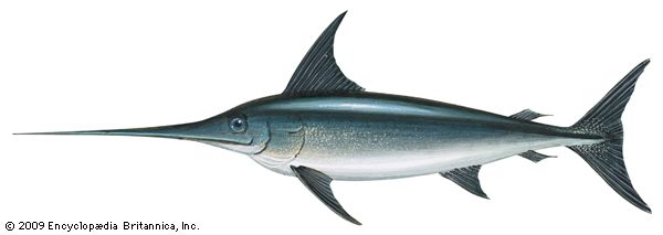
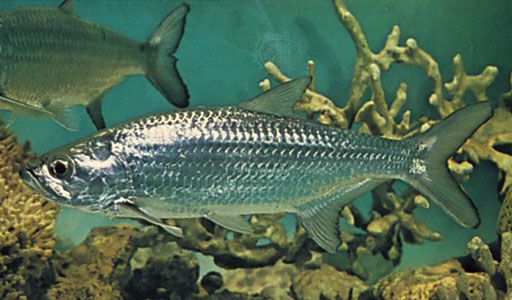
- Biological Uniqueness: Originally part of an ocean bay, the lake was isolated by volcanic activity. As the water transitioned from salt to fresh, oceanic species—including sharks, swordfish, and tarpon—adapted to the environment, making it the only freshwater lake to host such life.4
- Geographical Importance: Covering 3,149 square miles, it serves as a major hydrological hub, fed by over 40 rivers and drained by the San Juan River, which flows into the Caribbean Sea.4
- Historical and Economic Potential: The lake has long been central to discussions regarding a trans-Nicaragua canal. During the 19th century, it served as a vital transit route for gold prospectors traveling to California via the Vanderbilt Road.4
- Archaeological Value: The lake contains over 400 islands, most notably Ometepe, a major site for pre-Columbian statuary and ceramics.4
How do volcanoes shape the landscape of Nicaragua?
Volcanoes are a defining feature of Nicaragua’s landscape, particularly in the western region, where a string of approximately 40 volcanoes stretches northwest-southeast along the Pacific coast. These volcanic forces have shaped the country in several profound ways:6
- Geological Formation: Volcanic activity was responsible for creating the inland basin that contains Lake Nicaragua and Lake Managua. These lakes were once part of an ocean bay that became isolated as volcanic eruptions formed the surrounding land.4
- Landscape and Islands: The chain of volcanoes bisects Lake Nicaragua, leading to the formation of numerous islands, including Ometepe Island, which is formed by the Concepción and Madera volcanoes connected by a lava bridge.47
- Agricultural Productivity: While volcanic eruptions can pose hazards like ash falls, the long-term decomposition of nutrient-rich volcanic fallout produces some of the world’s most fertile soils. Consequently, these volcanic zones have become highly productive agricultural areas and centers of dense population.89
Sources
- Concepción Volcano — Encyclopædia Britannica
- Ometepe Island — Encyclopædia Britannica
- Madera Volcano — Encyclopædia Britannica
- Lake Nicaragua — Encyclopædia Britannica
- Lake Managua — Encyclopædia Britannica
- Nicaragua - Relief — Encyclopædia Britannica
- Nicaragua - Settlement patterns — Encyclopædia Britannica
- Central America - Geography and climate — Encyclopædia Britannica
- volcano - Ash falls — Encyclopædia Britannica
- Nicaragua - Drainage — Encyclopædia Britannica
Published on · 2 min read