Dixon Entrance
Dixon Entrance is a 50-mile-wide (80 km) passage located in the eastern North Pacific Ocean. It stretches eastward from the open ocean to the Hecate Strait…
What is Dixon Entrance?
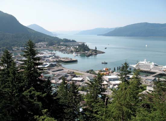
Dixon Entrance is a 50-mile-wide (80 km) passage located in the eastern North Pacific Ocean. It stretches eastward from the open ocean to the Hecate Strait in Canada. Geographically, it is bordered by the Alexander Archipelago of Alaska to the north and Haida Gwaii in British Columbia to the south.
A portion of the international border between the United States and Canada runs through this passage. Historically carved by continental glaciers, the entrance now functions as the primary maritime approach to the port of Prince Rupert. The passage was named in 1788 by Sir Joseph Banks in honor of Captain George Dixon, who navigated the area in 1787.1
What is the significance of the Alexander Archipelago?
The Alexander Archipelago is a significant group of approximately 1,100 islands located off the coast of southeastern Alaska. These islands are the tops of a submerged section of the Coast Ranges and hold importance across several domains:
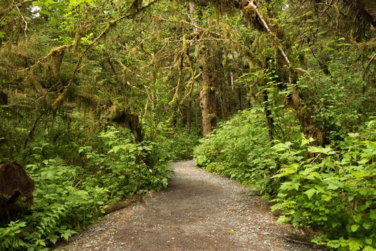
- Ecological and Protected Status: The archipelago is largely contained within the Tongass National Forest. It is part of a massive, internationally protected World Heritage site that includes Glacier Bay National Park and Preserve, as well as other national monuments like Misty Fjords and Admiralty. The region is also noted for being one of the wettest in Alaska, with annual precipitation reaching up to 300 inches.23
- Cultural Heritage: The islands were the exclusive ancestral home of the Tlingit and Haida peoples, who are renowned for their totem poles. The Sitka National Historical Park preserves significant aspects of this history.2
- Economic and Navigational Role: The archipelago supports industries such as lumbering, fishing, fur collecting, and mining. Its deep, narrow channels form a vital part of the Inside Passage, a picturesque and essential maritime route for the Alaska Marine Highway system.2
How do glaciers shape coastal geography?
Glaciers profoundly shape coastal geography through a combination of intense erosion during glacial periods and subsequent marine inundation as sea levels rise.
Erosional Impact
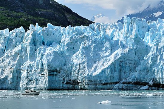
During the Pleistocene Epoch, lower sea levels allowed glaciers to descend from coastal mountains and excavate deep, U-shaped troughs into the bedrock. These features are characterized by steep walls and great depths, often extending far below current sea level. When the ice eventually melted, the sea flooded these valleys, creating fjords—long, narrow arms of the sea found in regions like Norway, Alaska, and Chile.5678
Depositional Impact
Glaciers also reshape coasts through the deposition of till and outwash sediments. For example, Long Island was framed by terminal moraines left by the Laurentide Ice Sheet, which were later reworked by coastal processes into barrier islands. Additionally, glacial-marine deltas provide evidence of postglacial sea-level changes and isostatic rebound, where land rises after the weight of the ice is removed.6
What is the history of the port of Prince Rupert?
The port of Prince Rupert, located on Kaien Island in Chatham Sound, has a history rooted in its strategic position on the Pacific coast of British Columbia. Named in 1906 after the first governor of the Hudson’s Bay Company, the settlement began as a tent town and was incorporated as a city in 1910.11
The port’s development accelerated after 1914 when it became the western terminus of the Grand Trunk Pacific Railway, now part of the Canadian National Railway network. During World War II, the port served a critical military role as a marshaling and supply base for Allied forces operating in the Aleutians and the mid-Pacific.1112
In the 1970s, the city further expanded its connectivity by becoming the western terminus of the Yellowhead Highway. Today, its ice-free harbour remains a vital hub for fishing, forestry, and mining, while also serving as a key terminal for the Alaska Marine Ferries and the British Columbia Ferry System.11
Sources
- Dixon Entrance — Encyclopædia Britannica
- Alexander Archipelago — Encyclopædia Britannica
- Arctic - History of settlement — Encyclopædia Britannica
- Alaskan mountains - Climate of the Alaskan mountains — Encyclopædia Britannica
- glacial landform - Erosional landforms of continental glaciers — Encyclopædia Britannica
- fjord — Encyclopædia Britannica
- coast — Encyclopædia Britannica
- coastal landforms - Landforms of erosional coasts — Encyclopædia Britannica
- glacial landform - Glaciolacustrine deposits — Encyclopædia Britannica
- Quaternary - Landforms — Encyclopædia Britannica
- Prince Rupert — Encyclopædia Britannica
- Rupert River — Encyclopædia Britannica
- British Columbia - Transportation and telecommunications — Encyclopædia Britannica
Published on · 3 min read