Drumlin
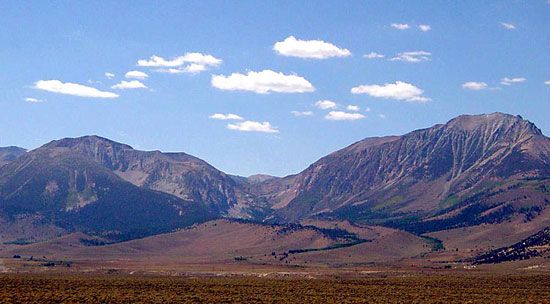
Drumlins, moraines, and eskers are distinct glacial landforms categorized by their composition and the processes that created them.
What is the difference between a drumlin and other glacial landforms like eskers or moraines?
Drumlins, moraines, and eskers are distinct glacial landforms categorized by their composition and the processes that created them.
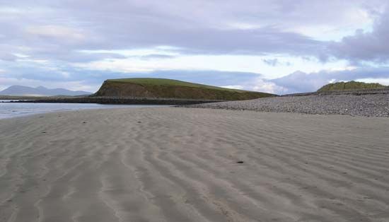
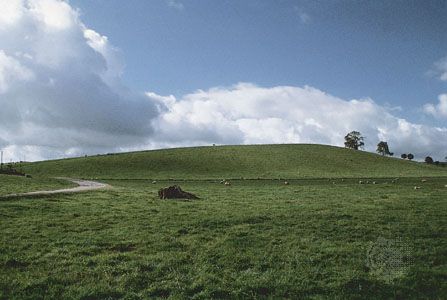
- Drumlins are streamlined, oval, or elongated hills composed primarily of till—an unstratified mixture of rock debris. They form subglacially, with their long axes aligned parallel to the direction of ice flow. A key diagnostic feature is their profile: the “stoss” (glacier) side is high and steep, while the “lee” side tapers gently.123
- Moraines are accumulations of till deposited directly by a glacier. Unlike drumlins, which are streamlined mounds, moraines often form linear, ridgelike features that mark the margins or positions of a glacier. For example, terminal moraines represent the outermost edge of an ice advance, while ground moraines consist of a broader, irregular blanket of till.423
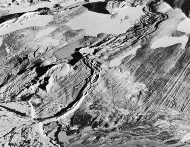
- Eskers differ significantly because they are glaciofluvial deposits rather than till. They are sinuous, steep-walled ridges formed by streams flowing in subglacial tunnels. As the ice melts, these channel deposits remain as long, winding ridges of stratified sand and gravel.35
How do drumlins help geologists understand past ice flow directions?
Geologists use drumlins as reliable indicators of past ice movement because these streamlined, elongated mounds are shaped directly by the flow of glaciers over till or bedrock.31
Their utility in reconstructing ice flow is based on two primary characteristics:
- Alignment: The long axis of an individual drumlin is typically oriented parallel to the direction of regional ice flow. By mapping the orientation of these features within a drumlin field, geologists can determine the specific path the ice sheet took across the landscape.31
- Asymmetry: Drumlins exhibit a distinct profile that reveals the direction of movement. The “stoss” side—the side facing the oncoming ice—is characteristically high and steep, while the “lee” side tapers gently in the direction the ice was traveling.31
Additionally, the internal composition of many drumlins displays a “fabric” where the long axes of individual rocks and sand grains are aligned parallel to the ice flow, providing further evidence of the forces exerted by the overriding ice.3
What are the typical characteristics of drumlins in terms of shape and size?
Drumlins are characterized by their streamlined, oval, or elongated shapes, which are formed by the movement of glacial ice over till or bedrock. Their physical profile is distinct, featuring a high, steep “stoss” side (facing the oncoming glacier) and a smooth, gently tapering “lee” side that points in the direction of ice flow.13
Regarding their dimensions, drumlins vary widely but typically fall within the following ranges:
While most are composed of till, some may contain significant amounts of gravel or feature a bedrock core draped in till. They are rarely found in isolation, often appearing in large clusters known as drumlin fields that can number in the thousands.13
How long does it take for a drumlin to form?
The exact timeframe required for a drumlin to form is not definitively established in current geological science. While it is known that these streamlined mounds of till develop subglacially near the margins of an ice sheet, the precise duration of the process remains a subject of ongoing study.13
Geologists have observed that drumlins often form directly down-ice from large lake basins that were overridden by advancing ice, suggesting a relationship between subglacial conditions and their development. However, because these features are created beneath active glaciers, observing their formation in real-time is extremely difficult, leaving the specific rates of accumulation and shaping as an area of active research.3
Sources
- drumlin — Encyclopædia Britannica
- moraine — Encyclopædia Britannica
- glacial landform - Depositional landforms of continental glaciers — Encyclopædia Britannica
- Quaternary - Landforms — Encyclopædia Britannica
- glacial landform - Glaciofluvial deposits — Encyclopædia Britannica
- glacial landform - Rock drumlins — Encyclopædia Britannica
Published on · 3 min read