Ennedi
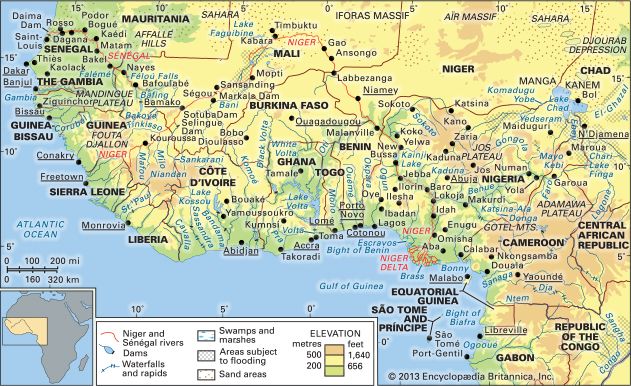
Ennedi is a plateau region located in northeastern Chad, central Africa, centered around the town of Fada. Geographically, it serves as a northeastern rim of…
What is Ennedi?
Ennedi is a plateau region located in northeastern Chad, central Africa, centered around the town of Fada. Geographically, it serves as a northeastern rim of the Chad Basin, a vast depression in Central Africa.12
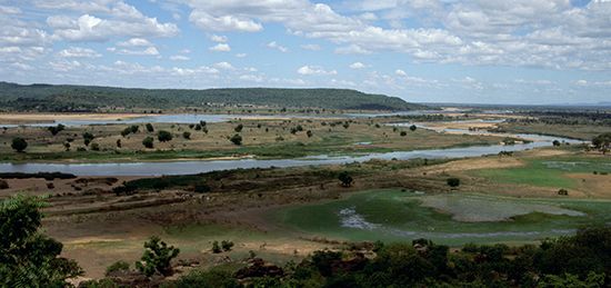
The terrain of the Ennedi region is primarily arid desert, characterized by sandstone peaks that reach elevations of up to 4,756 feet (1,450 meters). Despite the harsh environment, the area supports abundant wild game.1
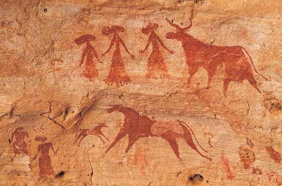
The region is home to a sparse population of semi-nomadic people, primarily Muslims who speak the Dazaga dialect. These residents maintain a seasonal lifestyle, living in permanent villages during the rainy months (July through September) and dispersing during the dry season to manage herds of camels, horses, donkeys, sheep, and goats. Agriculture, including the cultivation of dates, wheat, millet, and barley, is supported by the region’s oases. Historically, the area was considered difficult to govern, leading to a period of French military administration that lasted until 1965.1
What is the significance of the ancient Mega-Chad sea in the region’s history?
The ancient sea known as Mega-Chad is of profound significance to the geological and environmental history of the Chad Basin. Occupying a vast depression in Central Africa, this prehistoric body of water once covered approximately 154,400 square miles (400,000 square km) and reached depths exceeding 600 feet (180 meters) at its maximum extent.42
The significance of Mega-Chad lies in its role as the primary physiographic influence on the region:
- Geological Record: The sea’s history is preserved in the stratigraphic record through thick layers of diatomaceous earth, lacustrine sands, and terraced shorelines. These deposits, along with the remains of fish and mollusks found in now-arid tracts, provide critical evidence of the region’s dramatic climatic shifts.4
- Hydrological Connectivity: During its high stages, Mega-Chad was not an isolated basin; it drained into the Atlantic Ocean via the Benue River system, connecting the interior of the continent to the coast.42
- Landscape Formation: As the sea receded, it left behind extensive dune systems that had been flooded, which now form linear islands within the modern Lake Chad.2
How do semi-nomadic groups adapt to life in the Sahara desert?
Semi-nomadic groups in the Sahara have developed sophisticated strategies to survive in one of the world’s most challenging environments. Their adaptation relies on a combination of mobility, economic diversification, and the strategic use of limited resources.910
Pastoralism and Mobility
The core of semi-nomadic life is pastoral nomadism, where groups move cyclically within established territories to locate sufficient pasturage for their livestock. While cattle are kept in the moister southern borderlands, sheep, goats, and camels serve as the primary livestock in the desert interior due to their hardiness. This mobility allows groups to respond to environmental fluctuations, such as droughts, by migrating to find better grazing conditions.119
Economic Diversification
Adaptation is further supported by a flexible economic approach:
- Agriculture: Many semi-nomadic groups practice agriculture between their seasonal migrations, cultivating crops such as barley, wheat, and millet.11
- Oasis Integration: Groups often maintain ties to oases, where they trade livestock products for grain and other goods produced by sedentary agriculturalists.1011
- Trade: Historically, the greater mobility of nomads facilitated their involvement in trans-Saharan trade, allowing them to secure essential resources by transporting goods between population centers.910
What are the main differences between a plateau and a mountain massif?
The primary distinction between a plateau and a mountain massif lies in their topography and structural formation.
Plateau
A plateau is an extensive area of elevated land characterized by low relative relief and a remarkably flat surface. While plateaus stand at a higher elevation than the surrounding terrain, they are defined by their horizontal consistency. They are typically bounded by steep slopes known as escarpments, though some may be enclosed by mountains. Plateaus are formed through processes such as volcanism, crustal shortening, or thermal expansion of the lithosphere.1516
Mountain Massif
In contrast, a massif is a principal mountain mass or a distinct block of the Earth’s crust. Unlike the broad, flat expanse of a plateau, a massif is often defined as a structural unit bounded by faults or flexures that has been displaced as a single block without significant internal change. While plateaus are noted for their flatness, massifs represent concentrated, elevated mountain structures.1715
Sources
- Ennedi — Encyclopædia Britannica
- Chad Basin — Encyclopædia Britannica
- Sahara - Physiography — Encyclopædia Britannica
- Lake Chad — Encyclopædia Britannica
- Chad - Relief and drainage — Encyclopædia Britannica
- Africa - Pleistocene and Holocene developments — Encyclopædia Britannica
- history of Chad - Early history of Chad — Encyclopædia Britannica
- Chad - History of Chad — Encyclopædia Britannica
- Sahara - People of the Sahara — Encyclopædia Britannica
- Sahara: Top Questions — Encyclopædia Britannica
- oasis — Encyclopædia Britannica
- The Sahara Was Once Green — Encyclopædia Britannica
- Sahara - Transportation — Encyclopædia Britannica
- pastoral nomadism — Encyclopædia Britannica
- plateau — Merriam-Webster
- plateau — Encyclopædia Britannica
- massif — Merriam-Webster
- plateau - Formative processes — Encyclopædia Britannica
- list of mountains - Europe — Encyclopædia Britannica
Published on · 3 min read