Komadugu Yobe River
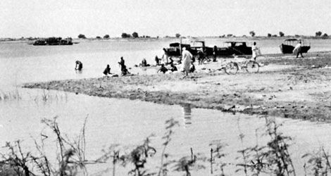
The Komadugu Yobe River is a river located in western Africa that serves as a tributary to Lake Chad.
What is Komadugu Yobe River?
The Komadugu Yobe River is a river located in western Africa that serves as a tributary to Lake Chad.1
It is formed by the confluence of the Hadejia and Komadugu Gana rivers. The river flows for a total of 200 miles (320 km) before emptying into the western end of Lake Chad. For approximately 95 miles (150 km) of its course, the river acts as the international border between Nigeria and Niger.1
What is the current environmental status of Lake Chad?
The environmental status of Lake Chad is characterized by a significant and long-term reduction in surface area. Since the 1960s, the lake has shrunk by approximately 90 percent, a decline driven by a combination of climate variability and increased water withdrawals for irrigation.2
Key factors influencing its current state include:
- Hydrological Variability: The lake’s size fluctuates seasonally and annually based on local precipitation, evaporation, and the discharge from its primary feeders, the Chari and Logone river systems.23
- Historical Decline: While the lake once covered nearly 10,800 square miles in 1870, its area in the early 21st century has typically been reduced to about 580 square miles.23
- Human and Political Challenges: Beyond environmental degradation, restoration efforts have been severely hindered by the presence of the terrorist group Boko Haram.2
- Potential Mitigation: Some research indicates that recent increases in groundwater levels may help prevent the lake from disappearing entirely, suggesting that future conservation strategies should incorporate these groundwater resources.2
How do rivers like the Hadejia support local agriculture?
Rivers like the Hadejia River play a vital role in supporting local agriculture in northern Nigeria by providing essential water resources in a region where desertification often limits available farmland.36
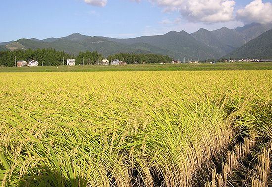
The Hadejia River valley serves as a productive agricultural corridor where farmers cultivate a variety of crops, most notably rice, which thrives in the river’s valley environment. In addition to rice, the river supports the production of staple grains such as sorghum and millet, which are essential to the regional diet.36
Beyond crop cultivation, these seasonal rivers are critical for fishing, providing a significant food source for local populations, particularly following periods of drought that have historically impacted livestock herds. The river also supports the livelihoods of local Hausa and Fulani peoples, who keep livestock such as cattle, goats, and sheep in the surrounding areas.63
What are the main geographical features of the Lake Chad basin?
The Lake Chad basin is a vast, downwarped section of the Precambrian African Shield, characterized by its unique geological history and physical structure.49
Geological and Physical Features
- Ancient Origins: The basin was once occupied by a massive ancient sea known as Mega-Chad. During the early Holocene Epoch, this sea covered approximately 130,000 square miles and reached depths of up to 550 feet.49
- Topography: The basin is rimmed by a semicircle of mountains, including the volcanic Tibesti Massif to the north, the Ennedi Plateau to the northeast, the Ouaddaï mountains to the east, and the Adamawa and Mandara ranges to the southwest.4
- Lowest Point: The basin’s floor dips toward the northeast, reaching its lowest elevation at the Djourab Depression, which sits at 573 feet above sea level.49
Hydrology
- River Systems: The basin’s drainage is dominated by the Chari and Logone rivers, which provide about four-fifths of the lake’s inflow.410
- Variability: The lake is highly sensitive to climate, with its surface area fluctuating significantly due to seasonal precipitation, evaporation, and irrigation withdrawals.103
Sources
- Komadugu Yobe River — Encyclopædia Britannica
- 6 Lakes That Are Drying Up - Lake Chad — Encyclopædia Britannica
- Lake Chad - Hydrology — Encyclopædia Britannica
- Chad - Relief and drainage — Encyclopædia Britannica
- Lake Chad - Study and exploration — Encyclopædia Britannica
- Hadejia — Encyclopædia Britannica
- Nigeria - Agriculture, forestry, and fishing — Encyclopædia Britannica
- Niger River - Irrigation — Encyclopædia Britannica
- Lake Chad - Geology and physiography — Encyclopædia Britannica
- Lake Chad - Climate — Encyclopædia Britannica
- Lake Chad — Encyclopædia Britannica
Published on · 3 min read