Galty Mountains
The Galty Mountains are a mountain range located in southern Ireland, stretching across the border between southwestern County Tipperary and southeastern…
What is Galty Mountains?
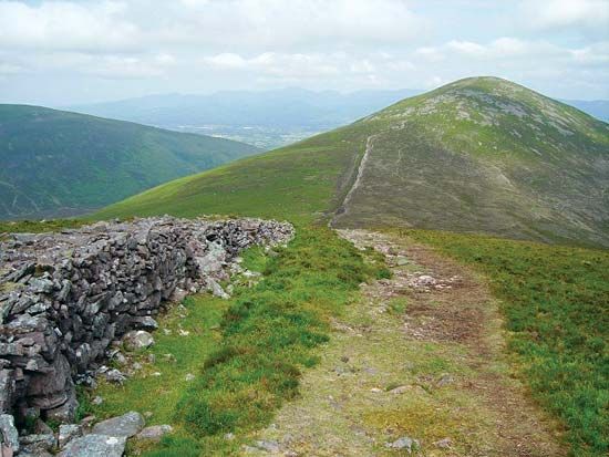
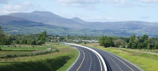
The Galty Mountains are a mountain range located in southern Ireland, stretching across the border between southwestern County Tipperary and southeastern County Limerick.1
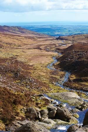
The range follows an east–west trend typical of the region’s southern landscape. Composed primarily of sandstone, the mountains reach their highest elevation at Galtymore, which stands at 3,018 feet (920 meters). The terrain provides significant evidence of past glacial activity, characterized by corries—ice-scooped basins often containing lakes—and block moraines, which are mounds of glacial debris that obstruct natural drainage.1
What is the process of glaciation?
Glaciation is the process by which glaciers form, expand, and cover the Earth’s surface. This phenomenon involves the accumulation of ice and the subsequent movement of these ice masses, which significantly reshape the landscape through erosion and deposition.234
Glacial Erosion
Glaciers move under the influence of gravity through internal deformation (creep) and basal sliding. As they move, they act as powerful abrasive systems, using rock debris embedded in their base to scour, scratch, and gouge the underlying bedrock. Additionally, glaciers perform “plucking” or quarrying, where they remove larger pieces of rock from the bed, often by exploiting existing fractures or through pressure changes. These processes create distinct landforms, such as U-shaped valleys, cirques, and horns.354
Glacial Deposition
As glaciers move, they transport debris, which is eventually deposited as the ice melts.6
- Till: Material deposited directly by ice, typically a non-stratified mixture of rock fragments, sand, and clay.76
- Meltwater Deposits (Outwash): Debris reworked and laid down by meltwater streams, resulting in stratified, sorted layers of sediment.86
These processes are cyclical, alternating between glacial stages and warmer interglacial stages.7
What are corries and how are they formed?
A corrie, also known as a cirque, is an amphitheatre-shaped basin with steep, precipitous walls located at the head of a glacial valley.1011
Formation Process
The formation of a corrie is primarily driven by the erosive power of a glacier and the following mechanisms:
- Frost Shattering: At the head of the glacier, a large crevasse known as a bergschrund separates moving ice from the stationary rock wall. In early summer, this opening exposes the rock to temperature fluctuations, causing frost action and ice wedging that disintegrate the rock and create a steep headwall.1011
- Glacial Erosion: Rock debris falls into the bergschrund or onto the glacier, where it is incorporated into the ice. As the ice moves, this debris acts as an abrasive tool, scouring and deepening the floor of the basin through glacial abrasion and plucking.1011
- Basin Development: The intense erosion often creates an “over-deepened” basin. If the glacier retreats, this depression may fill with water to form a small mountain lake known as a tarn.1011
What other mountain ranges are found in Ireland?
Ireland’s landscape is defined by a central lowland plain ringed by various coastal mountain ranges, each shaped by complex geological history and glaciation.13
Beyond the Macgillycuddy’s Reeks in the southwest, notable mountain ranges include:
- Wicklow Mountains: Located in the east, this extensive range features granite hills and is topped by Lugnaquillia.1213
- Mourne Mountains: Situated in Northern Ireland, this range is known for its granite peaks, including Slieve Donard, the highest point in Northern Ireland.14
- Galty Mountains: A sandstone range in the south that displays significant evidence of glacial activity, such as corries.15
- Other Ranges: The Blue Stack Mountains in the north, the Twelve Pins in the west, the Knockmealdown and Comeragh mountains in the south, and the Sperrin Mountains in the west of Northern Ireland.1214
Sources
- Galty Mountains — Encyclopædia Britannica
- glacial landform - Glacial erosion — Encyclopædia Britannica
- glacial stage — Encyclopædia Britannica
- glacial landform - Cirques , tarns, U-shaped valleys, arêtes, and horns — Encyclopædia Britannica
- glacier - Glacier flow — Encyclopædia Britannica
- Pleistocene Epoch - Glaciation — Encyclopædia Britannica
- glaciation — Merriam-Webster
- glacial landform - Meltwater deposits — Encyclopædia Britannica
- glacial landform - Glacial deposition — Encyclopædia Britannica
- cirque — Encyclopædia Britannica
- glacial landform - Striations — Encyclopædia Britannica
- Macgillycuddy’s Reeks — Encyclopædia Britannica
- Ireland - Relief — Encyclopædia Britannica
- Northern Ireland - Relief — Encyclopædia Britannica
- Wicklow Mountains — Encyclopædia Britannica
- Wicklow Mountains — Merriam-Webster
Published on · 3 min read