Greenland Ice Sheet
The Greenland Ice Sheet is a remarkably ancient feature of our planet. Geological records indicate its presence dating back to the Eocene Epoch…
How old is the Greenland Ice Sheet and what can it tell us about Earth’s climate history?
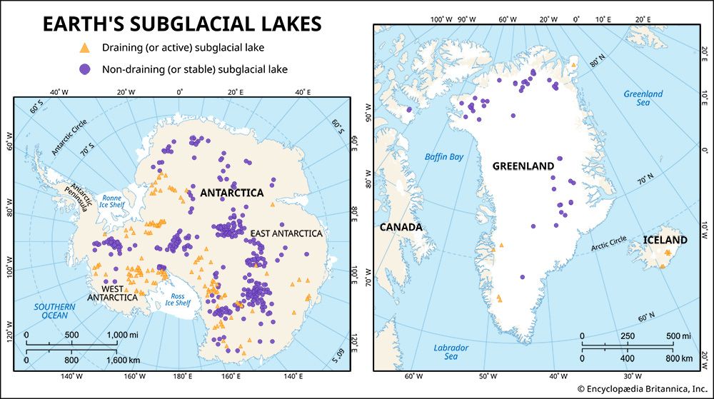
The Greenland Ice Sheet is a remarkably ancient feature of our planet. Geological records indicate its presence dating back to the Eocene Epoch, approximately 56 million to 33.9 million years ago, with evidence suggesting it has existed continuously for the past 18 million years.1
This ice sheet serves as a vital archive for Earth’s climate history. By extracting ice cores, scientists can analyze:
- Temperature and Precipitation: Ratios of oxygen and hydrogen isotopes in the ice reveal past air temperatures and moisture sources.23
- Atmospheric Composition: Air bubbles trapped within the ice provide direct samples of ancient atmospheres, showing historical fluctuations in carbon dioxide and methane levels.23
- Volcanic Activity: Concentrations of sulfate and other acids help identify major historical volcanic eruptions and their impact on global climate.3
- Environmental Conditions: Measurements of dust and microparticles offer insights into past wind patterns and atmospheric circulation.23
These records allow researchers to study paleoclimate and understand how the planet has responded to natural climate shifts over millennia.13
How might the complete melting of the Greenland Ice Sheet affect global weather patterns?
The complete melting of the Greenland Ice Sheet would have profound consequences for global weather and climate systems, primarily through its impact on ocean circulation and sea levels.
Disruption of Ocean Currents
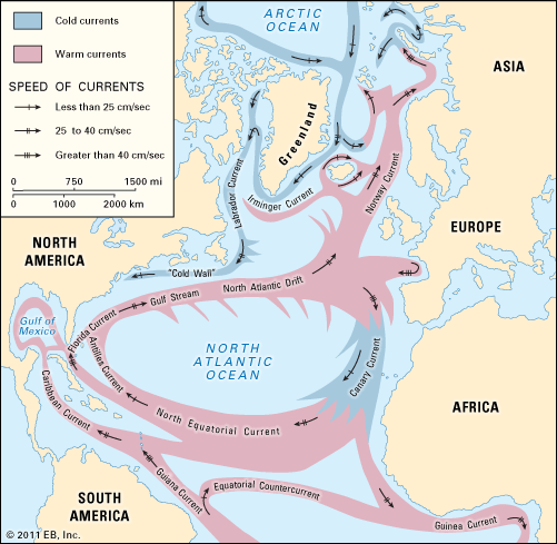
A primary concern is the potential collapse or significant weakening of the Atlantic Meridional Overturning Circulation (AMOC). As the ice sheet melts, it releases vast quantities of fresh water into the North Atlantic. This influx reduces the salinity and density of surface waters, preventing them from sinking and effectively stalling the “conveyor belt” that distributes heat globally.4
Global Climatic Consequences
The disruption of this circulation could trigger several disruptive effects:
- Regional Cooling: A weakened AMOC would likely lead to dramatic cooling in Europe, as the region would no longer receive the same volume of warm surface water via the Gulf Stream.4
- Shift in Precipitation: Rain belts could relocate, particularly in southern Africa, potentially increasing the frequency and duration of droughts.4
- Monsoon Variability: Changes in ocean heat distribution could alter the timing and intensity of the Indian monsoon intensity of the Indian monsoon.4
- Southern Hemisphere Warming: Reduced heat transport to the north may cause an increase in average temperatures across continents in the Southern Hemisphere.4
Sea Level Rise
Beyond weather patterns, the total loss of the Greenland Ice Sheet would contribute approximately 24 feet (7.4 meters) to global sea level rise, threatening to submerge numerous islands, lowland regions, and major coastal cities worldwide.51
How does the Greenland Ice Sheet compare to Antarctica’s ice sheets?
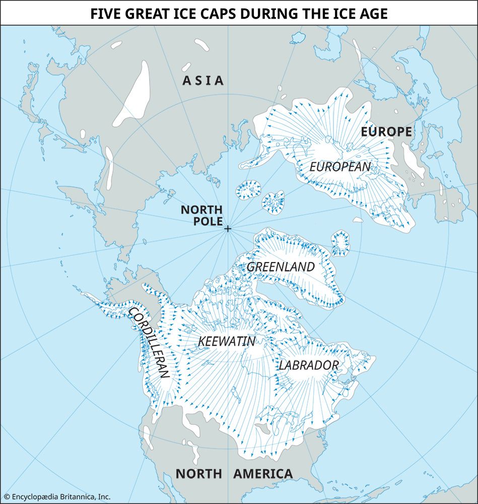
The Greenland Ice Sheet and the Antarctic Ice Sheet are the world’s two remaining great ice masses, together holding approximately 99 percent of Earth’s glacier ice. While both are critical to global climate, they differ significantly in scale, geography, and dynamics.7
Key Comparisons
Feature
Greenland Ice Sheet
Antarctic Ice Sheet
Size
~1.7 million sq km
~13.8 million sq km
Ice Volume
~2.9 million cubic km
~29 million cubic km
Global Fresh Water
~12% of world’s glacier ice
~90% of world’s ice; 80% of fresh water
Potential Sea Level Rise
~7.4 meters (24 feet)
~45–60 meters (150–200 feet)
Geography
Confined by coastal mountains
Vast, unconfined polar continent
Distinct Characteristics
- Location and Climate: Greenland’s ice sheet is located between 60° N and 80° N, making it a sub-polar feature protected by Arctic waters. In contrast, the Antarctic Ice Sheet covers a massive continent centered at the South Pole, where temperatures are significantly colder; the interior of East Antarctica experiences the coldest temperatures on Earth.83
- Accumulation: Antarctica is essentially a “cold desert,” with very low annual snow accumulation (mean of 15 cm or less). Greenland experiences higher precipitation, with a mean annual snow accumulation of about 37 cm.6
- Structure: Greenland’s ice is largely confined by peripheral mountains, whereas Antarctica features extensive ice shelves that extend over the ocean. Furthermore, much of the bedrock beneath the Antarctic ice sheet is depressed below sea level due to the immense weight of the ice.7
What is the Greenland Ice Sheet and how large is it?
The Greenland Ice Sheet is a massive body of ice covering approximately 80 percent of the island of Greenland. It is the largest ice mass in the Northern Hemisphere and the second-largest in the world, surpassed only by the ice sheet covering Antarctica.101
Regarding its size and dimensions:
- Area: The ice sheet covers roughly 1,700,000 square kilometers (about 656,000 square miles).101
- Length and Width: It extends approximately 2,220 km (1,380 miles) in a north-south direction, with a maximum width of about 1,094 km (680 miles) near its northern margin.1
- Thickness: The ice has an average thickness of about 1,500 meters (5,000 feet), reaching its greatest elevations at two primary domes that rise over 3,000 meters above sea level.101
This vast ice sheet contains about 12 percent of the world’s total glacier ice. If it were to melt completely, it is estimated that global sea levels would rise by approximately 7.4 meters (24 feet).1
Sources
- Greenland Ice Sheet — Encyclopædia Britannica
- Pleistocene Epoch - Ice-core records — Encyclopædia Britannica
- ice core — Encyclopædia Britannica
- Atlantic Meridional Overturning Circulation — Encyclopædia Britannica
- Global warming - Ice melt and sea level rise — Encyclopædia Britannica
- iceberg - Impacts on ice sheets and sea level — Encyclopædia Britannica
- ice sheet — Encyclopædia Britannica
- glacier - Accumulation — Encyclopædia Britannica
- glacier - Climatic conditions — Encyclopædia Britannica
- glacier - Greenland Ice Sheet — Encyclopædia Britannica
Published on · 4 min read