Huallaga River
The Huallaga River is a major waterway located in central and northern Peru. Originating in the Andes mountains just south of Cerro de Pasco, the river flows…
What is Huallaga River?
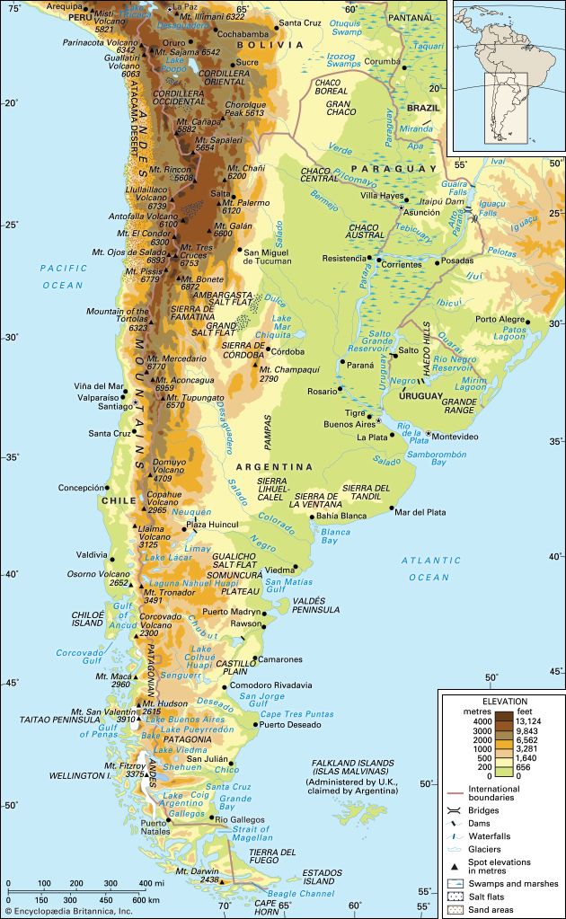
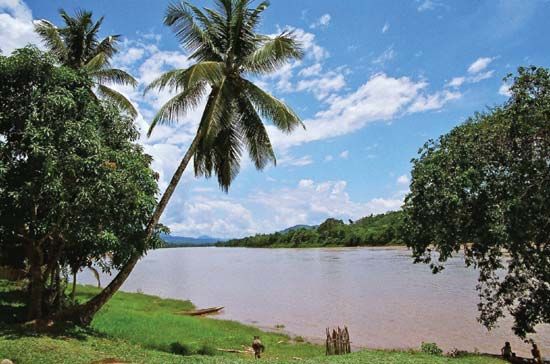
The Huallaga River is a major waterway located in central and northern Peru. Originating in the Andes mountains just south of Cerro de Pasco, the river flows in a north-northeasterly direction, passing through cities such as Huánuco and Tingo María.1
As it travels, the river carves a distinct valley between the Cordillera Central and the Cordillera Azul before entering the Amazon River basin. It eventually joins the Marañón River downstream from the town of Lagunas. While the river spans an estimated length of 700 miles (1,100 km), it is largely considered unnavigable.1
What are the major mountain ranges in Peru?
The Andes Mountains form the primary mountain system in Peru, created by tectonic activity along the western edge of South America. While often described as three distinct cordilleras—the Occidental, Central, and Oriental—these designations are not used locally within Peru.23
Key features of the Peruvian Andes include:
- Cordillera Occidental: Runs parallel to the coast and contains the Cordillera Blanca, a rugged, snowcapped range home to Mount Huascarán, the country’s highest peak at 22,205 feet (6,768 meters). To its west lies the lower, snow-free Cordillera Negra.234
- Southern Highlands: In the south, the landscape transitions into the Puna, a high plateau region with elevations between 13,000 and 16,000 feet. This area features a volcanic chain that includes Misti.2
- Mountain Knots: The ranges are connected by high-altitude plateaus known as knots, such as the Vilcanota and Pasco knots, which serve as critical junctions for the mountain chains.3
How does the Amazon River system work?
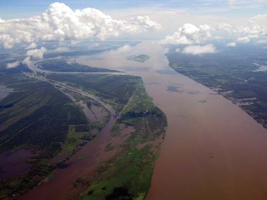
The Amazon River system is the world’s largest drainage network, carrying approximately one-fifth of all the water that runs off the Earth’s surface. Its complex operation is defined by its vast basin, diverse tributaries, and unique hydrological patterns.7
Origins and Drainage
The system originates high in the Andes Mountains of Peru, where numerous streams—including the Marañón, Ucayali, and Huallaga—flow through deep valleys before turning east toward the Atlantic Ocean. These Andean tributaries are typically “whitewater” rivers, carrying heavy sediment loads picked up from the tectonically active mountains. In contrast, other tributaries originating in crystalline highlands are classified as “blackwater” (rich in humic acids) or “clearwater” (higher mineral content).789
Hydrology and Flooding
The river’s flow is characterized by remarkable regularity. Because the basin is so vast and the gradient so gentle, the rise and fall of water levels occur as a slow, predictable “gigantic wave” that moves downstream from November to June. This system is fed by alternating rainy seasons in the Peruvian and Ecuadorian Andes, which merge into a single high-flow period downstream.10
The river’s floodplain, or várzea, acts as a massive storage area that regulates the discharge, preventing the river from building a traditional delta at its mouth. Instead, the immense volume of fresh water pushes into the Atlantic, diluting the ocean’s salinity for over 100 miles from the coast.710
What is the climate like in the Andes mountains?
The climate of the Andes Mountains is exceptionally diverse, primarily dictated by altitude, latitude, and the influence of topographic barriers. Because of these factors, the region features a complex array of microclimates where tropical rainforests and frozen peaks can exist within a few miles of each other.5
Vertical Climatic Zones
Temperature in the Andes decreases significantly with altitude, leading to well-defined vertical zones:513
- Tierra Caliente (up to 4,900 feet): Tropical and warm, particularly at the base or foothills.513
- Tierra Templada (4,900–8,200 feet): Subtropical with mild daytime temperatures; this is often considered the most hospitable zone.513
- Tierra Fría (8,200–11,500 feet): Temperate and semi-humid, supporting major population centers and agriculture.513
- Tierra Helada (above 11,500 feet): Cold and dry, transitioning to polar conditions at the highest ridges where temperatures remain below freezing.513
Influencing Factors
- Precipitation: Rainfall varies drastically based on exposure. The eastern slopes (facing the Amazon basin) generally receive heavy, seasonal rainfall, while the western slopes are influenced by the cold Peru (Humboldt) Current, which stabilizes the air and contributes to arid conditions in some areas.513
- El Niño: Interannual climate anomalies, such as El Niño, can cause extreme weather shifts, including torrential rains or severe droughts.14
Sources
- Huallaga River — Encyclopædia Britannica
- Peru - The Sierra, or Andean, region — Encyclopædia Britannica
- Andes Mountains - Physiography of the Central Andes — Encyclopædia Britannica
- Cordillera Blanca — Encyclopædia Britannica
- Andes Mountains - Climate — Encyclopædia Britannica
- Peru - Climate — Encyclopædia Britannica
- Amazon River — Encyclopædia Britannica
- Amazon River - Physiography of the river course — Encyclopædia Britannica
- Amazon River - Hydrology of the Amazon River — Encyclopædia Britannica
- Peru - Lakes and rivers — Encyclopædia Britannica
- Marañón River — Encyclopædia Britannica
- Amazon River - Climate — Encyclopædia Britannica
- South America - Cold climates — Encyclopædia Britannica
- Andes Mountains - Plant and animal life — Encyclopædia Britannica
- Climate - The El Niño phenomenon — Encyclopædia Britannica
- South America - Factors influencing climate — Encyclopædia Britannica
Published on · 3 min read