Marañón River
The Marañón River is a primary headwater of the Amazon River, originating in the snowcapped Andes of central Peru near Lake Lauricocha Lake Lauricocha.
What is Marañón River?
The Marañón River is a primary headwater of the Amazon River, originating in the snowcapped Andes of central Peru near Lake Lauricocha Lake Lauricocha.1
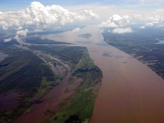
Spanning approximately 879 miles (1,415 km), the river flows northwest through high-altitude plateaus before carving a deep canyon through the Andean ranges. In its midcourse, the river traverses high jungle terrain characterized by numerous unnavigable rapids and waterfalls, most notably the Pongo de Manseriche. Upon emerging from these rapids, the river descends to lower elevations and meanders eastward through rain forest regions. After receiving the Huallaga River, it eventually converges with the Ucayali River near the town of Nauta to form the main stem of the Amazon.1
How does the Amazon River form from its headwaters?
The Amazon River is formed by the convergence of two primary headwater systems in the Peruvian Andes: the Marañón River and the Ucayali River.12
- The Marañón River: Rising in the central Peruvian Andes near Lake Lauricocha, the Marañón flows northwest through deep canyons and high-altitude plateaus. After passing through a series of rapids and the Pongo de Manseriche, it turns eastward and meanders through the rainforest, eventually receiving the Huallaga River.13
- The Ucayali River: This system is formed by the junction of the Apurímac and Urubamba rivers. It flows northward through a densely forested floodplain before meeting the Marañón.23
The confluence of the Marañón and Ucayali rivers, located near the town of Nauta, is considered the official head of the Amazon River. From this point, the river continues its eastward journey across the continent toward the Atlantic Ocean.124
What are the unique characteristics of the Andes mountain range?
The Andes Mountains are a remarkable geological and ecological feature, characterized by several unique attributes:
Geological Origins and Structure
- Plate Tectonics: The range is the result of the subduction of the oceanic Nazca Plate beneath the continental South American Plate, a process that began approximately 25 million years ago.6
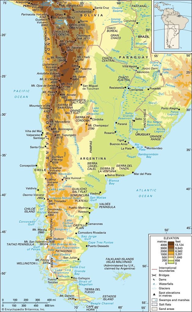
- Scale: Forming an unbroken rampart stretching 5,500 miles (8,900 km), the system exhibits an extraordinary vertical differential of over 40,000 feet between the Peru-Chile Trench and the highest peaks.76
- Volcanic Activity: As part of the Ring of Fire, the Andes remain volcanically active and prone to significant earthquakes.6
Climate and Environment
- Vertical Climatic Zones: The mountains feature distinct altitudinal bands, ranging from warm, humid foothills (tierra caliente) to freezing glacial summits (tierra helada).8
- Rain Shadow: The range acts as a massive orographic barrier, creating a vast rain shadow that results in arid regions like the Atacama Desert and the semidesert of Patagonia.8
- Interior Basins: The range encloses massive high-altitude plateaus, such as the Altiplano, which contains Lake Titicaca, the world’s highest navigable lake.9
Human Adaptation
- Ecological Ingenuity: Andean peoples developed sophisticated agricultural systems, including freeze-drying techniques and terracing, to thrive in high-altitude environments characterized by extreme temperature fluctuations.10
Why are the Pongo de Manseriche rapids significant?
The Pongo de Manseriche is significant primarily because it serves as the dramatic transition point for the Marañón River as it exits the Andes.
This gorge is the most spectacular of a series of unnavigable rapids and falls that characterize the river’s midcourse through the high jungle. Its importance lies in the drastic change in elevation it facilitates: upon emerging from the Pongo de Manseriche, the river drops to an elevation of only 575 feet (175 meters) above sea level. This transition marks the end of the river’s turbulent mountain journey and the beginning of its final 879-mile course, where it meanders eastward through the rainforest toward its confluence with the Ucayali River to form the Amazon River.1
Sources
- Marañón River — Encyclopædia Britannica
- Ucayali River — Encyclopædia Britannica
- Amazon River - Physiography of the river course — Encyclopædia Britannica
- Peru - Lakes and rivers — Encyclopædia Britannica
- Amazon River - Hydrology of the Amazon River — Encyclopædia Britannica
- Andes Mountains: Top Questions — Encyclopædia Britannica
- South America - Factors influencing climate — Encyclopædia Britannica
- Andes Mountains - Geology — Encyclopædia Britannica
- Andes Mountains - Physiography of the Central Andes — Encyclopædia Britannica
- Andes Mountains - Plant and animal life — Encyclopædia Britannica
- Andean Geosyncline — Encyclopædia Britannica
- Andean peoples — Encyclopædia Britannica
Published on · 3 min read