IJssel River
The IJssel River is an important river in the Netherlands and a major distributary of the Rhine River. It branches off from the Lower Rhine just southeast of…
What is IJssel River?
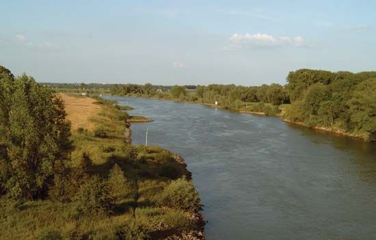
The IJssel River is an important river in the Netherlands and a major distributary of the Rhine River. It branches off from the Lower Rhine just southeast of Arnhem and flows northeastward for approximately 70 miles (113 km).12
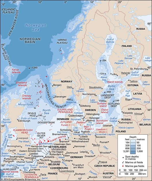
The river is characterized as slow-moving and navigable, though it deposits significant amounts of silt along its course. It eventually empties into the IJsselmeer—a freshwater lake created from the former Zuiderzee—between the Northeast and East Flevoland polders. Several notable municipalities, including Zutphen, Deventer, and Zwolle, are situated along its banks.13
What is a polder and how is it created?
A polder is a tract of low-lying land that has been reclaimed from a body of water, such as a lake or the sea, through human engineering.4
How a Polder is Created
The process of creating a polder involves several systematic steps:
- Diking: Engineers construct dikes (embankments) around the perimeter of the area to be reclaimed, effectively isolating it from the surrounding water.43
- Drainage: Once the area is enclosed, the water inside is removed. If the land surface is above low-tide level, water may be drained through tide gates that open at low tide and close automatically to prevent seawater from re-entering. For land below low-tide level, water must be mechanically pumped out over the dikes.43
- Soil Preparation: Newly reclaimed land often contains high levels of salt, which can prevent plant growth. To make the soil agriculturally productive, it must undergo procedures to flush out the salt, often using fresh water.43
- Infrastructure: Drainage channels and subsurface drains are installed to manage the water table, ensuring the root zone of crops remains dry enough for cultivation.3
The most famous examples of this engineering are the IJsselmeer Polders in the Netherlands, created following the construction of the Afsluitdijk.56
How does the Afsluitdijk protect the Netherlands from flooding?
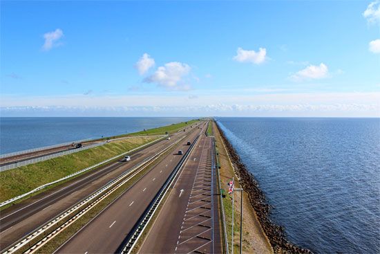
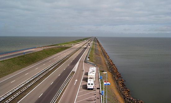
The Afsluitdijk, or “Enclosing Dam,” protects the Netherlands by physically sealing off the Zuiderzee from the North Sea and the Waddenzee. Completed in 1932, this 19-mile (30-km) barrier was designed to prevent the catastrophic flooding that had historically plagued the region, most notably during the flood of 1916, which accelerated the adoption of the Zuiderzee project.63
By separating the inland waters from the sea, the dam transformed the southern portion of the Zuiderzee into the IJsselmeer, a freshwater basin. This enclosure allows for the controlled management of water levels through a sophisticated system of sluices and locks integrated into the dam. Beyond flood protection, the project enabled the reclamation of vast tracts of land, known as polders, which are protected by their own secondary systems of dikes and pumping stations.63
What are the main differences between the Rhine and its distributaries?
The Rhine River and its distributaries differ primarily in their function, flow characteristics, and geographical context as the river reaches the Netherlands.
The Rhine River
The Rhine is a major European waterway that originates in the Alps and flows northward through Switzerland, Germany, and finally into the Netherlands. Throughout its course, it acts as a singular trunk stream characterized by:
- Hydrological Regulation: Its flow is moderated by Lake Constance and various tributaries, creating a regime favorable for navigation.81
- Navigation: It serves as a vital commercial artery, particularly between Basel and the North Sea, with major industrial hubs like Duisburg located along its banks.8
Distributaries
Upon entering the delta region in the Netherlands, the Rhine breaks into several wide branches, such as the Lek, Waal, and IJssel. These distributaries differ from the main river in the following ways:
- Flow Dynamics: Unlike the main river, which maintains a consistent channel for transport, distributaries are branching channels that carry water toward the sea or inland lakes like the IJsselmeer the sea or inland lakes like the IJsselmeer.89
- Engineering and Control: Following the Delta Project, these branches are heavily managed by sluices and lateral channels to prevent flooding, whereas the main river remains a primary navigation link, notably via the New Waterway Canal.8
- Sedimentation: Distributaries like the IJssel are often slow-moving and deposit significant amounts of silt, contrasting with the more regulated and swift-flowing sections of the upper and middle Rhine.89
Sources
- IJssel River — Encyclopædia Britannica
- IJssel — Merriam-Webster
- Netherlands - Drainage and dikes — Encyclopædia Britannica
- polder — Encyclopædia Britannica
- Drainage - Land reclamation — Encyclopædia Britannica
- Zuiderzee — Encyclopædia Britannica
- IJsselmeer Polders — Encyclopædia Britannica
- Rhine River - Physiography — Encyclopædia Britannica
- Rhine River - Hydrology of the Rhine River — Encyclopædia Britannica
- river - Braided channels — Encyclopædia Britannica
Published on · 3 min read