Kouilou River
The Kouilou River is a stream located in the western Republic of the Congo (Brazzaville) that flows southwestward for approximately 450 miles (725 km) from…
What is Kouilou River?
The Kouilou River is a stream located in the western Republic of the Congo (Brazzaville) that flows southwestward for approximately 450 miles (725 km) from its source in the plateau region to the Atlantic Ocean near Kayes, northwest of Pointe-Noire.12
The river is formed at Makabana by the confluence of the Niari River and the Louessé River; consequently, the Kouilou is sometimes considered the lower course of the Niari. While the river is used to float logs from the Mayombe lumbering region to the coast and is navigable for about 40 miles (65 km) below Kakamoéka, its overall utility for navigation is limited by numerous waterfalls and sandbars at its mouth caused by the Benguela Current.12
What is the significance of the Niari River in the Kouilou-Niari system?
The Niari River serves as the primary upper course of the Kouilou-Niari system, with the name “Niari” often extended to encompass the entire river down to the Atlantic Ocean. Its significance is defined by both its economic and agricultural contributions to the Republic of the Congo:42
- Economic Development: The Niari valley became a hub for settlement following World War II, largely driven by the construction of the railway connecting Brazzaville and Pointe-Noire.4
- Natural Resources: The basin is rich in mineral deposits, including copper, lead, and zinc.4
- Agricultural Importance: The region contains some of the most fertile soil in the country, making it a vital site for agricultural research stations and experimental farms.4
At Makabana, the Niari joins the Louessé River to form the Kouilou River, which continues the flow toward the coast.41
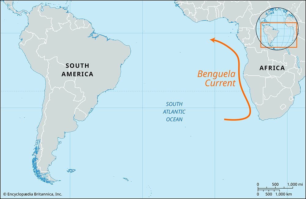
How does the Benguela Current affect the mouth of the Kouilou River?
The Benguela Current influences the mouth of the Kouilou River by contributing to the formation of sandbars, which significantly limit the river’s navigability for larger vessels.
While the current is widely recognized for its role in creating cool, nutrient-rich waters that support major fishing grounds and for its cooling effect on the climate of the southern Republic of the Congo, its interaction with the river’s discharge at the coast creates these physical obstructions.56
What role does the Mayombe region play in the local economy?
The Mayombe region (often spelled Mayumbe) plays a significant role in the local economy primarily as an agricultural hub within the Democratic Republic of the Congo.9
Its economic activity is supported by the Boma-Tshela railway, which serves as a vital transportation link for the region’s agricultural output. While the broader national economy faces challenges due to limited infrastructure and historical civil conflict, the Mayombe region remains a distinct area of agricultural production connected to the country’s wider transport network.9
Sources
- Kouilou River — Encyclopædia Britannica
- Republic of the Congo - Drainage — Encyclopædia Britannica
- Congo River - Transportation — Encyclopædia Britannica
- Niari River — Encyclopædia Britannica
- Benguela Current — Encyclopædia Britannica
- Republic of the Congo - Climate of the Republic of the Congo — Encyclopædia Britannica
- Gambia River — Encyclopædia Britannica
- Niger River - Transportation — Encyclopædia Britannica
- Ituri Forest - The economy of the Ituri Forest — Encyclopædia Britannica
- Democratic Republic of the Congo - Transportation and telecommunications — Encyclopædia Britannica
Published on · 2 min read