Laramie River
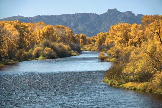
The Laramie River is a 216-mile (348-km) river located in the U.S. states of Colorado and Wyoming.
What is Laramie River?
The Laramie River is a 216-mile (348-km) river located in the U.S. states of Colorado and Wyoming.12
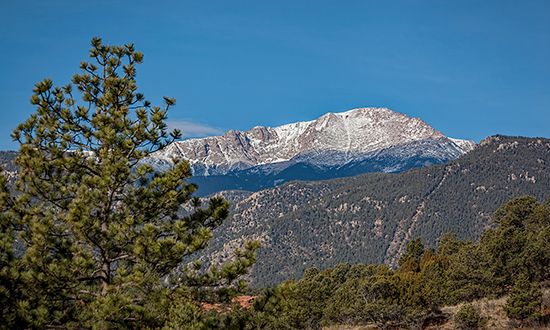
It originates in the Front Range of the Rocky Mountains within the Roosevelt National Forest in northern Colorado. From there, the river flows northward across the border into Wyoming, passing the city of Laramie. It continues through the Laramie Plains and various reservoirs before eventually joining the North Platte River at Fort Laramie. The river plays a significant role in the region by supplying water for irrigation projects in northern Wyoming.1
What is the North Platte River?
The North Platte River is one of the two primary headstreams that form the Platte River. It originates in the Medicine Bow, Park, and Rabbit Ears ranges of north-central Colorado and flows for 680 miles (1,094 km) through Wyoming and western Nebraska.4
After flowing north into Wyoming and bending east-southeast at Casper, the river continues into Nebraska. It eventually meets the South Platte River at the city of North Platte to form the Platte River.45
The North Platte is a vital component of the Missouri River basin’s multipurpose water projects, supporting irrigation, power generation, and flood control. Its flow is regulated by numerous dams and reservoirs, including Pathfinder, Seminoe, and Kingsley. Its primary tributaries include the Sweetwater, Laramie, and Medicine Bow rivers.4
Who was Jacques La Ramie?
Jacques La Ramie was a French-Canadian fur trapper who is the namesake for the city, river, plains, and mountains of Laramie, Wyoming. He was killed around 1819 by Indigenous people along the river that now bears his name.6
How do rivers support irrigation in the American West?
Rivers in the American West are fundamental to regional agriculture, serving as the primary source of water for millions of acres of otherwise arid land. To manage these resources, the U.S. Bureau of Reclamation constructs and maintains extensive systems of dams, canals, and pumping systems.789
These infrastructure projects support irrigation through several key functions:
- Flow Regulation: Dams, such as the Hoover Dam and Grand Coulee Dam, regulate river flow to ensure a consistent water supply throughout the growing season, mitigating the effects of drought and seasonal rainfall variability.7810
- Water Storage: Reservoirs capture water during periods of high flow, allowing it to be stored and distributed as needed for agricultural use.410
- Distribution: Conduits and canal networks transport water from major river basins—such as the Columbia, Colorado, and Platte—to productive farmland and pastures.785
While these systems have enabled intensive agriculture, they require careful management to balance water rights, environmental concerns, and the prevention of issues like soil salinity and reservoir silting.711910
Sources
- Laramie River — Encyclopædia Britannica
- Laramie — Merriam-Webster
- Laramie Mountains — Encyclopædia Britannica
- North Platte River — Encyclopædia Britannica
- Platte River — Encyclopædia Britannica
- Laramie — Encyclopædia Britannica
- U.S. Bureau of Reclamation — Encyclopædia Britannica
- North America - Water development — Encyclopædia Britannica
- Origins of agriculture - Irrigation — Encyclopædia Britannica
- land reclamation - Reclamation of arid land — Encyclopædia Britannica
- Irrigation - Water supply — Encyclopædia Britannica
Published on · 2 min read