Mafou River
The Mafou River is a headstream of the upper Niger River. It originates in the highlands of southern Guinea and flows northward for approximately 100 miles…
What is Mafou River?
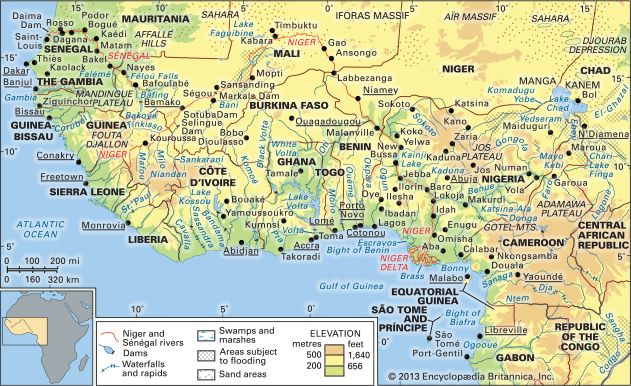
The Mafou River is a headstream of the upper Niger River. It originates in the highlands of southern Guinea and flows northward for approximately 100 miles (160 km) before joining the Niger near the town of Kouroussa.1
What is the source of the Niger River?
The Niger River originates in the highlands of Guinea on the eastern side of the Fouta Djallon mountains. Specifically, the river issues as the Tembi from a deep ravine located at an elevation of 2,800 feet (850 metres) above sea level, situated at 9°05′ N and 10°47′ W.1
While the Mafou River is a significant headstream that contributes to the upper Niger, the primary source of the river is the Tembi.21
What are the main geographical features of Guinea?
Guinea is characterized by four distinct geographic regions, each with unique features:34
- Lower Guinea: This region consists of the coast and a gently rolling coastal plain. The coastline is marked by rias (drowned river valleys) and tidal estuaries, while the plain itself is covered with laterite and sandstone gravel.3
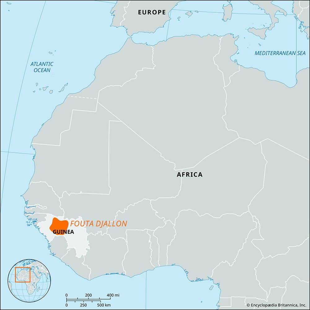
- Fouta Djallon: Often described as a massive sandstone block, this mountainous region features level plateaus, deeply incised valleys, and ancient volcanic structures. It serves as a vital watershed for many of western Africa’s major rivers.35
- Upper Guinea: Composed of the Niger Plains, this area slopes northeastward toward the Sahara. It is a relatively flat region, with an average elevation of about 1,000 feet, broken by rounded granite hills.3
- Forest Region (Guinea Highlands): Located in the southeastern corner, this area consists of isolated hills and mountain ranges, including the Nimba Range. It is home to the country’s highest point, Mount Nimba (5,748 feet).36
The country is well-watered, serving as the source for more than 20 rivers, including the Niger, Sénégal, and Gambia rivers.74
How do rivers influence the development of nearby towns like Kouroussa?
Rivers play a fundamental role in the development and economic vitality of towns like Kouroussa, Guinea. By serving as a head of navigation on the upper Niger River, Kouroussa functions as a vital river port and a central hub for trade.9
The influence of the river on such settlements is multifaceted:
- Commercial Hubs: Towns located along river valleys often become centers for processing and exporting agricultural goods. Kouroussa, for instance, serves as a primary trading center for crops like rice, onions, millet, peanuts, and cotton, as well as cattle raised in the surrounding savanna.9
- Agricultural Support: The fertile lands along river valleys are essential for food security. Irrigation projects and the natural flooding of alluvial loams allow for intensive cultivation of staples such as rice, which is a major crop in the Niger valley.101112
- Transportation and Connectivity: Rivers often dictate the placement of infrastructure. Kouroussa’s development is linked not only to its status as a port but also to its position along road and rail networks, facilitating the movement of goods and people.9
- Resource Exploitation: Historically, river towns have served as collection points for valuable natural resources, such as gold and wild rubber, further driving their initial growth and economic significance.9
Sources
- Mafou River — Encyclopædia Britannica
- Niger River - Physiography — Encyclopædia Britannica
- Guinea - Relief — Encyclopædia Britannica
- Guinea - Drainage and soils — Encyclopædia Britannica
- Guinea: Top Questions — Encyclopædia Britannica
- Fouta Djallon — Encyclopædia Britannica
- Guinea Highlands — Encyclopædia Britannica
- Gulf of Guinea — Encyclopædia Britannica
- Kouroussa — Encyclopædia Britannica
- Niger - Agriculture, forestry, and fishing — Encyclopædia Britannica
- Niger River - People and economy — Encyclopædia Britannica
- Niger - Settlement patterns — Encyclopædia Britannica
- Guinea - Agriculture, forestry, and fishing — Encyclopædia Britannica
- Gambia River — Encyclopædia Britannica
- Niger River - Irrigation — Encyclopædia Britannica
Published on · 2 min read