Milo River
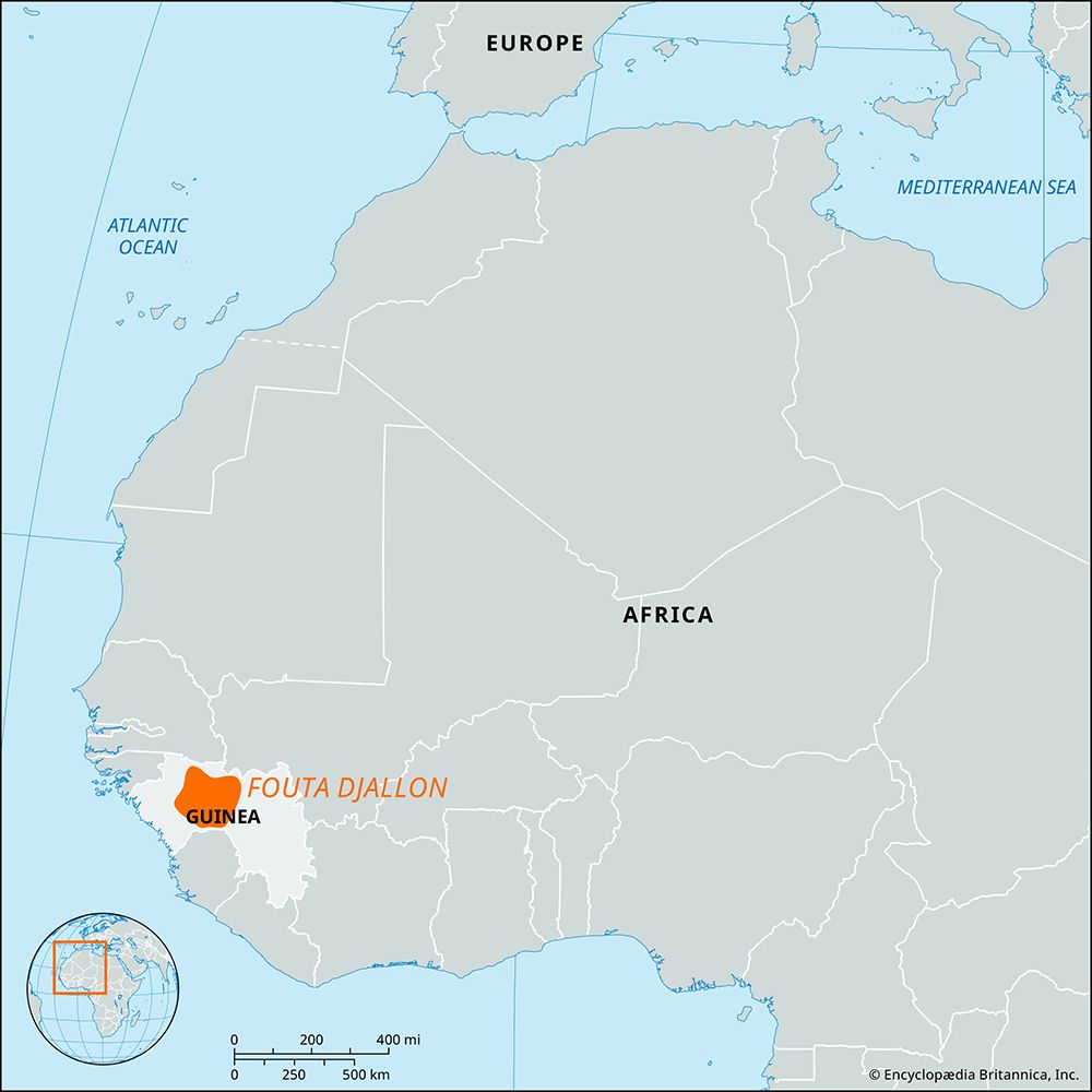
The Milo River is a waterway that originates in the southern outliers of the Fouta Djallon plateau in Guinea, located northeast of Macenta.
What is Milo River?
The Milo River is a waterway that originates in the southern outliers of the Fouta Djallon plateau in Guinea, located northeast of Macenta.1
The river flows northward for approximately 200 miles (320 km), passing the city of Kankan, Guinea. It eventually joins the Niger River at a point 20 miles (32 km) south of Siguiri. Along with other waterways such as the Mafou and the Sankarani, the Milo serves as one of the upper tributaries of the Niger River.12
What is the Fouta Djallon plateau and why is it important for rivers in West Africa?
The Fouta Djallon is a mountainous region located in west-central Guinea. Comprising a series of stepped sandstone plateaus, the region covers approximately 30,000 square miles (77,000 square km) and reaches an average elevation of 3,000 feet (914 meters).3
This region is critically important as the primary watershed for many of western Africa’s most significant rivers. Its central plateau serves as the source for the Gambia, Bafing, Koliba, Kolenté, Kaba, and Konkouré rivers. Furthermore, the eastern slopes of the Fouta Djallon feed various tributaries of the Niger River, while its southeastern extension, the Guinea Highlands, contains the actual source of the Niger itself.3
What are some other major tributaries of the Niger River?
The Niger River is fed by a vast network of tributaries that vary significantly in size and location along its 2,600-mile course. These tributaries are generally categorized by their position relative to the main river’s flow.
Upper Tributaries
In its upper reaches, the Niger receives several key tributaries, particularly as it flows through Guinea and Mali:
- Right bank: The Mafou, the Niandan, the Milo, and the Sankarani.2
- Left bank: The Tinkisso.2
- Inland Delta: Near Mopti, the river is joined by the Bani, which is its largest tributary on the right bank.2
Lower Tributaries
As the river enters Nigeria, it is joined by major systems that significantly increase its discharge:
- Kaduna River: An important tributary that contributes approximately one-fourth of the annual discharge below their confluence.2
- Benue River: The Niger’s greatest and longest tributary, which approximately doubles the river’s annual volume at their confluence in Lokoja.256
- Benue Tributaries: The Benue itself has several notable tributaries, including the Gongola, the Shemankar, the Faro, the Donga, and the Katsina Ala.atsina Ala](https://www.britannica.com/place/Katsina-Ala-River).2
How do seasonal changes affect the flow and navigation of rivers in this region?
Seasonal changes significantly influence the flow and navigability of the Niger River due to the region’s distinct rainfall patterns and high evaporation rates. Because precipitation varies across the basin, high-water periods occur at different times in different stretches.782
Impact on River Flow
- Upper and Middle Niger: The upper river experiences high-water discharge in June, while the middle stretch sees two distinct rises: the “white flood” (July–October) following the rainy season, and the “black flood” (beginning in December) caused by the arrival of upstream waters.7
- Lower Niger and Benue: The Benue River has a single high-water season from May to October. Consequently, the lower Niger below their confluence experiences high water starting in May or June.7
- Fluctuations: Water levels can fluctuate by as much as 35 feet (10 meters), and the middle sector of the river loses approximately two-thirds of its annual discharge volume to evaporation in the lake region.78
Impact on Navigation
Navigation is highly seasonal and restricted to small craft in many areas. During low-water periods, strong currents in narrow defiles, such as the gorge downstream from Timbuktu, pose significant dangers to vessels. Furthermore, the mouths of the river’s delta channels are frequently obstructed by sandbars, which have historically shifted the primary routes for maritime traffic.9
Sources
- Milo River — Encyclopædia Britannica
- Niger River - Physiography — Encyclopædia Britannica
- Fouta Djallon — Encyclopædia Britannica
- Falémé River — Encyclopædia Britannica
- Africa - Niger basin — Encyclopædia Britannica
- Benue River — Encyclopædia Britannica
- Niger River - Hydrology of Niger River — Encyclopædia Britannica
- Niger River - Climate — Encyclopædia Britannica
- Africa - Water resources — Encyclopædia Britannica
- Congo River: Top Questions — Encyclopædia Britannica
Published on · 3 min read