Mindoro
Mindoro is an island located in the west-central Philippines. It is situated across the Verde Island Passage from Luzon to the northeast and lies between the…
Where is Mindoro located within the Philippines, and what are its major geographical features?
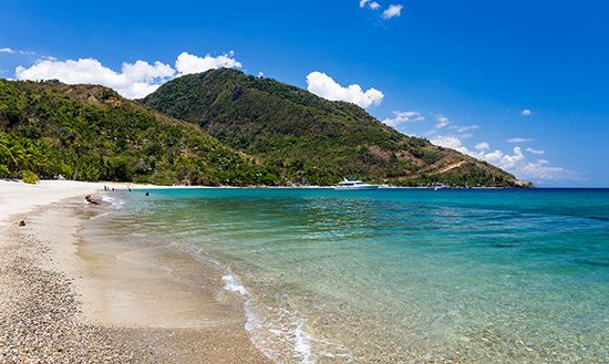
Mindoro is an island located in the west-central Philippines. It is situated across the Verde Island Passage from Luzon to the northeast and lies between the Mindoro and Tablas straits to the southwest and southeast, respectively.1
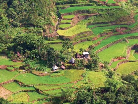
The island’s geography is defined by a mountainous core that extends for 100 miles (160 km) along its entire length. This interior is surrounded by a broken coastal plain, which is widest along the eastern shore. Unlike many other islands in the archipelago, Mindoro lacks deep coastal embayments or fringing islets.1
Key geographical features include:
- Peaks and Waterways: The island’s highest point is Mount Halcon, reaching 8,481 feet (2,585 meters) in the northeast. The landscape is carved by steep-sided river valleys, including the Pandan, Ibod, and Bongabong rivers.1
- Lakes: Lake Naujan is located in the northeastern part of the island.1
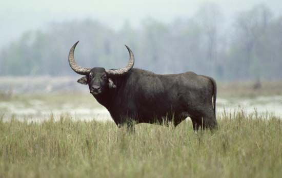
- Biodiversity: Mindoro is the unique home of the tamaraw, a small water buffalo.1
What are the primary economic activities on Mindoro, and how do they impact the island’s development?
Economic activities on Mindoro are diverse, reflecting the island’s varied topography and history as a resettlement area. The economy is characterized by a divide between the rugged interior and the more commercialized coastal regions.1
- Agriculture: In the interior, non-Christian, seminomadic peoples practice slash-and-burn (kaingin) farming. In more accessible areas, agriculture is a primary driver of local livelihoods, contributing to the island’s development as a resettlement zone.1
- Commercialization: Coastal areas, particularly in the west, are more densely populated and commercialized, largely driven by migration from the Batangas Peninsula of Luzon and other regions.1
- Natural Resources: The island possesses substantial deposits of coal in the south, representing a significant potential resource for development.1
- Research and Education: The University of the Philippines operates a marine biological station at Puerto Galera, which supports scientific study and environmental monitoring.1
While these activities support the local population, the island’s development has been shaped by historical challenges, including past security concerns and the impact of natural disasters like Super Typhoon Haiyan.1
What historical events have shaped Mindoro’s development and its relationship with the rest of the Philippines?
Mindoro’s development has been shaped by a history of isolation, migration, and environmental challenges that define its relationship with the broader Philippines.
Historically, the island’s population growth was significantly constrained by two primary factors: the prevalence of malaria and frequent raids by Muslim (Moro) seafarers from the southern islands. These conditions long kept the island sparsely populated and separated from the mainstream development occurring in other parts of the archipelago.1
The island’s modern character began to shift in 1948, when it was designated as one of the nation’s official resettlement areas. This policy encouraged migration from other regions, notably Christian Tagalogs from the Batangas Peninsula of Luzon and Hiligaynon peoples from the south, which transformed the coastal areas into more densely populated and commercialized zones. This influx of settlers created a “frontier” atmosphere that persists today, contrasting sharply with the rugged interior, which remains home to non-Christian, seminomadic groups such as the Negritos and Hanunóo.1
More recently, the island’s development has been tested by natural disasters, including the devastating impact of Super Typhoon Haiyan in 2013.1
How does Mindoro’s climate differ from other parts of the Philippines?
Mindoro’s climate is consistent with the general tropical and monsoonal patterns of the Philippines, characterized by distinct wet and dry seasons driven by prevailing wind currents.61
Because Mindoro is located in the western part of the archipelago, it experiences the most marked contrast between these seasons compared to eastern regions where the dry season may be absent. On Mindoro, the dry season typically spans from December to May, while the wet season occupies the remainder of the year.6
Like much of the country, the island is subject to tropical cyclones, known locally as typhoons, which are most frequent between June and December. The island’s vulnerability to these storms was highlighted by the significant damage caused by Super Typhoon Haiyan in 2013. While temperatures across the Philippines remain relatively constant, Mindoro’s mountainous interior—featuring peaks like Mount Halcon—creates localized variations where temperatures decline with elevation, providing a cooler climate than the coastal plains.617
Sources
- Mindoro — Encyclopædia Britannica
- Mindanao — Encyclopædia Britannica
- Philippines - Agriculture, forestry, and fishing — Encyclopædia Britannica
- Marinduque — Encyclopædia Britannica
- Mindoro — Merriam-Webster
- Philippines - Climate — Encyclopædia Britannica
- Guangxi - Climate — Encyclopædia Britannica
- Southeast Asia - Precipitation — Encyclopædia Britannica
Published on · 3 min read