Mont-aux-Sources
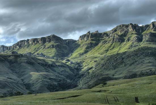
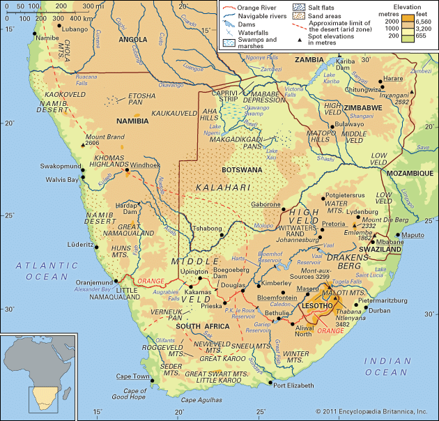
Mont-aux-Sources is a prominent mountain plateau located within the Drakensberg range, situated at the border of South Africa and Lesotho.
What is Mont-aux-Sources?
Mont-aux-Sources is a prominent mountain plateau located within the Drakensberg range, situated at the border of South Africa and Lesotho.1
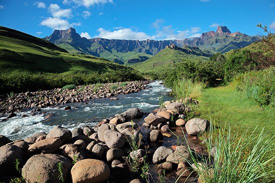
Explored by French missionaries in 1836, the name translates to “Mountain of Sources” because the plateau serves as a vital watershed for several major rivers, including the Orange, Vaal, and Tugela. The formation is primarily composed of basalt and reaches an elevation of approximately 10,000 feet (3,050 m), with its highest summit climbing to 10,823 feet (3,299 m) along the Lesotho–KwaZulu/Natal border. The edge of this plateau features dramatic, steep cliffs that overlook the Royal Natal National Park in South Africa.1
Which major rivers originate from the Drakensberg range?
The Drakensberg range serves as the primary watershed for South Africa, acting as the source for several significant river systems.2
Key rivers originating from or associated with the range include:
- Orange River: As the main watershed of South Africa, the Drakensberg is the source of this major river. Its headwaters rise in the Lesotho Highlands, with specific tributaries like the Seati (Khubedu) rising near the Mont-aux-Sources plateau.23
- Tugela River: This river rises as a stream on the Mont-aux-Sources plateau and flows through the Drakensberg range before descending via a series of waterfalls. It is recognized as the largest river by volume in South Africa.45
- Vaal River: A major tributary of the Orange River, the Vaal is also associated with the drainage systems originating from the high plateaus of the region.53
What is the significance of the Royal Natal National Park?
Royal Natal National Park is a significant protected area located within the Drakensberg mountain range in KwaZulu-Natal, South Africa.26
The park is primarily significant for its dramatic natural geography and its role as the headwaters for major river systems. Key features include:
- Tugela Falls: The park is home to these spectacular cataracts, which rank among the highest in the world, featuring a total drop of 3,110 feet (947 meters).63
- Hydrological Importance: The park encompasses the upper course of the Tugela River, which rises on the nearby Mont-aux-Sources plateau. This area is part of the broader Drakensberg watershed, which is critical to the region’s water supply.23
- Scenic Landscape: Situated at the foot of the Drakensberg escarpment, the park provides access to rugged mountain terrain, deep gorges, and the iconic “barrier of pointed spears” rock formations that define the region’s landscape.23
How do basalt plateaus form in mountain ranges?
Basalt plateaus, often referred to as flood basalts or traps, form when extensive lava flows and volcanic ash bury preexisting terrain9. Unlike typical volcanoes that create localized cones, these eruptions involve magma that is carried long distances from its source, resulting in a landscape not dominated by a single volcanic center.9
The formation process typically involves the following characteristics:
- Tectonic Association: These eruptions are frequently linked to hot spots or the rifting of continental plates, such as the breakup of supercontinents like Pangaea or Gondwana.91011
- Physical Structure: The resulting volcanic rock can reach thicknesses of tens to hundreds of meters. While the top surface of these flood basalts is typically very flat, it is often marked by sharply incised canyons and valleys created by subsequent erosion.9
- Composition: These plateaus are composed of basalt, an extrusive igneous rock low in silica and rich in iron and magnesium.12
- Examples: Notable examples include the Columbia Plateau in the United States, the Deccan Traps in India, and the Karoo in South Africa, where basalt caps a sandstone base to form the high, eroded peaks of the Drakensberg range.9112
Sources
- Mont-aux-Sources — Encyclopædia Britannica
- Drakensberg — Encyclopædia Britannica
- Tugela River — Encyclopædia Britannica
- South Africa - Drainage — Encyclopædia Britannica
- Orange River - Physiography — Encyclopædia Britannica
- Tugela Falls — Encyclopædia Britannica
- uMkhuze Game Reserve — Encyclopædia Britannica
- Garden Route National Park — Encyclopædia Britannica
- plateau - Formative processes — Encyclopædia Britannica
- basalt — Encyclopædia Britannica
- plateau - Geographic distribution — Encyclopædia Britannica
- igneous rock - Flood basalts — Encyclopædia Britannica
- volcano - Volcanism and tectonic activity — Encyclopædia Britannica
- mountain - Volcanism — Encyclopædia Britannica
Published on · 3 min read