Neisse River
The term "Neisse River" refers to two distinct rivers located in southwestern Poland, both of which originate in the Sudeten mountains and flow northward…
What is Neisse River?
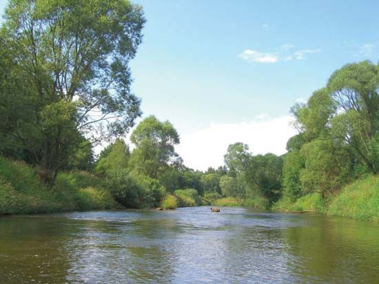
The term “Neisse River” refers to two distinct rivers located in southwestern Poland, both of which originate in the Sudeten mountains and flow northward into the Oder River1.
- Lusatian Neisse (Nysa Łużycka): This is the longer, more westerly river, spanning 157 miles (252 km). It is historically significant for forming a major portion of the Oder–Neisse Line, which serves as the border between Germany and Poland.1
- Glatzer Neisse (Nysa Kłodzka): This river is shorter, measuring 113 miles (182 km), and is situated entirely within the borders of Poland.1
While the name is sometimes associated with other European waterways, these two rivers are the primary geographical features identified by the name in this region.12
What is the historical significance of the Oder-Neisse line?
The Oder–Neisse Line is the border between Poland and Germany established in the aftermath of World War II. Its historical significance lies in its role as a major point of geopolitical contention and a symbol of post-war territorial restructuring.42
Territorial Shifts and Diplomacy
Following World War II, the Allied powers shifted Poland’s eastern border westward to the Curzon Line to accommodate the Soviet Union. To compensate Poland for this loss, the Allies transferred significant German territory to Polish administrative control. While the U.S. and Britain initially favored a different boundary, the Soviet Red Army had already placed the region under Polish administration by the Potsdam Conference, leading to the forced deportation of German inhabitants.4
Recognition and Stability
For decades, the line was a source of tension. While East Germany recognized it in 1950, West Germany long maintained it was only a temporary administrative border. Full recognition was not achieved until 1970, when West Germany signed treaties acknowledging the line as Poland’s inviolable border, a status later confirmed during German reunification in 1990.4
How did the border changes after World War II affect the region?
The border changes following World War II profoundly transformed the region, primarily through the establishment of the Oder–Neisse Line. This shift moved Poland’s western frontier to the Oder and Lusatian Neisse rivers, while its eastern border was pushed westward to the Curzon Line to accommodate the Soviet Union.4
These territorial adjustments had severe human and demographic consequences:
- Forced Migrations: Millions of ethnic Germans were forcibly expelled from the territories transferred to Polish administration and relocated to Germany. Simultaneously, millions of Poles were transferred from former Polish homelands that had been incorporated into the Soviet Union, and vast internal movements occurred as Poles resettled in the newly acquired northern and western territories.4567
- Demographic Distortion: The war and subsequent border shifts caused a massive population decline in Poland, dropping from nearly 35 million in 1939 to about 24 million by 1946. This created long-term imbalances in the population structure, including significant deficiencies in the number of males, urban dwellers, and educated citizens.7
- Geopolitical Tension: The new border became a major point of contention for decades. While East Germany recognized the line in 1950, West Germany initially viewed it as a temporary administrative boundary, only formally acknowledging it as inviolable in 1970.4
What are the main characteristics of the Sudeten mountains?
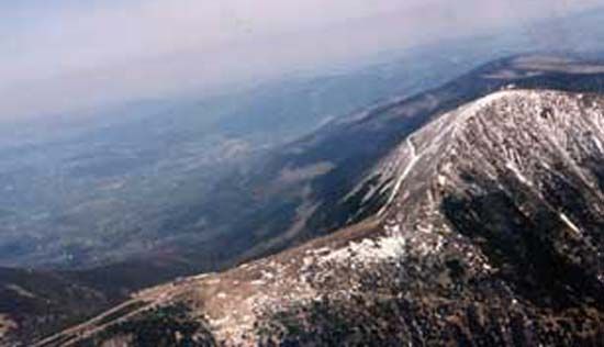
The Sudeten are a system of east-west mountain ranges forming a natural border between the Czech Republic and Poland. Geologically, they are the broken remnants of an ancient Bohemian Massif, characterized by rugged terrain and flattened summits, such as the highest peak, Sněžka (5,256 feet/1,602 meters).1213
The system is divided into three primary subgroups:
- West Sudeten: Includes the Lusatian Mountains, Jizera Mountains, and the Giant (Krkonoše) Mountains.12
- Middle Sudeten: Comprises the Orlice Mountains and the Broumovské range.12
- East Sudeten: Consists of the Jeseník Mountains.1214
Economically, the region has historically relied on mineral deposits, though many mining operations have declined. Traditional industries include textile manufacturing (cotton, wool, and linen), glass, and porcelain production. Due to the challenging terrain for farming, the area also features a significant cottage industry and a growing tourism sector, supported by extensive forests, hiking trails, and ski slopes.12141513
Sources
- Neisse River — Encyclopædia Britannica
- Oder-Neisse Line — Merriam-Webster
- Neisse — Merriam-Webster
- Oder–Neisse Line — Encyclopædia Britannica
- Potsdam Conference — Encyclopædia Britannica
- Hungary - Demographic trends — Encyclopædia Britannica
- Germany - Urban settlement — Encyclopædia Britannica
- Germany - Population distribution — Encyclopædia Britannica
- Poland - Demographic trends — Encyclopædia Britannica
- Oder River — Encyclopædia Britannica
- population - Forced migrations — Encyclopædia Britannica
- Sudeten — Encyclopædia Britannica
- Sudetenland — Encyclopædia Britannica
- Giant Mountains — Encyclopædia Britannica
- Poland - The Sudeten of Poland — Encyclopædia Britannica
- Jeseník Mountains — Encyclopædia Britannica
Published on · 3 min read