Pingo
Pingos are dome-shaped hills with ice cores that form under specific permafrost conditions, making them valuable indicators for studying climate change.…
How are pingos used to study climate change and permafrost thaw?
Pingos are dome-shaped hills with ice cores that form under specific permafrost conditions, making them valuable indicators for studying climate change. Because their formation requires precise environmental factors—such as the presence of permafrost and specific groundwater availability—they serve as markers for past and present climatic states.123
Scientists study pingos to understand permafrost thaw in several ways:
- Historical Reconstruction: Scars and remnants of former pingos found in regions now outside of permafrost zones provide evidence of past climates, such as those during the Pleistocene Epoch.12
- Active Monitoring: Modern pingos often develop summit craters when their ice cores melt, a process that can be triggered by warming temperatures. Observing the rupture and degradation of these mounds helps researchers track the stability of current permafrost.12
- Environmental Indicators: Since they are restricted to specific latitudes and geological settings, their presence or decay offers a visible record of how regional landscapes respond to shifting thermal conditions.12
How does the presence of pingos indicate past or present permafrost conditions?
Pingos serve as significant indicators of permafrost conditions because their formation is strictly dependent on specific thermal and hydrological environments. Because they require precise conditions to develop, they provide researchers with a clear record of both past and present climatic states.1
Present Conditions
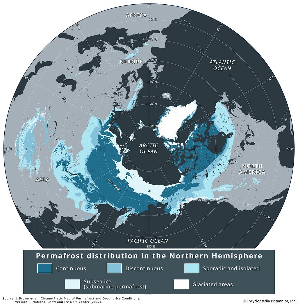
Modern pingos are generally restricted to latitudes between 65° and 75° N, where they serve as markers for active permafrost regions. Their presence indicates areas where groundwater is available and where the ground remains perennially frozen, allowing for the pressure-driven growth of ice cores. When the ice core of a pingo melts—often due to warming temperatures—the overlying material may rupture, creating a crater or lake. Monitoring these structural changes allows scientists to track the stability of current permafrost and the impacts of climate change.13
Past Conditions
Scars left by former pingos are used to reconstruct historical environments. These remnants have been identified in areas near the edges of former ice sheets dating back to the Pleistocene Epoch. Their existence in regions that are no longer frozen provides evidence of where permafrost once extended, helping scientists map the extent of past cold-climate zones.1
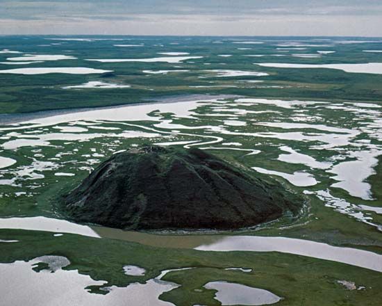
What is a pingo, and how does it form?
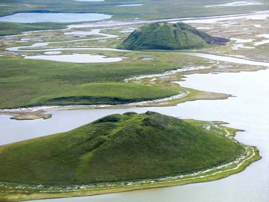
A pingo is a dome-shaped hill found in permafrost regions, characterized by a core of clear ice that pushes up the overlying ground. These circular or oval-shaped mounds can reach heights of up to 90 meters and are primarily found in continental tundras.11
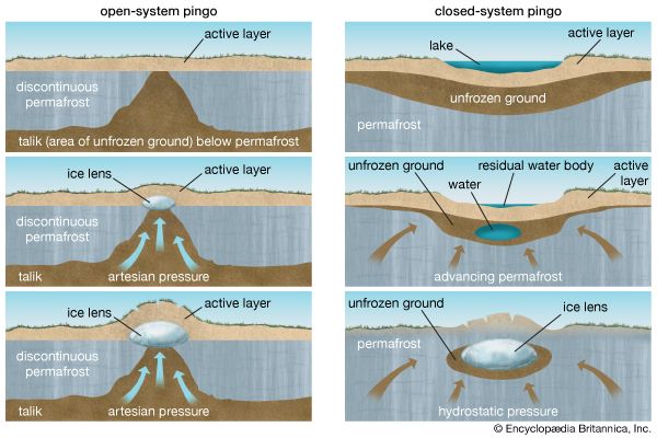
Pingos form through two distinct processes:
- Closed-system pingos: These occur in flat areas like river deltas where advancing permafrost traps a mass of saturated soil. As this confined water freezes, it expands and exerts upward pressure, heaving the surface into a mound.21
- Open-system pingos: These form on slopes in regions of thin or discontinuous permafrost. They are fueled by groundwater from an aquifer that is forced upward by artesian or hydrostatic pressure. As this water reaches the surface and freezes, it creates a lens of ice that lifts the overlying material.21
Because their formation requires specific thermal and hydrological conditions, pingos are vital indicators of climate change and past environmental states.2
What are some of the largest known pingos, and where are they located?
While specific names for individual “largest” pingos are not typically cataloged in the same way as mountain peaks, the Britannica knowledge base notes that these landforms can reach impressive dimensions.
Pingo dimensions generally fall within the following ranges:
- Height: They can reach up to 90 meters (approximately 300 feet) in height.1
- Diameter: They can span more than 800 meters (0.5 miles) across.1
Regarding their location, modern pingos are primarily found in continental tundras within the continuous permafrost zone, generally restricted to latitudes between 65° and 75° N.12
Closed-system pingos, which are typically larger than their open-system counterparts, are most commonly found in flat, low-lying areas such as river deltas and shallow lake basins. In contrast, open-system pingos are generally smaller and are typically found on slopes in mountainous or hilly regions where groundwater is forced upward by artesian pressure.12
Sources
- pingo — Encyclopædia Britannica
- permafrost - Pingos — Encyclopædia Britannica
- glacial landform - Permafrost , patterned ground, solifluction deposits, and pingos — Encyclopædia Britannica
- glacier - Information from deep cores — Encyclopædia Britannica
- Pleistocene Epoch - Ice-core records — Encyclopædia Britannica
Published on · 3 min read