Red River
Several Native American tribes have historical connections to the Red River region, particularly the river system flowing through the southern United States.
What Native American tribes have historical connections to the Red River region?
Several Native American tribes have historical connections to the Red River region, particularly the river system flowing through the southern United States.
- Caddo: The Caddo people originally occupied the lower Red River area in present-day Louisiana and Arkansas. They were a semisedentary agricultural society with a long-standing presence in the region before colonial pressures and treaties forced them to relocate to Oklahoma.1
- Wichita: By the late 18th century, the Wichita moved south under pressure from other tribes, eventually locating near the area of present-day Wichita Falls, Texas, near the Red River.2
- Comanche: In the 19th century, the Comanche were granted territory by the United States that extended from the Red River north to the Cimarron River.3
- Kiowa: Since 1868, the Kiowa have shared a reservation with the Comanche located between the Washita and Red rivers in Oklahoma.4
It is important to acknowledge that these tribes were often displaced from their ancestral lands due to colonial expansion and broken treaties, a history that reflects the profound impact of settler encroachment on Indigenous sovereignty and way of life.134
How did the Red River get its name, and what are its unique characteristics?
The name “Red River” is applied to several major waterways, each deriving its name from the distinct reddish appearance of its waters caused by sediment.
- Red River of the North: This river, which flows through the United States and Canada, is named for the reddish-brown silt it carries along its course. Its valley is notable for being the former floor of glacial Lake Agassiz, resulting in some of the most fertile agricultural soil in North America.6
- Red River (Asia): Flowing through China and Vietnam, this river derives its name from the “red lands” in its basin. It carries massive quantities of silt due to the easily crumbled soil in its path, which it deposits into a large, densely populated delta at the Gulf of Tonkin8.7
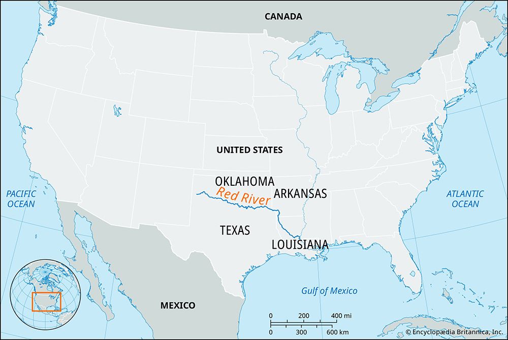
- Red River (U.S.): This 1,290-mile-long river flows through the southern United States. Historically, navigation on this river was famously impeded by the “Great Raft,” a massive 160-mile-long log jam that required specialized snag boats to clear in the 19th century.1
What are the major tributaries of the Red River, and how do they contribute to its flow?
The Red River in the United States and the Red River in Asia possess distinct tributary systems that significantly influence their respective water volumes and regional geography.
Red River (United States)
The U.S. Red River, which spans 1,290 miles, is fed by a diverse network of tributaries that drain a vast 93,000-square-mile basin. Its principal tributaries include:
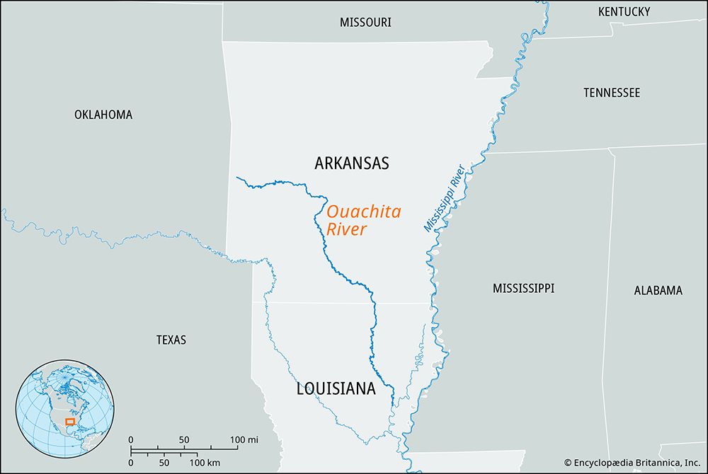
- North Fork of the Red, Kiamichi, Little, Black (Ouachita), Pease, Sulphur, Wichita, and Washita rivers6
- Bodcau and Cypress bayous6
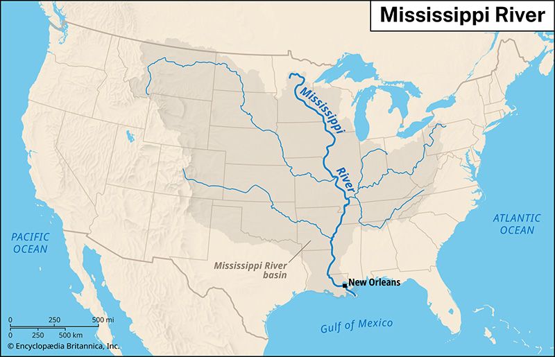
These tributaries are integral to regional water management; many have been dammed to create reservoirs as part of extensive flood-control and development programs. For instance, the Washita River flows into Lake Texoma, which is formed by the Denison Dam on the Red River. While these rivers contribute to the flow, the volume of the Red River is also managed through complex flood-control systems, particularly following the construction of the Old River control structure.68
Red River (Asia)
The Red River in northern Vietnam relies on two major tributaries to boost its flow, especially during the rainy season when discharge can reach 335,500 cubic feet per second:9
These tributaries contribute to the river’s highly irregular annual volume and its heavy load of silt, which is deposited into the expansive Red River delta.9
How have flood control measures been implemented along the Red River?
Flood control measures along the Red River have been implemented through diverse engineering strategies tailored to the specific needs of the U.S. and Asian regions.
Red River (United States)
In the United States, flood control is managed through a comprehensive program of dams and reservoirs. A primary example is the Denison Dam, completed in 1944, which created Lake Texoma to regulate flow. Additionally, numerous reservoirs have been constructed on the river’s tributaries across Texas, Oklahoma, Arkansas, and Louisiana to mitigate flooding and support regional development. Historically, the river’s connection to the Mississippi was also altered; the construction of a flood-control system on the Old River effectively ended the Red River’s role as a tributary to the Mississippi, providing greater control over water distribution.8
Red River (Asia)
In northern Vietnam, flood protection relies heavily on extensive dike systems designed to protect the densely populated delta and the capital, Hanoi. These systems are supplemented by hydraulic infrastructure like the Nhue Giang River canal and the large Day River barrage, which were built to regulate water flow for agricultural stability. However, these systems face significant challenges; for instance, during the 1971 floods, the dikes were unable to contain the water, leading to catastrophic loss of life, a failure attributed in part to poor maintenance during the Vietnam War.10116
Sources
- Red River of the North — Encyclopædia Britannica
- Caddo — Encyclopædia Britannica
- Wichita — Encyclopædia Britannica
- Comanche — Encyclopædia Britannica
- Kiowa — Encyclopædia Britannica
- Red River — Encyclopædia Britannica
- Vietnam - Drainage — Encyclopædia Britannica
- Red River — Encyclopædia Britannica
- Washita River — Encyclopædia Britannica
- levee — Encyclopædia Britannica
- 12 of the World’s Deadliest Natural Disasters - Vietnam floods of 1971 — Encyclopædia Britannica
- Nhue Giang River — Encyclopædia Britannica
- reservoir — Encyclopædia Britannica
- dam - Reservoirs — Encyclopædia Britannica
Published on · 4 min read