Rossel Island
Rossel Island is a volcanic island located at the eastern extremity of the Louisiade Archipelago in Papua New Guinea. Situated approximately 230 miles (370…
What is Rossel Island?
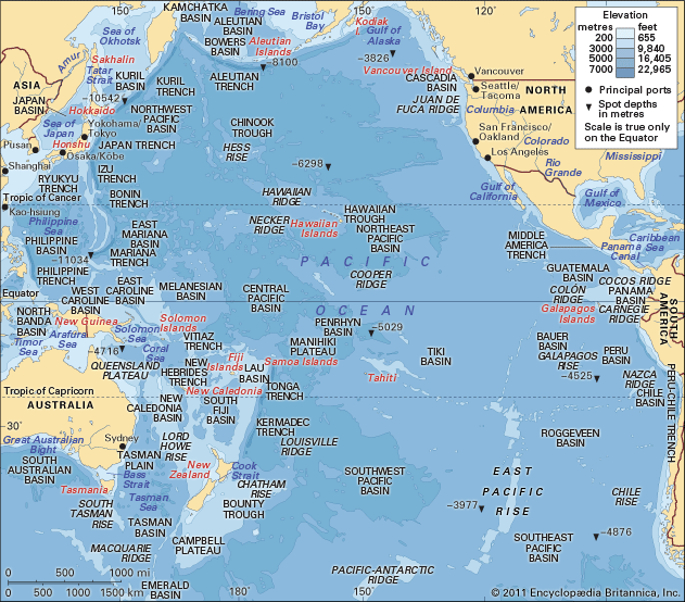
Rossel Island is a volcanic island located at the eastern extremity of the Louisiade Archipelago in Papua New Guinea. Situated approximately 230 miles (370 km) southeast of New Guinea in the southwestern Pacific Ocean, it is one of the largest islands in the group, measuring 21 by 10 miles (34 by 16 km).12
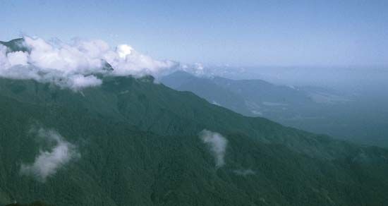
The island is characterized by its mountainous terrain and is fringed by coral reefs. A notable linguistic feature of the island is that its native language is non-Austronesian, distinguishing it from the languages spoken in the surrounding regions. Economically, the island is known for the export of shell necklaces and bèche-de-mer (trepang).12
What makes the Rossel language unique compared to its neighbors?
The Rossel language is unique because it is classified as a non-Austronesian language, which sets it apart from the languages spoken in the surrounding areas of the Louisiade Archipelago.1
In the broader context of Papua New Guinea, indigenous languages are divided into two distinct groups: Austronesian and non-Austronesian (often referred to as Papuan languages). While Austronesian speakers typically inhabit coastal regions and offshore islands, non-Austronesian speakers—who make up the majority of the country’s population—are primarily found in the interior highlands. By being a non-Austronesian language located on an offshore island, the Rossel language defies the typical geographic distribution of these language groups in the region. Furthermore, unlike the Austronesian family, the non-Austronesian languages do not form a single, genetically unified family but are instead organized into several dozen distinct language families.314
What are the other major islands in the Louisiade Archipelago?
The Louisiade Archipelago consists of nearly 100 islands, with the three largest being volcanic and mountainous in nature. In addition to Rossel Island, the other major islands are:2
- Tagula Island (Sud-est): As the largest island in the archipelago, it measures 50 by 15 miles (80 by 24 km) and covers an area of 310 square miles (800 square km). It is characterized by rugged terrain, reaching an elevation of 2,644 feet (806 metres) at Mount Riu, and is known for its copra exports.25
- Misima Island: Along with Tagula and Rossel, this island is one of the primary volcanic landmasses within the group.2
While these three islands are the most significant in size and topography, the remainder of the archipelago is composed primarily of smaller coral formations.2
How did the Battle of the Coral Sea affect this region?
The Battle of the Coral Sea was a pivotal naval and air engagement that significantly altered the course of the war in the Pacific, including the region surrounding the Louisiade Archipelago.
In 1942, Japanese forces occupied the islands of the archipelago as part of a broader strategy to seize control of the Coral Sea. Their primary objective was to establish air bases at Port Moresby in New Guinea and at Tulagi in the Solomon Islands, which would have threatened Australia.72
The Allied victory in the battle effectively halted this invasion. By sinking or damaging key Japanese carriers and inflicting heavy aircraft losses, the Allied forces forced the Japanese invasion fleet to abandon its mission and retreat to Rabaul. This strategic success prevented the Japanese from securing the air superiority they needed to capture Port Moresby, thereby safeguarding the region from further immediate encroachment.7
Sources
- Rossel Island — Encyclopædia Britannica
- Louisiade Archipelago — Encyclopædia Britannica
- Papua New Guinea - Languages of Papua New Guinea — Encyclopædia Britannica
- Papuan languages — Encyclopædia Britannica
- Tagula Island — Encyclopædia Britannica
- Louisiade Archipelago — Merriam-Webster
- Battle of the Coral Sea — Encyclopædia Britannica
Published on · 2 min read