Salado River
The name "Salado River" refers to several distinct watercourses in Argentina and Mexico. Because the name is shared, it is important to distinguish between…
What is Salado River?
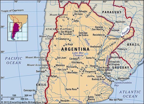
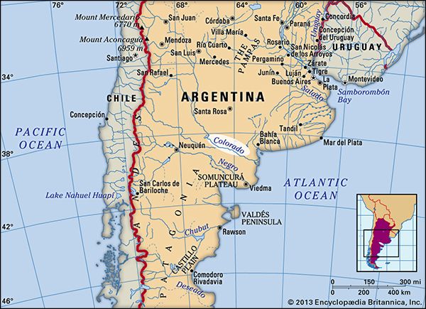
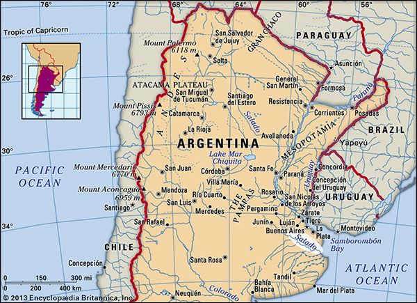
The name “Salado River” refers to several distinct watercourses in Argentina and Mexico. Because the name is shared, it is important to distinguish between these geographical features:
- Argentina (Buenos Aires Province): This Salado River flows southeast for about 400 miles through the Pampas to the Atlantic Ocean. Historically, it served as a frontier between Spanish colonial settlements and indigenous territories.1
- Argentina (Northern): Also known as the Juramento in its upper course, this river spans 1,120 miles, flowing from the Andes southeast into the Paraná River.2
- Argentina (West Central): Sometimes called the Desaguadero, this 850-mile river flows south into the Colorado River.2
- Mexico: This Salado River rises in the Sierra Madre Oriental and flows into the Rio Grande. It is vital for regional irrigation, particularly for cotton cultivation.3
What are the Pampas in Argentina?
The Pampas are vast, predominantly flat plains in central Argentina, extending from the Atlantic Ocean coast to the Andean foothills. The name is derived from a Quechua word meaning “flat surface”.4
The region covers approximately 295,000 square miles and is divided into two distinct zones:4
- Humid Pampa (East): A temperate, well-watered area that serves as the nation’s economic heart and most populous region.4
- Dry Pampa (West): A largely barren zone characterized by saline areas, brackish streams, and sandy deserts.4
Historically, the Pampas were home to the gaucho, a nomadic horseman who hunted wild cattle and horses. By the late 19th century, the landscape was transformed through the fencing of large estancias, the introduction of pedigreed livestock, and the expansion of railways. Today, the region is a major agricultural hub, producing wheat, corn, soybeans, and beef for both domestic consumption and export.546
How do dams like the Venustiano Carranza affect river ecosystems?
Dams like the Venustiano Carranza, which creates a reservoir on the Salado River, significantly alter river ecosystems by changing natural water flow and sediment transport.
The primary environmental impacts of such structures include:
- Obstruction of Migration: Dams act as physical barriers that prevent fish from reaching their natural spawning grounds. While technologies like fish passes—such as fish ladders or locks—are sometimes used to mitigate this, they are not always successful in preventing population declines.9
- Sediment Accumulation: Reservoirs trap silt and sediment that would otherwise flow downstream. This process can reduce the effective storage capacity of the dam over time and alter the downstream riverbed, which is critical for various aquatic habitats.2
- Habitat Alteration: By creating large reservoirs, dams transform free-flowing river sections into stagnant or slow-moving water bodies. This change in environment can displace native species that rely on specific flow conditions.9
While these dams provide essential benefits like irrigation for agriculture, they fundamentally reshape the biological and physical landscape of the river.10
Why do many rivers in Spanish-speaking countries share the name Salado?
The prevalence of the name “Salado” for rivers across Spanish-speaking countries is not due to a single historical origin, but rather the descriptive nature of the Spanish language. In Spanish, salado is the past participle of the verb salar (“to salt”), derived from the Latin sal (“salt”). Consequently, the term translates to “salty” or “salted.”
Explorers and settlers frequently named geographic features based on their observable characteristics. Rivers labeled as “Salado” typically possess high mineral content or brackish water, often resulting from the river flowing through salt-rich soil or arid regions where evaporation concentrates dissolved minerals. This naming convention is also reflected in related terms like salada, which refers to salt-covered plains left behind by evaporated lakes.3
Because many regions in the Americas share similar arid or semi-arid climates, multiple rivers—such as those in Argentina and Mexico—independently received the same descriptive name to indicate the quality of their water.
Sources
- Salado River — Encyclopædia Britannica
- Salado River — Encyclopædia Britannica
- Salado — Merriam-Webster
- the Pampas — Encyclopædia Britannica
- Gaucho — Encyclopædia Britannica
- Argentina - The Pampean zone — Encyclopædia Britannica
- Argentina - The Pampas — Encyclopædia Britannica
- Argentina - Agriculture, forestry, and fishing — Encyclopædia Britannica
- dam - Fish passes — Encyclopædia Britannica
- dam - Construction techniques — Encyclopædia Britannica
- dam - Reservoirs — Encyclopædia Britannica
- salada — Merriam-Webster
Published on · 3 min read