Severnaya Zemlya
Severnaya Zemlya is an archipelago located in the Arctic Ocean, situated within the Krasnoyarsk kray (region) of northern Russia. It lies between the Kara…
Where is Severnaya Zemlya located, and what are its main geographical features?
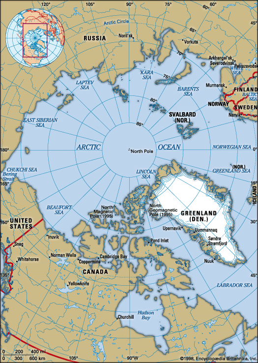
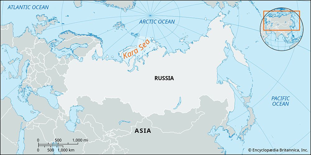
Severnaya Zemlya is an archipelago located in the Arctic Ocean, situated within the Krasnoyarsk kray (region) of northern Russia. It lies between the Kara Sea to the west and the Laptev Sea to the east, positioned immediately north of Cape Chelyuskin and separated from the Siberian mainland by the Vilkitsky Strait.1
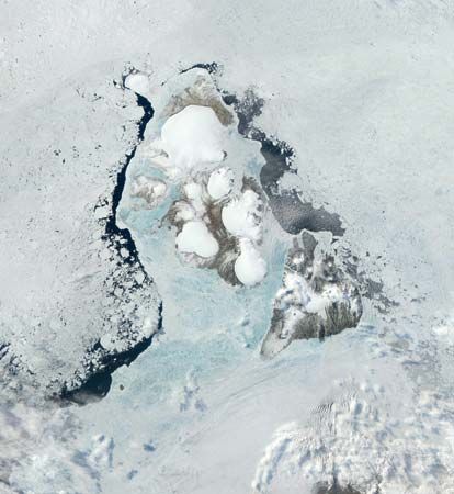
The archipelago consists of four large islands—Oktyabrskoy Revolyutsi, Bolshevik, Komsomolets, and Pioner—along with several smaller ones. Its geographical features include:1
- Glaciation: Approximately 48 percent of the land is covered by ice, which can reach depths of up to 820 feet. Outlet glaciers from these ice caps occasionally reach the sea and serve as a source of icebergs.12
- Topography: The islands are generally low-lying, primarily consisting of plateaus under 2,000 feet high, though the highest point reaches 3,166 feet.12
- Climate and Vegetation: The region experiences a severe climate with winter temperatures around -22° F (-30° C). Vegetation is limited, consisting mostly of low-lying lichens and bushes.1
What is the climate like in Severnaya Zemlya, and how does it affect the local ecosystem?
The climate of Severnaya Zemlya is severe, characterized by harsh, frigid conditions that significantly restrict biological activity. During the winter, temperatures typically drop to -22° F (-30° C), while summer temperatures remain very low, hovering between 33° and 35° F (1° to 2° C). The region experiences a very short growing season, with the land remaining covered by snow for most of the year and only free of it for approximately two and a half months.1
These extreme environmental conditions dictate the local ecosystem, which is notably limited in diversity. The vegetation is sparse, consisting primarily of low-lying lichens and bushes that can survive in the cold, nutrient-poor environment. Consequently, animal life on the archipelago is also restricted, as the harsh climate and limited plant life provide few resources to support a complex food web.1
How does Severnaya Zemlya compare to other Arctic archipelagos in terms of size and characteristics?
Severnaya Zemlya and other Arctic archipelagos, such as Novaya Zemlya, share the classification of Arctic desert, characterized by barren landscapes, significant ice cover, and severe climates.154
In terms of size and physical characteristics, the archipelagos differ as follows:
Feature
Severnaya Zemlya
Novaya Zemlya
Total Area
14,175 sq miles (36,712 sq km)
31,900 sq miles (82,600 sq km)
Topography
Primarily low-lying plateaus; max elevation 3,166 ft
Mountainous (Ural system); max elevation 5,220 ft
Ice Cover
~48% of land area
25% of land area
Climate
Winter: -22° F; Summer: 33°–35° F
Winter: 3° to -8° F; Summer: 36°–44° F
While both regions are defined by their harsh, cold environments, Novaya Zemlya is significantly larger and more mountainous, acting as a geological extension of the Ural Mountains. In contrast, Severnaya Zemlya is more compact and lower in elevation, with a higher percentage of its total landmass permanently glaciated. Both archipelagos support only limited, hardy vegetation like lichens and low-lying bushes, reflecting the extreme constraints of the polar desert environment.514
When was Severnaya Zemlya first discovered, and why was its discovery so late?
Severnaya Zemlya was officially discovered in 1913 by the Russian naval expedition led by the icebreakers Taymyr and Vaygach.12
The late discovery of this archipelago, which remained the last major piece of unsurveyed territory in the Soviet Arctic until it was fully mapped between 1930 and 1932, is primarily attributed to the extreme environmental conditions of the region. The archipelago is located in a remote, high-latitude area characterized by a severe climate, with temperatures often dropping to -22° F (-30° C) and significant portions of the land remaining permanently covered by ice.21
These factors, combined with the presence of treacherous sea ice, made the area exceptionally difficult to access and navigate with the maritime technology available prior to the 20th century. While other Arctic regions like Novaya Zemlya had been known since medieval times, the specific location and ice-locked nature of Severnaya Zemlya effectively shielded it from earlier exploration efforts.24
Sources
- Severnaya Zemlya — Encyclopædia Britannica
- Arctic - The Russian Arctic — Encyclopædia Britannica
- Arctic - Other glacier groups — Encyclopædia Britannica
- Novaya Zemlya — Encyclopædia Britannica
- Arctic - Climate of the Arctic — Encyclopædia Britannica
- Russia - Arctic desert — Encyclopædia Britannica
- list of islands - Russia — Encyclopædia Britannica
- North America - Temperature — Encyclopædia Britannica
- Arctic - The Arctic Ocean — Encyclopædia Britannica
Published on · 3 min read