Timiş River
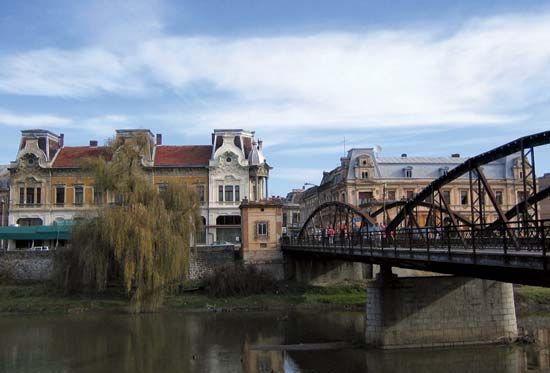
The Timiș River is a 211-mile (340 km) waterway that rises in the Cernei Mountains at the western edge of the Southern Carpathian Mountains in Romania.
What is Timiş River?
The Timiș River is a 211-mile (340 km) waterway that rises in the Cernei Mountains at the western edge of the Southern Carpathian Mountains in Romania.1
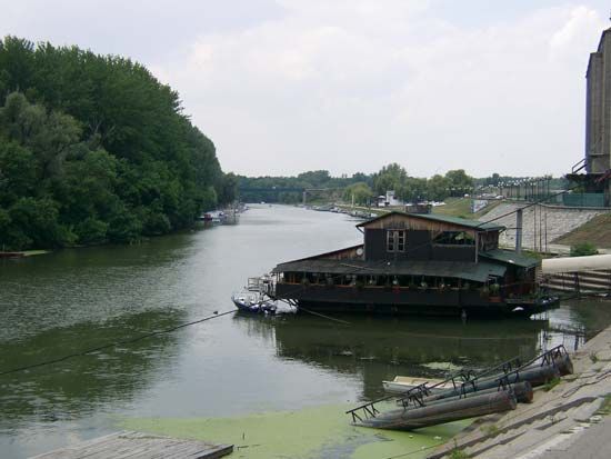
The river follows an arc, flowing north, west, and then south through the cities of Caransebeș and Lugoj before entering the Danube River at Pančevo, Serbia, located east of Belgrade. Its exit from the Carpathians via the Domaneșnea gap forms a critical passage known as the Timiș-Cerna Gap, which connects the Tisza River plain and the city of Timișoara to the Danubian Plain. Beyond this gap, the river traverses a wide alluvial floodplain, and its primary tributary is the Bârzava. The Timiș is navigable only by small craft.1
What are the main characteristics of the Carpathian Mountains?
The Carpathian Mountains form a vast, arc-shaped mountain system in Central and Eastern Europe, characterized by diverse geological structures and distinct climatic zones.
Physiography and Geology
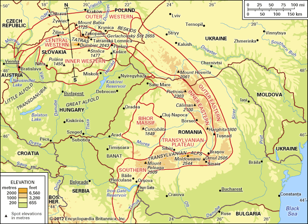
The range is generally divided into the Western Carpathians and the Southeastern Carpathians. The Western Carpathians feature a central block of crystalline and metamorphic rocks, including the Tatras, which exhibit high-mountain glacial relief. In contrast, the Southeastern Carpathians are formed by a triangular block surrounding the Transylvanian Plateau, with the Southern Carpathians primarily composed of metamorphic rocks. Geologically, the system consists of parallel structural ranges, including flysch bands and volcanic formations.34
Climate and Ecology
The Carpathians experience a continental climate influenced by their position between western and eastern Europe. Precipitation varies significantly with altitude, ranging from less than 24 inches in depressed areas to over 65 inches on the highest massifs. The mountains support distinct vegetation stages, from oak and elm forests in the foreland to alpine pastures at higher elevations. The region is home to diverse wildlife, including bears, wolves, and lynx8.56
How does the Danube River impact the geography of Eastern Europe?
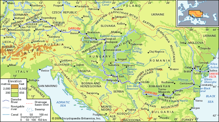
The Danube River is a defining geographical feature of Eastern Europe, acting as a vital artery that shapes the landscape and supports the economic development of the nations along its banks.910
Geographical Impact
The river’s middle and lower courses are characterized by vast plains and significant landforms:
- Plains and Basins: The Danube traverses the Little Alfold and Great Alfold plains, creating fertile, level country that has historically supported settlement.11
- Deposition and Deltas: As the river slows, it deposits massive amounts of silt, forming islands and the expansive Danube Delta. This delta, covering approximately 1,660 square miles, continues to grow seaward annually, creating a unique ecosystem of lakes, swamps, and grinduri (oblong strips of land).11
- Gorges: The river cuts through mountain ranges, most notably at the Iron Gate, which separates the Southern Carpathians and the Balkan Mountains, historically serving as a natural barrier and a strategic passage.11
Economic and Strategic Role
The river serves as a critical commercial highway, connecting inland cities like Budapest and Belgrade to the Black Sea. Through extensive engineering, including the Main–Danube Canal and the Danube–Black Sea Canal, the river has been integrated into a continent-wide waterway system, facilitating trade and hydroelectric power generation.910
What is the historical significance of the Banat region?
The Banat is a historically significant, ethnically diverse region of Eastern Europe defined by its role as a strategic frontier. The term banat originated from a Persian word for “lord” and evolved to signify a frontier province under military governorship.12
Historical Evolution
The region has been a crossroads for various civilizations, including the Romans, Huns, and Avars. By the 9th century, it became an integral part of Hungary, later organized as the Banat of Severin in 1233. Following a period of Ottoman rule, the region was acquired by Austria in 1718 via the Treaty of Passarowitz, which marked the end of Ottoman westward expansion.1213
Administration and Partition
Under Austrian rule, the region was organized as the Temeser Banat, and authorities encouraged the settlement of colonists from the Rhineland, Lorraine, and Luxembourg to develop the area. Following World War I, the Treaty of Trianon (1920) formally divided the Banat among Romania, Yugoslavia, and Hungary, reflecting the complex geopolitical shifts of the 20th century.12
Sources
- Timiş River — Encyclopædia Britannica
- Timișoara — Encyclopædia Britannica
- Carpathian Mountains - Physiography of the Carpathian Mountains — Encyclopædia Britannica
- Carpathian Mountains - Geology — Encyclopædia Britannica
- Carpathian Mountains - Climate — Encyclopædia Britannica
- Carpathian Mountains - Transportation — Encyclopædia Britannica
- Carpathian Mountains - Tourism — Encyclopædia Britannica
- Carpathian Mountains - Plant and animal life — Encyclopædia Britannica
- Danube River - Physiography — Encyclopædia Britannica
- Danube River — Encyclopædia Britannica
- Danube River - The economy — Encyclopædia Britannica
- Banat — Encyclopædia Britannica
- Treaty of Passarowitz — Encyclopædia Britannica
Published on · 3 min read