Yaqui River
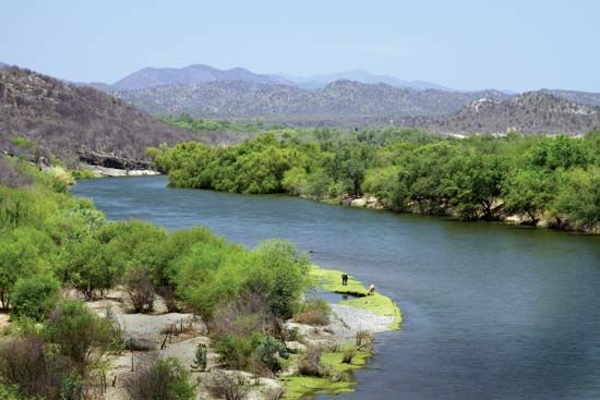
The Yaqui River is the largest river system in the state of Sonora, located in northwestern Mexico. It is formed in the Sierra Madre Occidental by the…
What is Yaqui River?
The Yaqui River is the largest river system in the state of Sonora, located in northwestern Mexico. It is formed in the Sierra Madre Occidental by the confluence of the Bavispe and Papigochi rivers and flows approximately 200 miles (320 km) southward and westward before emptying into the Gulf of California.1
While the river is not navigable, it is vital for regional agriculture. It is controlled by the Álvaro Obregón and Novillo dams, which facilitate extensive irrigation for crops such as wheat, corn, rice, and fruits. The river’s waters have also been central to the agricultural development of the Yaqui people, an Indigenous group native to the region, whose farming practices shifted toward cash crops like cotton and wheat following large-scale irrigation projects in the 1940s.12
Who are the Yaqui people?
The Yaqui are an Indigenous people historically centered in the southern region of Sonora, Mexico, with a significant population also residing in southern Arizona, United States. They speak a dialect of the Cahita language, which is part of the Uto-Aztecan family.23
Traditionally settled agriculturists, the Yaqui are known for their history of resilient resistance against Spanish colonization and later Mexican government encroachment on their tribal lands during the 19th century. Following periods of conflict and forced deportation, much of their territory was restored in the 1930s.2
Modern Yaqui agriculture has evolved significantly since the 1940s due to large-scale irrigation projects, shifting from subsistence farming of corn, beans, and squash to the production of cash crops like wheat and cotton. While the Yaqui are Roman Catholic, their religious practices incorporate distinct Indigenous traditions. Today, the community maintains a strong cultural identity across both sides of the U.S.-Mexico border.23
How do dams affect river ecosystems?
Dams significantly alter river ecosystems by transforming natural environments to serve human needs, often resulting in profound ecological consequences. While some structures, such as beaver dams, create beneficial wetlands that support diverse fish and waterfowl populations, large-scale human-engineered dams frequently disrupt these systems.45
Key impacts include:
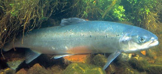
- Obstruction of Migration: Dams block or impede the movement of spawning fish, leading to dramatic population declines in species like salmon. While fish passes (such as ladders or locks) are sometimes used to mitigate this, they are not always successful.64
- Sediment Trapping: Reservoirs capture much of the river’s sediment load. This deprives downstream areas of silt, which can lead to the erosion of riverbanks rather than their natural replenishment, and can eventually render reservoirs useless as they fill with silt.789
- Hydrological and Thermal Changes: Dams regulate water flow, which can alter the thermal climate of downstream waters and disrupt the natural hydrologic cycle. This regulation often isolates rivers from their surrounding floodplains, destroying riparian wetlands and breeding grounds.101112
- Habitat Loss: The creation of large reservoirs often results in the inundation of vast landscapes, displacing human communities and destroying local flora and fauna.48
What is the Sierra Madre Occidental?
The Sierra Madre Occidental is a major mountain range in northwestern Mexico that runs parallel to the Pacific coast. It is a key component of the broader Sierra Madre mountain system, which encloses the central Mexican Plateau.1415
Physical Features
The range extends approximately 700 miles (1,100 km) in length and varies from 100 to 300 miles (160 to 480 km) in width. Most summits exceed 6,000 feet (1,800 meters), with some peaks rising above 10,000 feet (3,000 meters). While the eastern side features relatively broken relief, the western side is characterized by formidable escarpments that drop into deep canyons known as barrancas, the most famous being the Copper Canyon.16
Ecology
The region’s vegetation varies by elevation, featuring conifer forests in the tierra fria and mixed oak-pine forests in the tierra templada. Lower, drier areas are home to drought-tolerant, scrubby vegetation. Wildlife includes deer, coyotes, black bears, and, in remote northern areas, gray wolves.17
Sources
- Yaqui River — Encyclopædia Britannica
- Yaqui — Encyclopædia Britannica
- Yaqui — Merriam-Webster
- dam - Fish passes — Encyclopædia Britannica
- Why do beavers build dams? — Encyclopædia Britannica
- dam - Rise of environmental and economic concerns — Encyclopædia Britannica
- river - Environments of deposition — Encyclopædia Britannica
- lake - The water budget — Encyclopædia Britannica
- river - Peak discharge and flooding — Encyclopædia Britannica
- Yangtze River - Human impact on the environment — Encyclopædia Britannica
- Mississippi River - Flood control — Encyclopædia Britannica
- dam - Reservoirs — Encyclopædia Britannica
- Wetland - Riparian wetlands — Encyclopædia Britannica
- Sierra Madre - Physiography of the Sierra Madre — Encyclopædia Britannica
- Sierra Madre Occidental — Merriam-Webster
- Sierra Madre - Plant and animal life — Encyclopædia Britannica
- Sierra Madre — Encyclopædia Britannica
Published on · 3 min read