Arinos River
The Arinos River is a river located in west-central Brazil. It originates in the Araporé Mountains, situated northeast of Cuiabá near Diamantino. From its…
What is Arinos River?
The Arinos River is a river located in west-central Brazil1. It originates in the Araporé Mountains, situated northeast of Cuiabá near Diamantino. From its source, the river flows west briefly before turning north-northwest across the Mato Grosso Plateau. It eventually reaches its junction with the Juruena River, which serves as a major headstream for the Tapajós River headstream for the Tapajós River.1
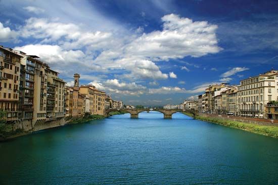
Please note that the Arinos River is distinct from the Arno River, which is a major waterway in the Tuscany region of Italy.2
What is the significance of the Tapajós River system?
The Tapajós River is a major tributary of the Amazon River, formed by the confluence of the Teles Pires and Juruena rivers in central Brazil.3 Its significance lies in several key areas:3
- Navigation and Connectivity: Unlike many other Amazonian tributaries that are blocked by falls and rapids, the entire 400-mile (650-km) course of the Tapajós is navigable. It serves as a vital transportation artery, and through a complex network of rivercraft routes and canals, it can even provide a connection to the Paraguay River system, eventually reaching as far as Buenos Aires.3
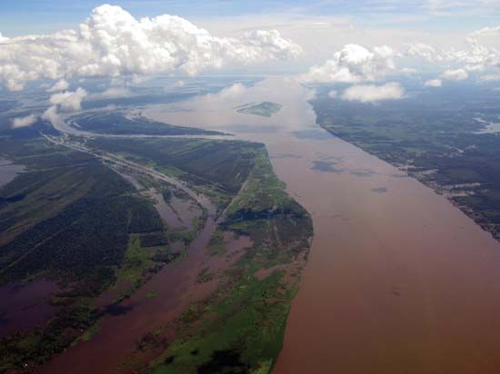
- Hydrology: Classified as a “clearwater” river, the Tapajós has a higher mineral content and lower levels of humic acids compared to the darker “blackwater” rivers of the region. At its mouth near Santarém, the river’s interaction with the Amazon creates distinct estuarine features, including funnel-shaped freshwater lakes.43
- Geographic Scope: The river system traverses the Mato Grosso Plateau and forms important state boundaries between Mato Grosso, Amazonas, and Pará, playing a central role in the drainage of the Amazon basin.3
What are the unique geographical features of the Mato Grosso Plateau?
The Mato Grosso Plateau is an ancient erosional plateau situated within the Brazilian Highlands of central Brazil. It features several distinct geographical characteristics:
- Elevation and Watershed: With an average elevation of approximately 3,000 feet (900 meters) above sea level, the plateau serves as a critical continental divide. It separates the Amazon River basin to the north from the Río de la Plata system (specifically the Paraguay River basin) to the south.78
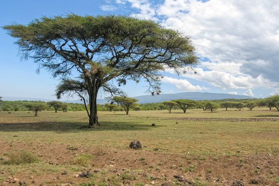
- Topography and Vegetation: The landscape is characterized by a mix of savanna grasslands and woodland. In the highlands, one finds extensive plains known as campos, which feature scrub growth and light forest.78
- Southern Transition: To the south, the plateau descends into the Pantanal, a vast, seasonally inundated floodplain that serves as a major basin for the upper Paraguay and Cuiabá rivers.79
- Drainage: The northern slopes are drained by a dendritic system of streams that feed into the Amazon, including the Xingu, Tapajós, and Madeira rivers.8
How do rivers in the Amazon basin support local ecosystems?
Rivers in the Amazon basin are fundamental to the region’s ecological health, acting as both a life-sustaining resource and a driver of biological diversity. Their influence is primarily exerted through the following mechanisms:
- Nutrient Cycling and Soil Enrichment: The annual flooding of várzea forests—areas inundated by nutrient-rich “whitewater” rivers—is critical for the ecosystem. As these waters recede, they deposit fertile silt that rejuvenates the soil, supporting a mosaic of wetlands and vegetation that would otherwise struggle in the basin’s typically acidic, nutrient-poor soils.1011
- Seed Dispersal: The river system facilitates a unique symbiotic relationship between plants and animals. During the high-water season, many fish species, such as the tambaqui and various catfish, migrate into flooded forests to feed on fruit and seeds. By consuming these fruits and later defecating the seeds in different locations, these fish act as essential agents for forest regeneration and seed dispersal.12
- Habitat Diversity: The rivers create a complex environment that supports an immense variety of life. From the estuaries and marshes to the distinct igapó (blackwater-flooded) forests, these aquatic systems provide niches for thousands of species, including river dolphins, manatees, and approximately 2,500 species of fish.1310
Sources
- Arinos River — Encyclopædia Britannica
- Arno River — Encyclopædia Britannica
- Juruena River — Encyclopædia Britannica
- Tapajós River — Encyclopædia Britannica
- Brazil - Rivers of Brazil — Encyclopædia Britannica
- Amazon River - Physiography of the river course — Encyclopædia Britannica
- Mato Grosso Plateau — Encyclopædia Britannica
- Mato Grosso — Encyclopædia Britannica
- Paraguay River — Encyclopædia Britannica
- Amazon River - Hydrology of the Amazon River — Encyclopædia Britannica
- Amazon River - Animal life — Encyclopædia Britannica
- Vegetarian piranhas — Encyclopædia Britannica
- Amazon River - Plant life — Encyclopædia Britannica
- Amazon River — Encyclopædia Britannica
- Amazon basin — Encyclopædia Britannica
- Amazon River - Soils of the Amazon River — Encyclopædia Britannica
Published on · 3 min read