Bani River
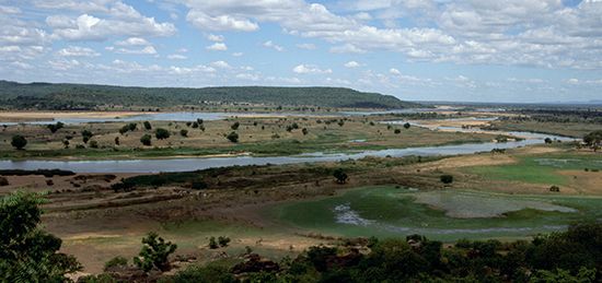
The Bani River is the principal right-bank tributary of the Niger River in Mali, West Africa. It is formed by the confluence of the Baoulé and Bagoé…
What is Bani River?
The Bani River is the principal right-bank tributary of the Niger River in Mali, West Africa. It is formed by the confluence of the Baoulé and Bagoé headstreams, located approximately 100 miles (160 km) east of Bamako.1
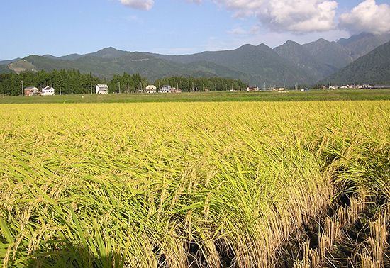
The river flows for about 230 miles (370 km) in a northeasterly direction before joining the Niger River at Mopti within the swampy Macina depression. Navigable only in part, the Bani flows through a savanna region where the local economy relies on cattle herding and the cultivation of crops such as rice, millet, sorghum, and corn along its banks.12
What is the significance of the Niger River’s internal delta?
The internal delta of the Niger River—often referred to as the Macina region—is a vast, low-lying area in Mali characterized by a complex network of lakes, swamps, and braided channels. Its significance is primarily rooted in its ecological and economic contributions to the region:345
- Agricultural Productivity: The delta is one of the most fertile areas in Africa. Its flat terrain and near-nonexistent gradient cause the river to spread out, creating rich alluvial soils that are highly productive for [subsistence agriculture]7. Key crops grown in this region include rice, millet, wheat, and corn.46
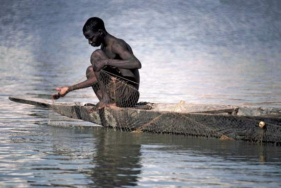
- Fisheries: The internal delta serves as a vital fishing ground, making Mali one of the largest producers of fish in [western Africa]5. While the sector has faced challenges from drought, pollution, and dam construction, it remains a cornerstone of the local economy.6
- Livestock Support: The region is a major hub for livestock raising, particularly for the Fulani people, who breed cattle and sheep in the area.46
- Hydrological Dynamics: During the rainy season, the delta experiences general inundation, where lakes and channels connect to form a vast, unified water system. This seasonal flooding is essential for maintaining the fertility of the land and supporting the diverse ecosystems within the basin.35
How do seasonal changes affect river navigation in West Africa?
Seasonal changes significantly dictate the navigability of rivers in West Africa, primarily due to the direct relationship between rainfall patterns and water discharge levels. Because the Niger River basin experiences varied climatic conditions, high-water and low-water seasons occur at different times depending on the specific stretch of the river.9
- Fluctuating Water Levels: Navigation is heavily dependent on these seasonal fluctuations. For example, while the lower Niger from the Atlantic Ocean to Onitsha remains navigable by large vessels year-round, other sections are restricted. Between Onitsha and the confluence of the Benue River, large vessels can only operate for 10 months of the year (June–March), relying on the influx of water from the Benue during its high-water season.10
- Navigational Hazards: During low-water periods, strong currents in narrow gorges—such as the defile downstream from Timbuktu—can pose significant dangers to vessels. Furthermore, extreme fluctuations in water levels often serve as a major handicap for commercial shipping beyond Lokoja.1110
- Regional Variations: In the middle Niger, navigation for small craft is generally limited to high-water periods, and the river’s depth can vary by as much as 35 feet (10 meters) between seasons.911
What are the main crops grown in the savanna regions of Mali?
In Mali, agriculture is the foundation of the economy, with production divided between subsistence foodstuffs and commercial crops. The savanna and broader agricultural regions support a variety of staples and market-oriented products.512
Main Subsistence Crops
The primary subsistence crops grown across Mali’s agricultural zones include:
- Cereals: Millet, rice, wheat, and corn (maize) are central to the local diet.5
- Root Crops: Yams and cassava (manioc) are also widely cultivated.5
Commercial and Market Crops
The government actively supports the development of commercial agriculture to bolster the economy. Key crops include:5
- Cash Crops: Cotton is a major commercial export. Other market-oriented crops include peanuts (groundnuts), sugarcane, tobacco, and tea.512
- Market Gardens: These areas produce a diverse range of fruits and vegetables, such as cabbages, turnips, carrots, beans, tomatoes, bananas, mangoes, and oranges.5
Agricultural productivity is particularly high in the Niger River basin, where irrigation projects near towns like Ségou and Mopti have been established to enhance output.5
Sources
- Bani River — Encyclopædia Britannica
- Banas River — Encyclopædia Britannica
- Niger River - Physiography — Encyclopædia Britannica
- Macina — Encyclopædia Britannica
- Mali - Agriculture, forestry, and fishing — Encyclopædia Britannica
- Nigeria: Top Questions — Encyclopædia Britannica
- Mali - Drainage and soils — Encyclopædia Britannica
- Nigeria - Drainage — Encyclopædia Britannica
- Niger River - Hydrology of Niger River — Encyclopædia Britannica
- Africa - Water resources — Encyclopædia Britannica
- Niger River - Transportation — Encyclopædia Britannica
- Africa - Other cash crops — Encyclopædia Britannica
- Mali — Encyclopædia Britannica
- Burkina Faso - Agriculture — Encyclopædia Britannica
- Senegal - Climate of Senegal — Encyclopædia Britannica
- Côte d’Ivoire - Rural environment — Encyclopædia Britannica
Published on · 3 min read