Cape Breton Highlands
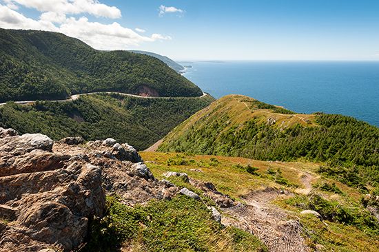
The Cape Breton Highlands are a forested upland region located on the northernmost part of Cape Breton Island in Nova Scotia, Canada.
What is the geographical location and extent of the Cape Breton Highlands?
The Cape Breton Highlands are a forested upland region located on the northernmost part of Cape Breton Island in Nova Scotia, Canada.1
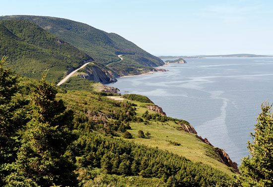
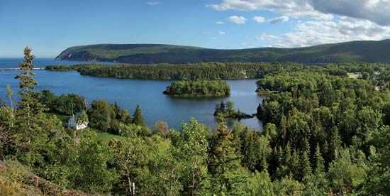
Occupying a large peninsula, the highlands are bounded by the Atlantic Ocean to the east and the Gulf of St. Lawrence to the west. The region is characterized by an undulating plateau that rises abruptly from the coast, averaging 1,200 feet (370 m) in elevation. Its highest point reaches 1,745 feet (532 m), marking the highest elevation in the province.12
While largely uninhabited outside of a narrow coastal fringe, a significant portion of the area is protected within the Cape Breton Highlands National Park, which spans 367 square miles (951 square km). The region is famously encircled by the 185-mile (298-km) Cabot Trail.12
What are the main ecological features and wildlife found in the Cape Breton Highlands?
The Cape Breton Highlands are characterized by a diverse landscape shaped by long-term river erosion and glacial activity during the Ice Age. The region’s ecological features are defined by its unique topography and climate, which includes high annual precipitation levels exceeding 63 inches (1,600 mm) on the plateau.12
Vegetation and Terrain
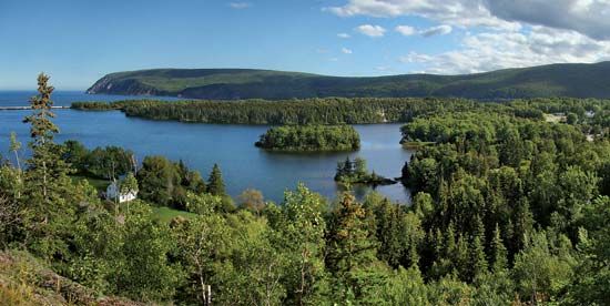
The area is primarily covered by dense forests, with fir, spruce, birch, and poplar being the dominant tree species. In contrast to the forested slopes, the central plateau features distinct ecological zones, including:1
- Muskeg: Bogs characterized by acidic, waterlogged soil.
- Heath: Open areas dominated by low-growing shrubs.
- Lakes: Numerous freshwater bodies scattered across the highland interior.1
Wildlife
The highlands support a variety of mammals and birds, including a notable population of seabirds that inhabit the coastal areas where the plateau meets the sea.1
What recreational activities and attractions are available in Cape Breton Highlands National Park?
Cape Breton Highlands National Park serves as a premier destination for outdoor recreation and scenic exploration in northern Nova Scotia. The park is widely recognized for its dramatic landscape, which features an undulating plateau rising abruptly from the Atlantic Ocean and the Gulf of St. Lawrence.21
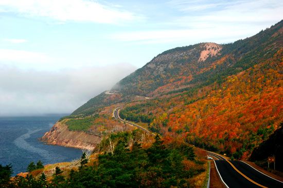
The primary attraction for visitors is the Cabot Trail, a 185-mile (298-km) scenic highway that encircles most of the highland region and runs along three sides of the park. This route provides access to the park’s diverse terrain, which includes dense forests of fir, spruce, birch, and poplar, as well as unique interior ecosystems like muskeg, heath, and various freshwater lakes.21
While the park is a popular hub for sightseeing and nature appreciation, the provided information does not detail specific recreational activities such as hiking trails, camping facilities, or water sports.
What is the highest point in the Cape Breton Highlands and how tall is it?
The highest point in the Cape Breton Highlands reaches an elevation of 1,745 feet (532 meters) above sea level. This peak also serves as the highest point in the entire province of Nova Scotia.1
Sources
- Cape Breton Highlands — Encyclopædia Britannica
- Cape Breton Highlands National Park — Encyclopædia Britannica
- Nova Scotia - Climate — Encyclopædia Britannica
Published on · 2 min read