Darling Range
The Darling Range is a prominent geological feature in southwestern Western Australia, characterized as an upfaulted block that forms a scarp at the edge of…
What is the geological history and formation of the Darling Range?
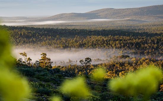
The Darling Range is a prominent geological feature in southwestern Western Australia, characterized as an upfaulted block that forms a scarp at the edge of the Great Plateau.12
Geologically, the range is primarily underlain by granite. Its formation is defined by its status as an upfaulted structural block, which has been significantly shaped by environmental processes over millions of years. A defining characteristic of the range is its capping of laterite, a reddish, iron-rich product formed through the intense weathering of rock.2
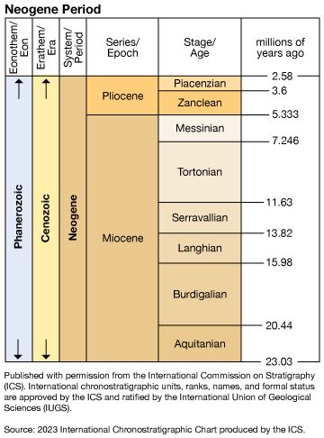
Evidence suggests that during the Paleogene and Neogene periods, the region was reduced to an area of low relief under humid tropical climatic conditions, which facilitated the formation of the laterite crust. Today, the scarp is dissected by ravines carved by rivers flowing toward the coast, such as the Helena, Canning, and Collie rivers. These features reflect a landscape where the interaction between ancient structural uplift and subsequent erosion has created the current topography.21
What are some of the notable peaks or landmarks within the Darling Range?
The Darling Range, which extends along the coast of Western Australia, features several notable peaks and landmarks that define its landscape.
Notable Peaks
The range reaches its highest elevations at the following summits:
- Mount Cooke: The highest peak in the range, reaching an elevation of 1,910 feet (582 meters).13
- Mount Solus: Standing at 1,827 feet (approx. 557 meters).1
- Mount Dale: Reaching an elevation of 1,781 feet (approx. 543 meters).1
Key Landmarks and Features
Beyond its peaks, the range is defined by significant geographical and human-made landmarks:
- John Forrest National Park: Located near Perth, this park is a prominent feature within the region.1
- Mundaring Weir: Situated on the Helena River, this major dam is a critical landmark used for irrigation and domestic water supply.1
- The Scarp: The range itself acts as a massive fault or scarp at the edge of the Great Plateau, characterized by deep ravines carved by rivers such as the Canning and the Collie.1
What role does the Darling Range play in Western Australia’s water supply and management?
The Darling Range plays a vital role in the water management of southwestern Western Australia. The range acts as a significant catchment area where the scarp is dissected by numerous ravines carved by rivers flowing toward the coast. Several of these rivers, most notably the Helena, Canning, and Collie, have been dammed to create reservoirs that provide essential irrigation and domestic water supplies for the region.1
It is important to distinguish the Darling Range in Western Australia from the Darling River in eastern Australia. While the Darling River is a major component of the Murray-Darling river system and is managed through extensive dam and weir projects to support irrigation and town water across New South Wales and South Australia, it is a separate geographical entity.45
In Western Australia, water resources remain a critical concern. While the coastal plain of the Perth Basin relies on groundwater for about half of its supply, the infrastructure developed within the Darling Range remains a fundamental component of the state’s broader water management strategy.6
How do the Darling Range mountains compare in height and extent to other mountain ranges in Australia?
The Darling Range is significantly smaller in both height and extent compared to Australia’s primary mountain system, the Great Dividing Range.
Comparison of Extent
- Darling Range: This feature is a scarp or fault block that parallels the southwest coast of Western Australia for approximately 200 miles (320 km).1
- Great Dividing Range: In contrast, this massive watershed stretches about 2,300 miles (3,700 km) along the eastern coast of Australia, spanning from the Cape York Peninsula in the north to the Grampians in the south.78
Comparison of Height
- Darling Range: The range is relatively low, with average heights ranging from 800 to 1,000 feet (250–300 meters). Its highest peak, Mount Cooke, reaches 1,910 feet (582 meters).1
- Great Dividing Range: This system contains much higher elevations. In Queensland, the mountains average 2,000–3,000 feet (600–900 meters), with some peaks reaching 5,000 feet (1,500 meters). The Australian Alps segment contains the continent’s highest point, Mount Kosciuszko, at 7,310 feet (2,228 meters).789
Sources
- Darling Range — Encyclopædia Britannica
- Australia - The Western Plateau — Encyclopædia Britannica
- Darling Range — Merriam-Webster
- Darling River — Encyclopædia Britannica
- Western Australia - Resources and power — Encyclopædia Britannica
- New South Wales - Drainage — Encyclopædia Britannica
- Exploring 7 of Earth’s Great Mountain Ranges - Great Dividing Range — Encyclopædia Britannica
- Great Dividing Range — Encyclopædia Britannica
- Australian Alps — Encyclopædia Britannica
Published on · 3 min read