Erromango
Erromango is a volcanic island located in the nation of Vanuatu within the southwestern Pacific Ocean. Spanning 376 square miles (975 square km), the island…
What is Erromango?
Erromango is a volcanic island located in the nation of Vanuatu within the southwestern Pacific Ocean. Spanning 376 square miles (975 square km), the island features an interior peak, Santop, which reaches an elevation of 2,907 feet (886 metres).1
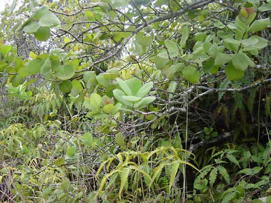
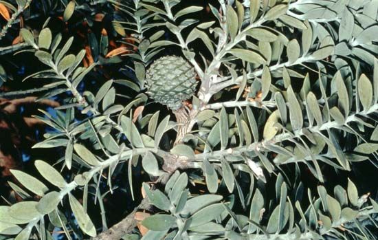
Historically, the island was known for a sandalwood trade that began in 1825; however, the resource was nearly depleted by the end of the 19th century due to overexploitation. Today, small private plantations have been established to revive sandalwood production for export. The island also contains significant timber resources, including kauri pine and various hardwoods, which are harvested by foreign logging companies.1
Geographically, Erromango lacks adequate harbours, with Cook Bay on the east coast serving as the only reliable anchorage. Transportation is supported by two airstrips located at Dillon Bay and Ipota, and the local economy includes the production of copra.1
What is the history of the sandalwood trade in the Pacific?
The sandalwood trade in the Pacific was a significant driver of early European commercial expansion, characterized by a pattern of rapid exploitation and resource depletion. As traders exhausted supplies in one location, they moved to new islands, following a chronological progression: after being depleted in Fiji by 1813, the trade shifted to Hawaii in the 1820s, the New Hebrides (now Vanuatu) in 1825, and New Caledonia by 1840.2
On islands like Erromango, the trade led to the near-total depletion of sandalwood trees by the end of the 19th century due to overharvesting. This industry was often marked by harsh conditions and atrocities committed by traders against indigenous populations. Because sandalwood is a slow-growing, semiparasitic plant, the intense demand for its aromatic heartwood—used in incense, perfumes, and religious rites—ultimately rendered many species endangered or extinct. As sandalwood supplies dwindled, European commercial interests in the region shifted toward other commodities, such as copra.123
What are the main geographical features of the island nation of Vanuatu?
The island nation of Vanuatu is a chain of 13 principal islands and numerous smaller ones in the southwestern Pacific Ocean, extending in an irregular Y shape for approximately 400 miles (650 km).4
The islands are characterized by a diverse relief, featuring rugged mountains, high and low plateaus, rolling hills, coastal terraces, and offshore coral reefs. The landscape is primarily composed of volcanic rock and sedimentary or coral limestones. Structural instability is common, evidenced by frequent earthquakes and the presence of several active volcanoes, such as Yasur on Tanna and the twin vents of Benbow and Marum on Ambrym. The highest point in the country is Tabwémasana, reaching 6,165 feet (1,879 meters) on Espiritu Santo.5
Much of the archipelago is covered by dense rain forest, though drier regions contain patches of savanna grassland. The climate is tropical, with a hot, wet season from November to April and a cooler, drier season from May to October.5
How do volcanic islands like Erromango form?
Volcanic islands like Erromango, part of the Vanuatu archipelago, are formed through the process of subduction at convergent plate boundaries.89
When two tectonic plates collide, the denser oceanic plate is forced downward into the Earth’s mantle beneath the overriding plate. As this descending slab reaches depths of approximately 100 km (60 miles), intense heat and pressure drive off volatile components, which trigger partial melting in the mantle wedge above. This process generates magma that rises to the surface, erupting to build a chain of volcanic islands known as an island arc build a chain of volcanic islands known as an island arc.81
In the case of Vanuatu, these islands are associated with the subduction of the Coral Sea floor beneath the overriding plate. These arcs typically feature a parallel deep-sea trench on their convex side, such as the New Hebrides Trench, which marks the site where the plates converge. Over time, the accumulation of extruded basaltic and andesitic materials from the seafloor builds the islands we see today.108119
Sources
- Erromango — Encyclopædia Britannica
- Pacific Islands - Growth of trading communities — Encyclopædia Britannica
- Sandalwood — Encyclopædia Britannica
- Vanuatu - Land — Encyclopædia Britannica
- Vanuatu — Encyclopædia Britannica
- Vanuatu - Economy — Encyclopædia Britannica
- Vanua Lava — Encyclopædia Britannica
- island arc — Encyclopædia Britannica
- plate tectonics - Island arcs — Encyclopædia Britannica
- volcanism — Encyclopædia Britannica
- New Hebrides Trench — Encyclopædia Britannica
- mountain - Volcanoes and island arcs surrounding the northwest Pacific basin — Encyclopædia Britannica
Published on · 3 min read