Flinders Island
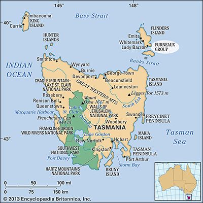
Flinders Island is the largest and northernmost island of the Furneaux Group, located in the eastern Bass Strait between Tasmania and the mainland of…
What is Flinders Island?
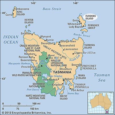
Flinders Island is the largest and northernmost island of the Furneaux Group, located in the eastern Bass Strait between Tasmania and the mainland of Australiaplace/Tasmania) and the mainland of Australia.1
Spanning approximately 800 square miles (2,080 square km), the island is characterized by hilly terrain, reaching its highest point at Strzelecki Peaks (2,552 feet/778 meters) in the south. It was named after the English navigator Matthew Flinders, who surveyed its coastline in 1798.1
The island’s economy is supported by agriculture, particularly cattle and sheep farming on the western coast, where the land features fertile terra rossa soils. The primary settlement is located at Whitemark. Additionally, the island serves as a sanctuary for the Cape Barren goose and has a significant history as a center for people of mixed European and Aboriginal descent.1
Who was Matthew Flinders and what were his explorations?
Matthew Flinders (1774–1814) was a distinguished English navigator and Royal Navy officer renowned for his extensive charting of the Australian coastline.
His major explorations included:
- Early Voyages: Arriving in Australia in 1795, he explored the southeast coast and circumnavigated Tasmania. During this period, he named the Bass Strait in honor of his colleague, George Bass.34
- The Investigator Expedition: As commander of the Investigator, he surveyed the entire southern coast from Cape Leeuwin to the Bass Strait starting in 1801.
- Circumnavigation: In 1802–1803, he charted the east coast and the Gulf of Carpentaria before completing the first full circumnavigation of the Australian continent.3
Following these achievements, Flinders was interned by French authorities on Mauritius for several years before returning to England. He documented his findings in Voyage to Terra Australis, published shortly before his death.3
What is the significance of the Bass Strait in Australian geography?
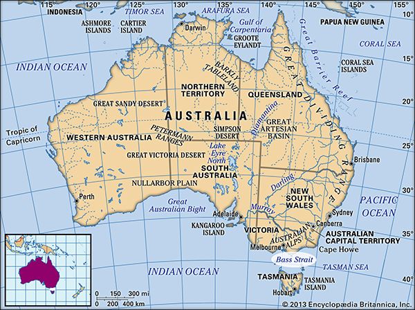
The Bass Strait is a significant geographical channel that separates the state of Victoria, Australia, from the island of Tasmania to the south.4
Its importance is defined by several key factors:
- Maritime Connectivity: The strait serves as a vital maritime link, connecting the Indian Ocean in the west to the Tasman Sea in the east. It is a critical corridor for shipping lanes and passenger ferry services, such as those operating between Devonport and Melbourne, which are essential for Tasmania’s transportation infrastructure.456
- Economic Resources: The region is a major hub for energy production. Following the discovery of natural gas in 1965 and oil in 1967, the strait has become a significant site for offshore petroleum extraction, particularly within the Gippsland Basin.45
- Geographical Features: Spanning a maximum width of 150 miles, the strait contains notable island groups, including King Island and the Furneaux Group, which are integral to the region’s maritime geography.4
What are the unique characteristics of the Cape Barren goose?
Sorry, the Britannica knowledge base does not contain information regarding the unique characteristics of the Cape Barren goose. While the provided search results identify the Cape Barren goose (Cereopsis novaehollandiae) as a gooselike waterfowl found in Australia, they do not detail its specific traits or behaviors.
Sources
- Flinders Island — Encyclopædia Britannica
- Kangaroo Island — Encyclopædia Britannica
- Matthew Flinders — Encyclopædia Britannica
- Bass Strait — Encyclopædia Britannica
- Tasman Sea — Encyclopædia Britannica
- Tasmania - Transportation and telecommunications — Encyclopædia Britannica
- Barnacle goose — Encyclopædia Britannica
- Goose — Encyclopædia Britannica
Published on · 2 min read