Fly River
The Fly River has had a limited impact on human settlement patterns, as the region it traverses is one of the least-inhabited areas of New Guinea. The river…
How has the Fly River influenced human settlement patterns in the region?
The Fly River has had a limited impact on human settlement patterns, as the region it traverses is one of the least-inhabited areas of New Guinea. The river flows through a vast, swampy plain known as the Fly-Digul shelf, which experiences extremely high annual rainfall, making it an inhospitable environment for large-scale human habitation.12
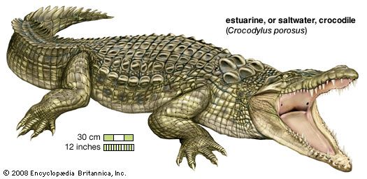
Consequently, there are few settlements of significant size along the river. The primary exception is the town of Kiunga, located approximately 490 miles inland, which serves as a port for shipping copper and gold mined in the nearby Star Mountains. Beyond this industrial activity, human presence remains sparse, characterized by small-scale activities such as crocodile hunting and a few coconut plantations. Furthermore, environmental degradation resulting from mining operations along the upper course of the river has become a source of political tension, further discouraging dense settlement in the area.1
How has mining activity in the region affected the Fly River and its surroundings?
Mining activity in the Star Mountains has significantly impacted the Fly River and its surrounding environment. The extraction of copper and gold, facilitated by the port at Kiunga, has led to substantial environmental degradation along the river’s upper course.1
This ecological damage has become a major point of political tension within the region, as the discharge of mining-related materials affects the river system. While the river naturally transports millions of tons of sediment downstream to form sandbars and islands in its estuary, the additional burden from industrial mining operations exacerbates the environmental challenges faced by the river’s ecosystem.1
Where is the Fly River located in Papua New Guinea, and how long is it?
The Fly River is located in Papua New Guinea, where it flows almost entirely through the country. It originates in the central highlands on the Victor Emanuel Range—specifically the Star, Kaban, and Hindenburg ranges—and travels south and southeast until it reaches the Gulf of Papua in the Coral Sea.1
For a brief portion of its middle course, the river serves as the international border between Papua New Guinea and the Indonesian territory of the island. The river spans a total length of more than 700 miles (1,100 km).1
What are the main tributaries of the Fly River, and how do they contribute to its flow?
The Fly River is fed by three principal tributaries that contribute to its significant volume and flow: the Strickland, Alice (Tedi), and Palmer rivers.1
These tributaries originate in the central highlands of the Victor Emanuel Range, specifically within the Star, Kaban, and Hindenburg ranges. As these waters converge, they feed the main channel of the Fly, which then flows south and southeast for over 700 miles toward the Gulf of Papua. Below the junction with the Palmer River, the channel broadens and deepens, becoming navigable for the remaining 530 miles to the sea.1
The river system is characterized by seasonal flooding, particularly between October and April, which transports vast quantities of sediment downstream. This process is essential to the formation of the shifting sandbars and islands found in the river’s expansive 40-mile-wide mouth.1
Sources
- Fly River — Encyclopædia Britannica
- New Guinea — Encyclopædia Britannica
Published on · 2 min read