Gila River
The Gila River valley is home to several significant archaeological sites that provide profound insights into ancient North American civilizations.
Are there any significant archaeological sites along the Gila River, and what have they revealed about ancient civilizations?
The Gila River valley is home to several significant archaeological sites that provide profound insights into ancient North American civilizations.
Hohokam Culture
The Hohokam culture flourished along the Gila and Salt rivers from approximately 200 to 1450 CE. They are renowned for their sophisticated agricultural engineering, having constructed the largest prehistoric canal irrigation system in the American West. Their development evolved from simple pit houses to complex villages featuring ball courts and, later, massive adobe community houses influenced by the Salado people. Key sites include the Hohokam Pima National Monument, which preserves partially excavated village remains.123
Casa Grande and Mogollon Sites
- Casa Grande Ruins National Monument: This site features a unique four-story structure built in the 14th century. Its design includes wall openings that align with the Sun and Moon, reflecting advanced astronomical awareness.3
- Gila Cliff Dwellings National Monument: Located near the river’s headwaters in New Mexico, these stone masonry dwellings were inhabited by the Mogollon culture between 1280 and the early 14th century, with evidence of occupation dating back to 100 CE.4
Where is the Gila River located, and what are its major tributaries?
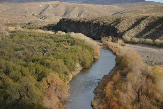
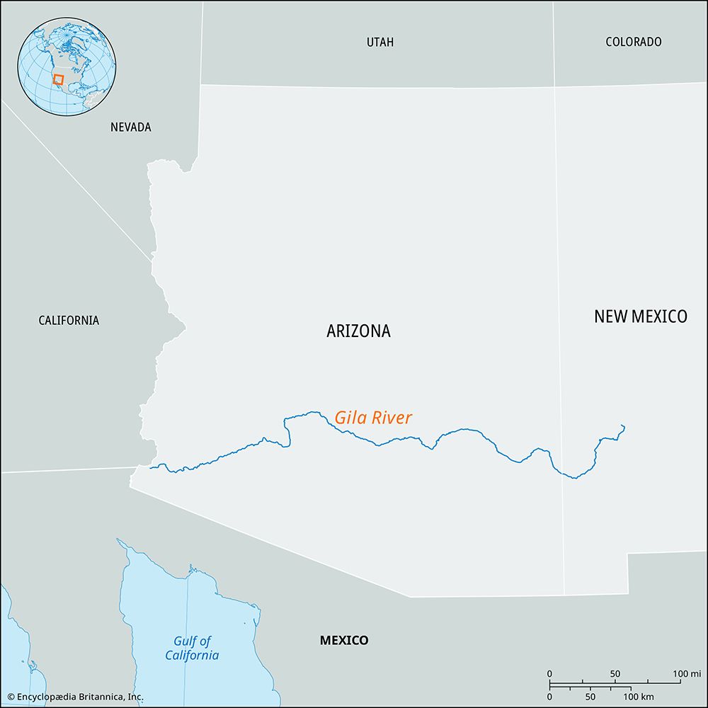
The Gila River rises in the Elk Mountains of southwestern New Mexico, near the Gila Cliff Dwellings National Monument. It flows for 630 miles (1,015 km) in a westerly and southwesterly direction across desert landscapes before joining the Colorado River at Yuma, Arizona.3
The river’s major tributaries include:
- San Francisco River: Joins the Gila near Clifton, Arizona.3
- San Pedro River3
- Santa Cruz River3
- Salt River: The primary tributary arriving from the northeast.3
- Agua Fria River3
Due to extensive water storage at the Coolidge Dam and the Roosevelt Dam on the Salt River, the riverbed is often dry and barren downstream to the Colorado.3
How does the Gila River contribute to agriculture and water supply in the southwestern United States?
The Gila River serves as a critical component of the water infrastructure in the southwestern United States, primarily through extensive water storage and management systems designed to support agriculture.
The river’s utility for irrigation is largely facilitated by the Coolidge Dam, constructed in 1928 near Globe, Arizona. This dam is specifically utilized to provide water for agricultural activities in the Casa Grande Valley. Furthermore, the Gila River system works in conjunction with the Roosevelt Dam on the Salt River to store virtually all available surface water in the region.36
Because these dams and irrigation systems capture nearly all available flow, the Gila River bed is typically left dry and barren for most of its length downstream to the Colorado River, with water reaching the lower reaches only during infrequent and occasionally devastating flood periods.36
What is the total length of the Gila River, and through which states does it flow?
The Gila River has a total length of 630 miles (1,015 km). It rises in the Elk Mountains of southwestern New Mexico and flows westward and southwestward across the state of Arizona until it reaches the Colorado River at Yuma.Mexico) at Yuma.36
Sources
- Hohokam culture — Encyclopædia Britannica
- Casa Grande Ruins National Monument — Encyclopædia Britannica
- Gila River — Encyclopædia Britannica
- Gila Cliff Dwellings National Monument — Encyclopædia Britannica
- Colorado River - Early inhabitants — Encyclopædia Britannica
- Arizona - Drainage — Encyclopædia Britannica
Published on · 2 min read