Mackenzie River
The Mackenzie River is a major river system located in northwestern North America, flowing through the Canadian north into the Beaufort Sea in the Arctic…
Where is the Mackenzie River located, and what is its length?
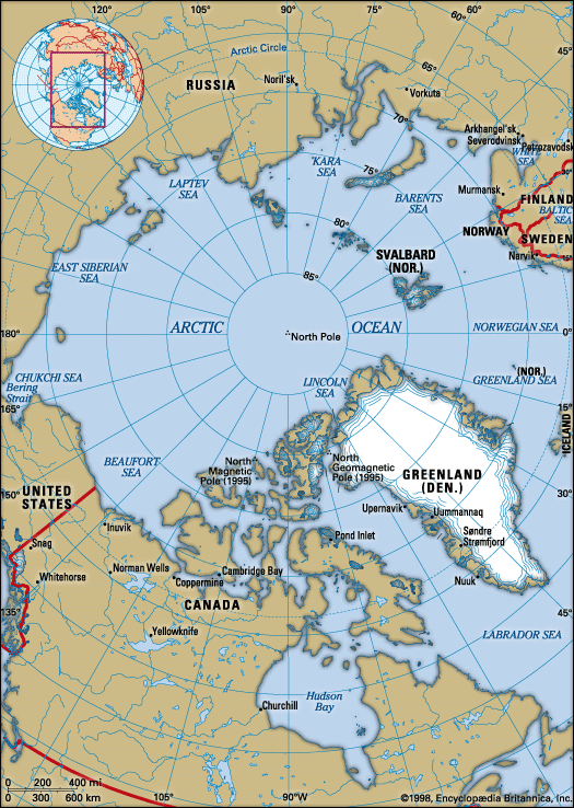
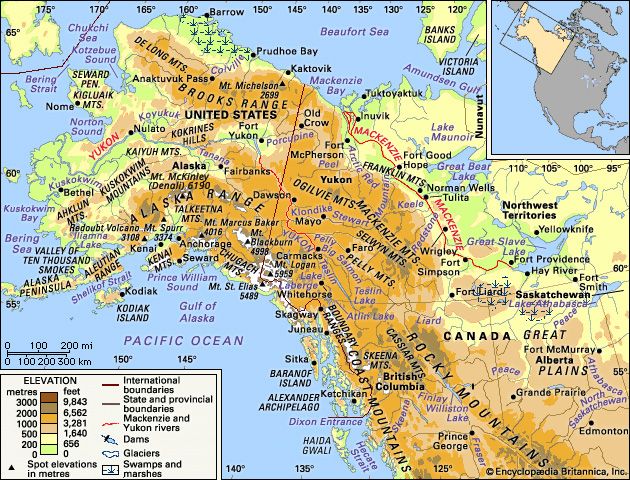
The Mackenzie River is a major river system located in northwestern North America, flowing through the Canadian north into the Beaufort Sea in the Arctic Ocean.1
Regarding its length, the measurement depends on how the system is defined:
- The Mackenzie River itself: Measured conventionally from Great Slave Lake, the river is 1,025 miles (1,650 km) long.1
- The entire river system: When including the headwaters of the Finlay River, the total length of the system is 2,635 miles (4,241 km).1
The river basin is the largest in Canada, draining an area of approximately 697,000 square miles (1,805,200 square km).1
How does the Mackenzie River impact the surrounding ecosystem and wildlife?
The Mackenzie River system plays a vital role in supporting diverse wildlife and sustaining the ecosystems of the Canadian north. As one of the world’s few remaining unspoiled regions, the basin provides essential habitats for a variety of species.1
Ecosystem and Wildlife Highlights
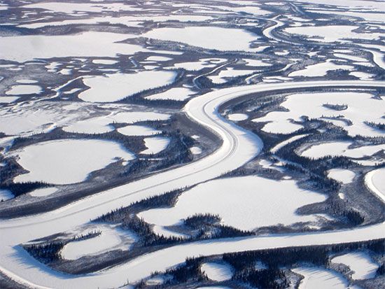
- Delta Habitat: The Mackenzie River delta is characterized by a complex network of intertwining channels, cutoff lakes, and circular ponds. These water bodies serve as an excellent habitat for muskrat, which have historically been a significant part of the local ecology and economy.3
- Aquatic Life: The basin’s large lakes, including Great Slave Lake and Lake Athabasca, support populations of lake trout and whitefish. While these species are subject to commercial fishing, their populations are managed through seasonal quotas to prevent depletion.4
- Forest Biodiversity: The vast forested plains within the basin are home to various fur-bearing animals, including marten, beaver, lynx, and fox, which remain part of the region’s natural heritage.4
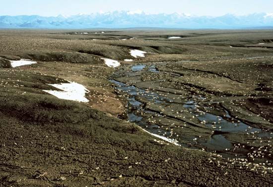
The presence of permafrost beneath the landscape further shapes the environment, influencing vegetation and the physical structure of the terrain across the Mackenzie Lowlands.3
Are there any major dams or hydroelectric projects on the Mackenzie River?
There are no major dams or hydroelectric projects located on the main stem of the Mackenzie River; its waters are utilized primarily for transportation rather than power generation.1
However, the broader Mackenzie River system does include significant hydroelectric developments on its tributaries:
- Peace River: In 1967, the W.A.C. Bennett Dam was completed near Hudson’s Hope, British Columbia. This project created Williston Lake and provides hydroelectric power that is transmitted hundreds of miles to the south.14
- Snare and Taltson Rivers: These rivers, which flow westward from the Canadian Shield into the Mackenzie Lowlands, host the only other developed waterpower sites in the region. These facilities supply electricity to the mines and residents of Yellowknife.1
What economic activities are associated with the Mackenzie River region?
The economy of the Mackenzie River region is diverse, though it is characterized by sparse population and resources that are often less accessible than those in southern Canada. Key economic activities include:
- Mineral Extraction: The region is a significant source of petroleum and natural gas. Major fields are located in northwestern Alberta, northeastern British Columbia, near the Mackenzie delta, and offshore in the Beaufort Sea. Additionally, the Athabasca Tar Sands contain enormous petroleum reserves. Historically, the region has also produced uranium, gold, lead, and zinc.
- Commercial Fishing: Large lakes in the basin, particularly Great Slave Lake and Lake Athabasca, support commercial fishing for lake trout and whitefish, which are transported to urban markets in Canada and the United States.
- Agriculture and Forestry: Farming, including grain and livestock production, is developed primarily in the southern Peace River area. Forests in the southern basin are utilized for lumber and pulpwood.
- Trapping: While less central to the economy than in the 19th century, trapping for pelts such as muskrat, marten, beaver, lynx, and fox continues throughout the basin.
- Transportation: The river itself serves as a vital artery for river transportation, utilizing shallow-draft tugs and barges to move goods.
Sources
- Mackenzie River — Encyclopædia Britannica
- Mackenzie River - The upper course — Encyclopædia Britannica
- Mackenzie River - The delta region — Encyclopædia Britannica
- Mackenzie River - People and economy — Encyclopædia Britannica
- Peace River — Encyclopædia Britannica
- Mackenzie River - History of Mackenzie River — Encyclopædia Britannica
Published on · 3 min read