Meseta Central
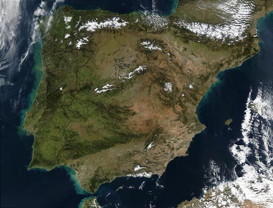
The Meseta Central has profoundly shaped Spain’s history and cultural development by serving as the nation’s geographic and political core. As the oldest and…
How has the Meseta Central influenced Spain’s history and cultural development?
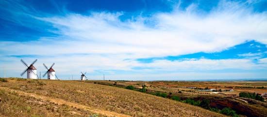
The Meseta Central has profoundly shaped Spain’s history and cultural development by serving as the nation’s geographic and political core. As the oldest and most complex geologic formation of the Iberian Peninsula, this vast plateau—centered on Madrid—dictated settlement patterns and economic life for centuries.12
Historically, the Meseta influenced the Reconquista and subsequent resettlement. In the northern Meseta (Castile and León), medieval urban centers emerged from Christian military foundations, characterized by walled nuclei and an open landscape suited for extensive dry farming. Conversely, the southern Meseta (Castile–La Mancha and Extremadura) saw more organized resettlement by powerful military orders, leading to the development of large, widely spaced villages and the latifundio system of large estates.3
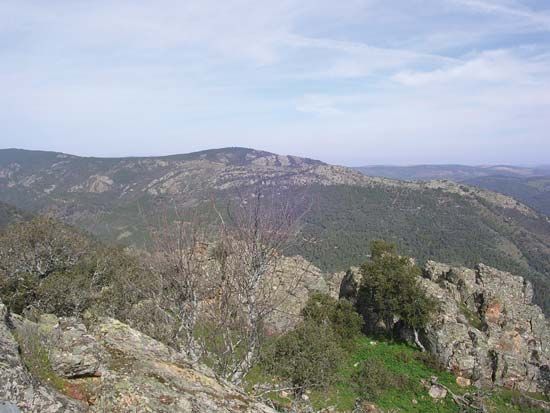
The plateau’s diverse geology—crystalline rocks in the west and limestone in the east—created distinct agricultural zones that defined local economies. Furthermore, the plateau’s high elevation and arid climate have long presented challenges, including soil erosion and the modern threat of desertification, which continue to influence Spanish land-use policies and environmental management.124
How has the Meseta Central affected Spain’s transportation network?
The Meseta Central has been a defining factor in the development of Spain’s transportation network, primarily due to its central location and challenging topography.
- Radial Design: Because the Meseta occupies the vast interior of the Iberian Peninsula, both the national railway and road systems were designed with a radial structure, using Madrid as the central hub.1
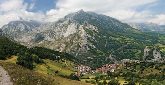
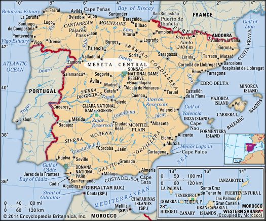
- Topographical Barriers: The plateau is surrounded and divided by significant mountain ranges, such as the Cantabrian Mountains to the north and the Sierra Morena to the south. These ranges have historically acted as formidable barriers to movement. For instance, the Sierra Morena’s rugged terrain necessitated the use of specific mountain passes, such as the Despeñaperros Pass, to connect the central plateau with southern regions like Sevilla.5
- Modern Infrastructure: While the modern road network was largely developed in the second half of the 20th century, the geographic constraints of the Meseta required significant engineering efforts to connect the interior to the coastal periphery. As traffic increased, the government implemented extensive plans to expand this radial network, often utilizing private investment and toll systems to manage the infrastructure across the plateau’s expansive and varied landscape.1
What major rivers originate from or flow through the Meseta Central?
The Meseta Central serves as the primary drainage basin for several of the most significant rivers on the Iberian Peninsula. Because the plateau is gently inclined toward the west, its major arteries flow toward the Atlantic Ocean.81
The major rivers associated with the Meseta Central include:
- Douro River: This river drains the northern Meseta, specifically the high basin of Castile and León of Castile and León.89
- Tagus River: Flowing through the southern Meseta, it is the longest river on the peninsula.81
- Guadiana River: Also draining the southern Meseta, this river system is characterized by complex hydrography, including intermittent streams and subterranean flows in limestone districts.839
While the Ebro and Guadalquivir rivers are major Spanish waterways, they are located in tectonic troughs outside the Meseta Central itself. Most rivers draining the Meseta are characterized by low annual volumes, deep valleys, and a long summer period of low water.198
What are some of the major cities located on the Meseta Central?
The Meseta Central is the vast interior plateau of Spain, serving as a historic and geographic hub for many of the country’s major cities. These urban centers often developed at nodal points in the road system or as administrative and military foundations.1
Key cities located on or associated with the Meseta Central include:
- Madrid: Situated at the center of the plateau, it serves as the national capital and the primary hub for Spain’s radial transportation network.102
- Toledo: The capital of Castile–La Mancha, this historic city is a leading commercial center within the southern Meseta.2
- Valladolid: A major city in Castile and León, reflecting the region’s history of medieval urban development.1
- Salamanca: Another prominent center in the northern Meseta, known for its historical significance and walled nuclei.1
- Burgos: A key city in the northern plateau that developed from Christian military foundations.1
- Cuenca: A provincial capital in the southern Meseta that has seen significant population growth since the early 20th century.2
- León: Historically significant as a military and administrative center in the north.1
- Soria: A city with ancient Celtiberian origins located in the northern Meseta region.1
Sources
- Meseta Central — Encyclopædia Britannica
- Spain - Human landscape — Encyclopædia Britannica
- Spain - Relief — Encyclopædia Britannica
- Spain - Soils — Encyclopædia Britannica
- Spain - Roads — Encyclopædia Britannica
- Sierra Morena — Encyclopædia Britannica
- Madrid - Modern Madrid — Encyclopædia Britannica
- Spain - Drainage — Encyclopædia Britannica
- Guadiana River — Encyclopædia Britannica
- Spain: Top Questions — Encyclopædia Britannica
- Castile–La Mancha — Encyclopædia Britannica
Published on · 3 min read