Mount Belukha
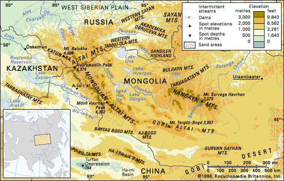
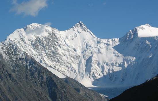
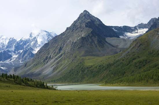
Mount Belukha is the highest peak in the Russian portion of the Altai Mountains, a complex mountain system located in Central Asia.
What is Mount Belukha?
Mount Belukha is the highest peak in the Russian portion of the Altai Mountains, a complex mountain system located in Central Asia.12
Situated within the Katun Mountains, this mountain features twin peaks, the highest of which reaches an elevation of 14,783 feet (4,506 meters). The area is characterized by year-round snow and extensive glaciation, with glaciers covering approximately 27 square miles (70 square km) of its surface. The largest of these, the Berel glacier, reaches an elevation of 6,396 feet (1,950 meters).12
What are the main characteristics of the Altai Mountains?
The Altai Mountains are a complex mountain system in Central Asia spanning Russia, China, Mongolia, and Kazakhstan. The name derives from the Turkic-Mongolian altan, meaning “golden.”2
Geological and Physical Features
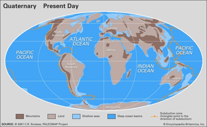
The system was formed by ancient mountain-building upthrusts and later reshaped by Quaternary Period upheavals and glaciation, which carved rugged, U-shaped valleys. The range is divided into three main sections:3
- Altai Proper: Features the highest peaks, including Mount Belukha (14,783 feet).23
- Mongolian Altai: Extends southeast from the border region of Russia, Mongolia, and China.4
- Gobi Altai: Dominates southern Mongolia, towering over the Gobi desert.24
The region is seismically active and rich in mineral resources, including gold, iron, and mercury. A dense network of rivers, such as the Katun and Biya, drains the area, alongside thousands of glacial and structural lakes.35
Vegetation Zones
The mountains host four distinct ecological zones: mountain subdesert, mountain steppe, mountain forest (dominated by conifers like larch and pine), and alpine regions.6
How do glaciers shape mountain landscapes?
Glaciers are powerful agents of landscape transformation, reshaping mountains through two primary processes: abrasion and plucking (or quarrying).78
Mechanisms of Erosion
- Abrasion: Glaciers act like giant sheets of sandpaper. They carry rock debris at their base, which grinds, polishes, and scratches the underlying bedrock, creating features ranging from microscopic striations to deep gouges.78
- Plucking: As ice flows over bedrock, it exerts stress that can fracture solid rock. Through mechanisms like pressure-induced cracking and refreezing (regelation), the glacier removes large blocks of stone, which then become additional “tools” for further abrasion.7
Large-Scale Landforms
Glacial activity fundamentally alters the topography of mountain ranges:
- U-Shaped Valleys: Glaciers inherit V-shaped stream valleys and transform them into broad, parabolic U-shaped valleys by eroding the base and lower sidewalls.94
- Cirques and Tarns: Glaciers often form in amphitheatre-shaped hollows called cirques. When these basins are over-deepened and later fill with water, they form lakes known as tarns.9
- Arêtes and Horns: The headward erosion of multiple cirques can narrow ridges into sharp, knife-edge arêtes. When several cirques erode around a single peak, they create a steep, jagged horn, such as the Matterhorn.9
- Hanging Valleys: Because smaller tributary glaciers erode more slowly than the main glacier, their floors are left high above the main valley floor upon melting, often resulting in waterfalls.4
Which countries share the Altai mountain system?
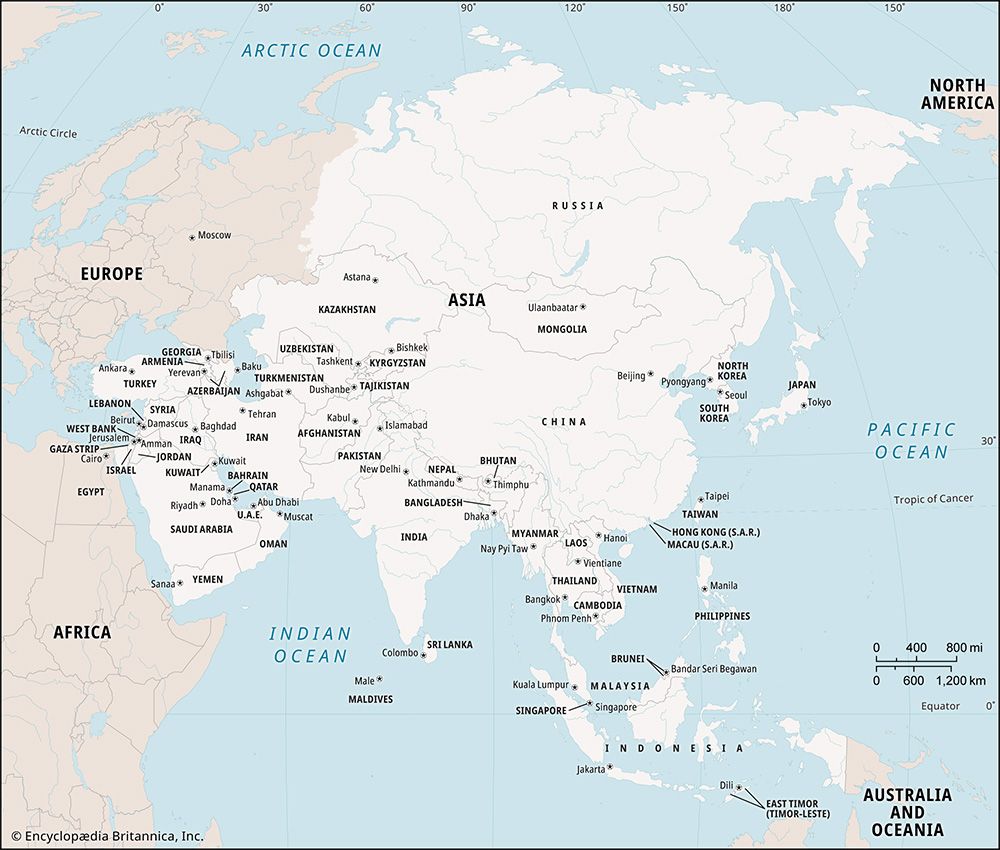
The Altai Mountains are a vast mountain system in Central Asia that spans four countries:2
- Russia: Home to the Altai proper, specifically within the Altay republic.23
- China: The range extends into the northern tip of the Xinjiang region and forms part of the border with Mongolia.23
- Mongolia: Contains the Mongolian Altai and the Gobi Altai, which dominate the country’s southern regions.23
- Kazakhstan: The system reaches into the extreme eastern portion of the country.23
The range stretches approximately 1,200 miles from the Gobi desert to the West Siberian Plain, with its highest peaks located near the intersection of the Russian, Mongolian, and Chinese borders.23
Sources
- Mount Belukha — Encyclopædia Britannica
- Altai Mountains — Encyclopædia Britannica
- Altai Mountains - Physiography — Encyclopædia Britannica
- Altai Mountains - Geology — Encyclopædia Britannica
- Altai Mountains - Drainage — Encyclopædia Britannica
- Altai Mountains - Plant life — Encyclopædia Britannica
- glacial landform - Cirques , tarns, U-shaped valleys, arêtes, and horns — Encyclopædia Britannica
- glacial valley — Encyclopædia Britannica
- glacial landform - Glacial erosion — Encyclopædia Britannica
- glacial landform - Small-scale features of glacial erosion — Encyclopædia Britannica
- Tien Shan - Glaciation — Encyclopædia Britannica
Published on · 3 min read