Narew River
The Narew River is an east-bank tributary of the Vistula River that spans 272 miles (438 km). It originates in the Belovezhskaya Forest in western Belarus…
What is Narew River?
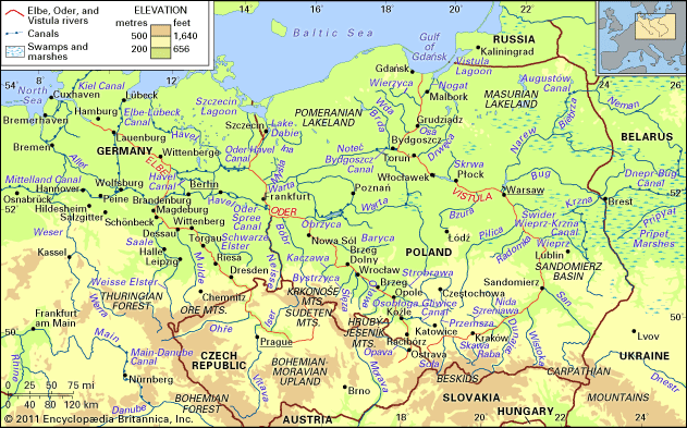
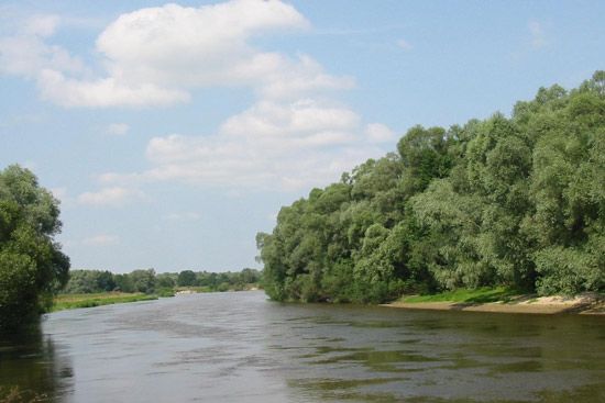
The Narew River is an east-bank tributary of the Vistula River that spans 272 miles (438 km). It originates in the Belovezhskaya Forest in western Belarus and flows westward through marshlands and wooded plains into Poland.1
As it travels, the river follows a winding path: it turns north near Bialystok, receives the Biebrza and Pisa rivers, and eventually swings south to join with its largest tributary, the Bug River. The Narew ultimately empties into the Vistula River approximately 20 miles (32 km) northwest of Warsaw. The river system, along with the Bug and the Dnieper–Bug Canal, serves as a vital link to the inland waterway networks of Russia, Ukraine, and Belarus.12
What makes the Belovezhskaya Forest a unique ecosystem?
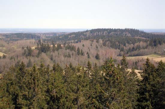
The Belovezhskaya Forest is a unique ecosystem primarily because it is one of the largest surviving remnants of the primeval mixed forest that once covered the European plain. Spanning over 460 square miles, it serves as a critical biological bridge, hosting a diverse range of flora and fauna native to both western and eastern Europe.2
Key features that define its ecological significance include:
- Ancient Flora: The forest contains old-growth trees, including pine, beech, oak, alder, and spruce, with some specimens reaching ages of 350 to 600 years and heights exceeding 150 feet.2
- Biodiversity: It provides a habitat for various wildlife, such as elk, deer, lynx, and wild boar.2
- Conservation Success: The forest is the most notable home of the European bison, or wisent, which was successfully reintroduced here after being hunted to extinction in the wild following World War I.2
- Protected Status: Recognized as the oldest nature preserve in Europe, it is designated as a World Heritage site.2
How does the Vistula River impact the geography of Poland?
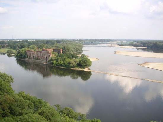
The Vistula River is the largest river in Poland, serving as a central geographical and economic artery that flows 651 miles from the southern mountains to the Baltic Sea. Its impact on the nation’s geography is profound:3
- Topographical Diversity: The river traverses diverse landscapes, beginning as a mountain stream in the Beskid range before transitioning into a lowland river that crosses the North European Plain. Its course is defined by three distinct reaches, carving gaps through hills and uplands and creating wide valleys that reach up to nine miles in width.34
- Delta Formation: At its mouth, the Vistula forms the Żuławy Wiślane, a fertile, forestless delta plain that sits partly below sea level. This region has been shaped by centuries of human engineering, including dikes and canals, to manage water flow and sediment.4
- Connectivity: The river acts as a vital link in the European waterway network. Through the Bydgoszcz Canal, it connects to the Oder River, while its eastern tributaries link it to the inland systems of Belarus, Ukraine, and Russia.34
- Urban Development: Historically and currently, the Vistula has dictated the location of major population centers, including Warsaw, Kraków, and Gdańsk, which developed along its banks to leverage the river for trade, transport, and water supply.35
What are the characteristics of a braided river like the Narew?
The provided search results do not characterize the Narew River as a braided river; rather, they describe it as a river flowing through wooded plains and marshlands. However, the characteristics of braided river systems in general are well-documented.1
Braided channels are defined by their dynamic and irregular nature, typically featuring multiple midstream bars composed of sand or gravel that subdivide the flow at low-water stages. Key characteristics include:8
- Channel Dynamics: These rivers possess weak banks, mobile bed material, and a very high width-depth ratio, which can exceed 1,000:1.8
- Flow Patterns: During high water, many bars are submerged. The river frequently changes position without the systematic lateral erosion seen in meandering rivers.89
- Floodplain Formation: Braided rivers create irregular floodplain deposits. Channels and islands are often abandoned and eventually coalesce as they fill with overbank sediment, often resulting in a thin cap of floodplain sediment atop a thick valley fill.9
- Environmental Context: They are commonly found near the edges of land ice or on outwash plains where valleys are filled with incoherent, coarse sediment.8
Sources
- Narew River — Encyclopædia Britannica
- Belovezhskaya Forest — Encyclopædia Britannica
- Vistula River — Encyclopædia Britannica
- Vistula River - The economy — Encyclopædia Britannica
- Vistula River - Physiography — Encyclopædia Britannica
- Vistula River - Hydrology of the Vistula River — Encyclopædia Britannica
- Vistula River - History — Encyclopædia Britannica
- river - Braided channels — Encyclopædia Britannica
- river - Floodplain deposits, origins, and features — Encyclopædia Britannica
Published on · 3 min read