North German Plain
The North German Plain features a maritime climate characterized by cool summers, mild winters, and strong northwesterly winds. Because the region is…
What is the climate like in the North German Plain?
The North German Plain features a maritime climate characterized by cool summers, mild winters, and strong northwesterly winds. Because the region is influenced by moist air carried inland from the North Sea by prevailing westerly winds, it experiences high humidity and frequent rainfall, particularly in the cooler seasons.12
While the climate is generally temperate, there are distinct regional variations. Precipitation is relatively low compared to other parts of Germany, typically ranging from 20 to 30 inches (500 to 750 mm) annually. As one moves eastward across the plain, continental influences become more pronounced, leading to a decrease in precipitation and more extreme temperature ranges. Additionally, winter temperatures in the plain tend to be consistently colder than in the south, partly due to winds arriving from Scandinavia, with a general cooling trend observed from west to east.2
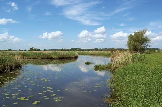
What are the major rivers and water bodies associated with the North German Plain?
The North German Plain is defined by a network of north-flowing rivers that serve as vital transportation arteries, connecting the region’s major ports to the interior of Europe.14
Major Rivers
The primary rivers draining the North German Plain include:
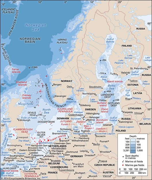
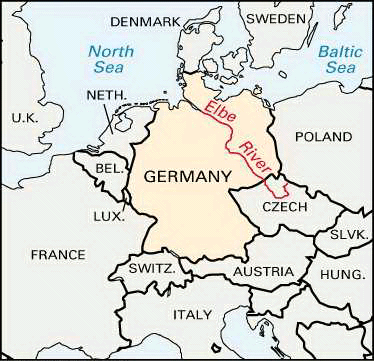
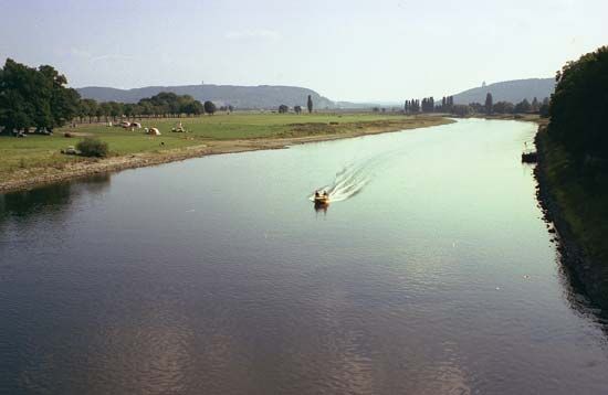
- Elbe River: One of central Europe’s most significant waterways, it flows northwest through Germany to the North Sea. It is a central axis for the region, with major cities like Hamburg and Magdeburg located along its course.15
- Weser River: Formed by the union of the Fulda and Werra rivers, the Weser flows northward through western Germany to the North Sea, supporting major port cities such as Bremen and Bremerhaven.16
- Rhine River: While it originates in the Alps, the Rhine flows through the western portion of the plain, serving as a critical commercial waterway.147
- Ems and Oder Rivers: These rivers also drain the lowland region, with the Oder marking part of the northeastern landscape.14
Waterways and Lakes
The region is connected by an extensive network of shipping canals, such as the Mittelland Canal, which links the Rhine, Weser, and Elbe rivers to Berlin.18
Natural lakes are relatively sparse, with the highest concentration found in the postglacial lowlands of the northeast. The largest is Lake Müritz in Mecklenburg–West Pomerania. Other notable, though smaller, lakes include Dümmer and Steinhude in Lower Saxony.4
What is the geographical extent of the North German Plain?
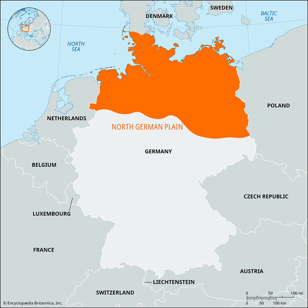
The North German Plain is a vast lowland region that serves as the northernmost morphological zone of Germany. It is a segment of the larger Great European Plain, which stretches from the coast of Belgium eastward across Germany and Poland into Belarus, the Baltic states, and Russia.18
Within Germany, the plain extends from the North Sea and Baltic Sea coasts in the north to the foreland of the Central German Uplands in the south. It also reaches northward through Schleswig-Holstein into the Jutland peninsula of Denmark.18
The width of the plain varies significantly; it is less than 90 miles (145 km) wide in the west and broadens considerably as it extends eastward. The region is characterized by low relief, with nearly the entire area lying less than 330 feet (100 meters) above sea level.111
How has the North German Plain influenced the cultural development of northern Germany?
The North German Plain has profoundly shaped the cultural and economic development of northern Germany through its unique geography, which facilitated maritime trade and fostered distinct linguistic traditions.
Economic and Commercial Influence
The region’s geography—characterized by a dense network of navigable rivers and access to the North Sea and Baltic Sea—served as a foundation for the Hanseatic League. This powerful association of merchant guilds and towns, centered in cities like Lübeck and Hamburg, dominated northern European trade from the 13th to the 15th century. By controlling the flow of goods between the industrial west and the resource-rich “colonial” lands of the east, these cities established a cultural and economic network that defined the region’s identity for centuries.1812
Linguistic Development
The plain’s topography also aligns with Germany’s major dialectal divisions. The region is the historical home of Low German (Plattdeutsch), which was spoken across the entire North German Plain by the Saxon people. While standard German eventually became the dominant language, Low German persists today, particularly among rural populations and in coastal areas, serving as a vital link to the region’s historical and ethnic heritage.13
Sources
- North German Plain — Encyclopædia Britannica
- Germany - Climate of Germany — Encyclopædia Britannica
- North Sea - Hydrology — Encyclopædia Britannica
- Elbe River — Encyclopædia Britannica
- Germany - Drainage of Germany — Encyclopædia Britannica
- Weser River — Encyclopædia Britannica
- Germany - Waterways — Encyclopædia Britannica
- Germany - The North German Plain — Encyclopædia Britannica
- Mittelland Canal — Encyclopædia Britannica
- Fulda River — Encyclopædia Britannica
- Germany - Land of Germany — Encyclopædia Britannica
- Hanseatic League — Encyclopædia Britannica
- North Sea — Encyclopædia Britannica
- Hanseatic League - The League at its outset — Encyclopædia Britannica
- Germany - Languages of Germany — Encyclopædia Britannica
- Germanic languages - The emergence of Germanic languages — Encyclopædia Britannica
Published on · 3 min read