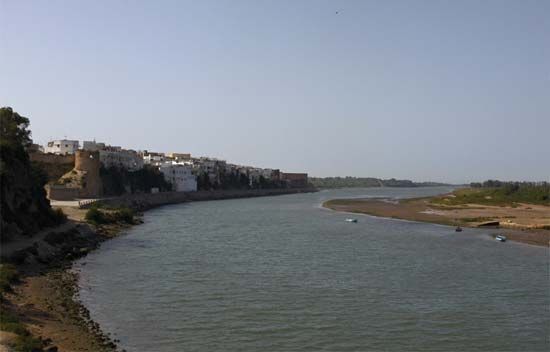
Oum el-Rbia River
The Oum el-Rbia River is the primary river of central Morocco. It originates in the Middle Atlas mountains and travels approximately 345 miles (555 km)…
What is Oum el-Rbia River?
The Oum el-Rbia River is the primary river of central Morocco. It originates in the Middle Atlas mountains and travels approximately 345 miles (555 km) westward, eventually emptying into the Atlantic Ocean near the town of Azemmour1.
While the river is not navigable, it is a vital, perennially torrential waterway that serves as a significant source of hydroelectric power and irrigation for the region. Several dams, such as Im Fout, Daourat, and Sidi Saïd Maachou, have been constructed along its course to harness these resources. The river’s basin supports the cultivation of various agricultural products, including wheat, citrus fruits, cotton, grapes, and flax. Its primary tributaries, the El-Abid and the Tessaout, join the river from the south.1
What are the main mountain ranges in Morocco?
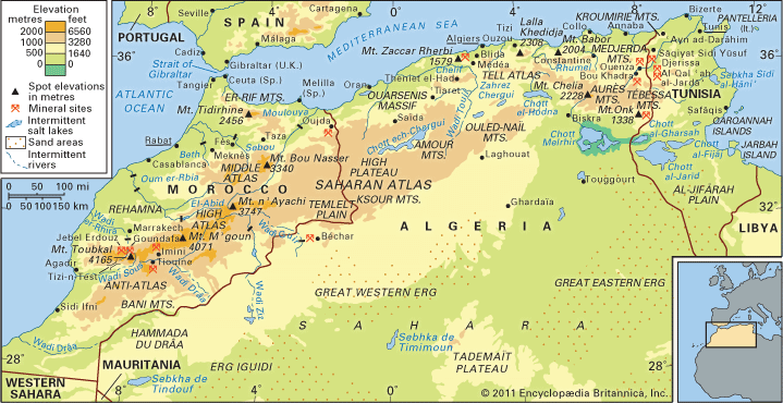
Morocco’s landscape is defined by two primary mountain systems: the Rif Mountains and the Atlas Mountains. These ranges act as significant geographical barriers, separating the Atlantic regions from the interior and the Sahara.2
The Rif Mountains
Located in northern Morocco, the Rif extends approximately 180 miles along the Mediterranean coast. This crescent-shaped range is geologically linked to the cordilleras of the Iberian Peninsula. Its highest peak is Mount Tidirhine, which reaches an elevation of 8,058 feet (2,456 meters).32
The Atlas Mountains
The Atlas system runs southwest to northeast across the country and is divided into three distinct chains:2
- High Atlas (Haut Atlas): The most prominent chain, extending 460 miles. It contains Mount Toubkal, which at 13,665 feet (4,165 meters) is the highest point in Morocco.42
- Middle Atlas (Moyen Atlas): This range trends northward from the High Atlas and reaches elevations of up to 10,958 feet (3,340 meters).2
- Anti-Atlas: Extending southwestward from the High Atlas toward the Atlantic, this range is characterized by a much drier climate compared to the northern chains.25
How is hydroelectric power generated from rivers?
Hydroelectric power is generated by converting the potential energy of water into mechanical energy and, ultimately, into electricity.7
The process typically involves the following steps:
- Collection: Dams are used to impound rivers, creating a reservoir that stores water at a higher elevation. The vertical distance between the water surface and the turbines is known as the head.7
- Conveyance: Water is directed downward through large pipes or tunnels called penstocks toward the powerhouse.7
- Generation: The force of the falling water causes turbines to rotate. These turbines are connected to generators, which convert the mechanical rotation into electrical energy.7
- Transmission: Transformers increase the voltage of the generated electricity to make it suitable for long-distance transmission.7
While this process provides a renewable energy source, it can have significant environmental impacts, such as disrupting fish migration and displacing communities.87
What crops are commonly grown in the Mediterranean climate?
The Mediterranean climate is characterized by mild, wet winters and hot, dry summers, a combination that supports a distinct range of agricultural products.
Key Crops
- Olives: The olive tree is perhaps the most iconic crop of the region. It thrives in the subtropical belts between 30° and 45° latitude, where it is cultivated extensively for both table use and olive oil production.9
- Cereals: Wheat and barley are the most significant field crops, often dominating the agricultural landscape in both coastal and interior regions. Other cereals such as corn (maize), rye, oats, and rice are also grown depending on local irrigation and soil conditions.10
- Fruits and Nuts: The region is famous for a wide variety of fruits, including citrus, grapes (for vineyards), figs, and various nuts like hazelnuts, walnuts, almonds, and pistachios.10
- Industrial and Vegetable Crops: Farmers frequently grow cotton, tobacco, sugar beets, sunflowers, and potatoes. Vegetable gardens are also a common feature of the agricultural landscape.10
Agricultural output often varies based on local topography and the availability of irrigation, with higher-value crops typically concentrated in coastal fringes.10
Sources
- Oum el-Rbia River — Encyclopædia Britannica
- Rif — Encyclopædia Britannica
- Exploring 7 of Earth’s Great Mountain Ranges - Atlas Mountains — Encyclopædia Britannica
- High Atlas — Encyclopædia Britannica
- Morocco - Relief of Morocco — Encyclopædia Britannica
- Atlas Mountains - Climate of the Atlas Mountains — Encyclopædia Britannica
- Did you know? — Merriam-Webster
- hydroelectric power — Encyclopædia Britannica
- Mediterranean Sea - Climate — Encyclopædia Britannica
- Europe - Mediterranean climate — Encyclopædia Britannica
- Mediterranean Sea - Biological resources — Encyclopædia Britannica
- Olive — Encyclopædia Britannica
- Turkey - Agriculture — Encyclopædia Britannica
Published on · 3 min read