Pelly River
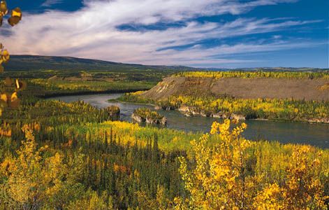
The Pelly River is a 378-mile (608-km) stream located in central Yukon, Canada. It serves as one of the primary headstreams of the Yukon River.
What is Pelly River?
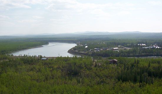
The Pelly River is a 378-mile (608-km) stream located in central Yukon, Canada. It serves as one of the primary headstreams of the Yukon River.1
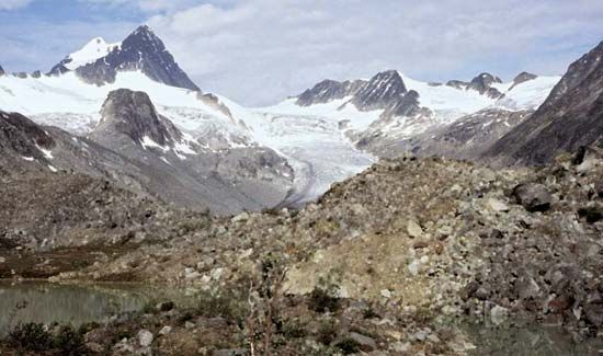
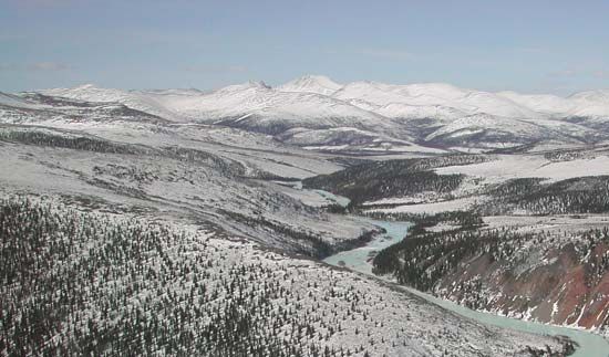
The river originates in the Mackenzie Mountains near the territory’s southeastern border and flows westward. Along its course, it receives two major tributaries, the Ross and Macmillan rivers, before it eventually joins the upper Yukon River at Fort Selkirk.1
Named in 1840 by explorer Robert Campbell, the river honors Sir John Henry Pelly, who served as the governor of the Hudson’s Bay Company. While the river is navigable for small boats for over 200 miles (320 km) up to Hoole Canyon, navigation is restricted in the shallows of Bradens Canyon.1
What is the significance of the Yukon River?
The Yukon River is a major North American waterway that has played a pivotal role in the history, economy, and cultural identity of northwestern Canada and Alaska. Spanning 1,980 miles (3,190 km), it served as a vital artery for exploration, trade, and the famous Klondike gold rush of 1896, which brought an influx of settlers and created an international mythology of the romantic frontier.34
Its significance is defined by several key factors:
- Historical Exploration and Trade: The river was a primary route for 19th-century fur traders, including those from the Hudson’s Bay Company, who established posts like Fort Selkirk to engage with local Indigenous populations.4
- Economic Development: Beyond the gold rush, the river basin has been a site for mining operations, including lead, zinc, silver, and copper extraction. It also served as the primary transportation corridor for freight and passengers until the mid-20th century, when it was largely superseded by road and air travel.54
- Natural and Cultural Landscape: The basin remains sparsely populated, preserving a vast, rugged wilderness that is now a significant draw for tourism. It encompasses diverse ecosystems, such as the Yukon–Charley Rivers National Preserve, and continues to be a defining feature of the region’s geography.56
What role did the Hudson’s Bay Company play in Canadian history?
The Hudson’s Bay Company (HBC) has been a central force in Canadian economic and political history since its incorporation in 1670. Originally chartered to seek a northwest passage and manage trade near Hudson Bay, the company was granted proprietary control over a vast region known as Rupert’s Land, which stretched from Labrador to the Rocky Mountains.89
For two centuries, the HBC was the primary driver of the fur trade, establishing a network of posts that facilitated interaction—and often intermarriage—with Indigenous peoples like the Cree, Innu, and Inuit. The company’s dominance was challenged by the North West Company until the two merged in 1821.89
The HBC functioned as a colonial authority until 1870, when it sold its remaining territories to the Canadian government. In the 20th century, the company transitioned from fur trading to retail, real estate, and natural resources. It remains a significant business entity in Canada today.89
What are the main geographical features of the Mackenzie Mountains?
The Mackenzie Mountains are a northern extension of the Rocky Mountains, located in Yukon and the Northwest Territories, Canada. They extend approximately 500 miles (800 km) northwestward from the British Columbia border.10
Key geographical features include:
- Watershed Role: The range acts as a critical watershed, separating the basins of the Mackenzie River to the east and the Yukon River to the west. It also serves as the source for the Pelly River.10
- Elevation and Relief: These mountains contain the highest and most rugged relief in the Northwest Territories. The highest point is Keele Peak at 9,751 feet (2,972 metres), with many other summits exceeding 8,000 feet (2,400 metres).1110
- Vegetation Zones: The tree line in the range is situated at approximately 3,000 feet (900 metres), meaning the upper slopes are barren and rocky.12
- Protected Areas: The region is home to Nahanni National Park, a UNESCO World Heritage site known for its spectacular scenery.10
Sources
- Pelly River — Encyclopædia Britannica
- Pelly — Merriam-Webster
- Yukon River — Encyclopædia Britannica
- Yukon River - History — Encyclopædia Britannica
- Yukon River - Physiography and hydrology — Encyclopædia Britannica
- Yukon River - People and economy — Encyclopædia Britannica
- Klondike River — Encyclopædia Britannica
- Hudson’s Bay Company — Encyclopædia Britannica
- Native American - Subarctic and Arctic peoples — Encyclopædia Britannica
- Mackenzie Mountains — Encyclopædia Britannica
- Franklin Mountains — Encyclopædia Britannica
- Northwest Territories - Land — Encyclopædia Britannica
- Mackenzie River - The lower course — Encyclopædia Britannica
- Mackenzie River - The upper course — Encyclopædia Britannica
- Mackenzie River — Encyclopædia Britannica
- Mackenzie Mountains — Merriam-Webster
Published on · 3 min read