Sahul Shelf
The Sahul Shelf is a stable continental shelf or platform located between the northern coast of Australia and the island of New Guinea. It is not situated in…
What is the Sahul Shelf and where is it located in the Pacific Ocean?
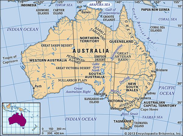
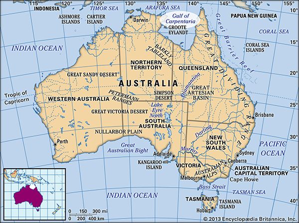
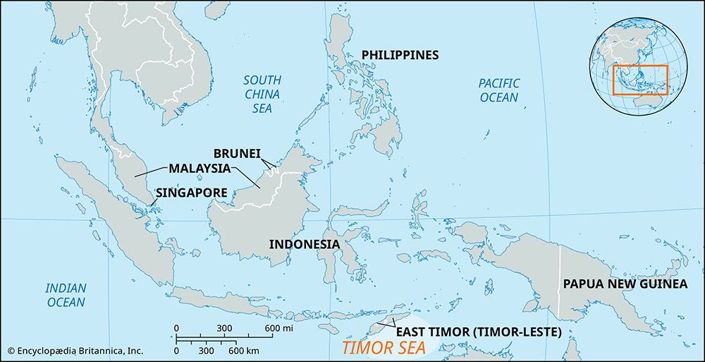
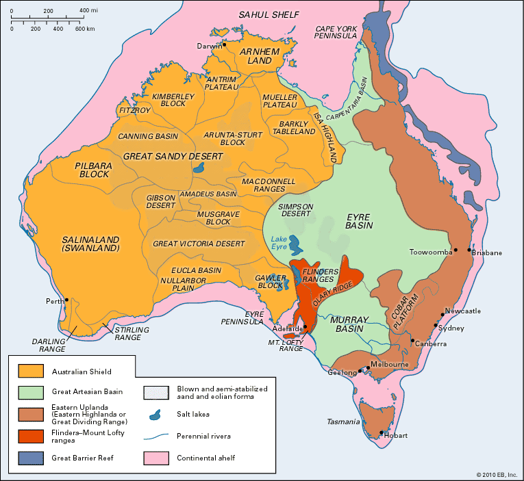
The Sahul Shelf is a stable continental shelf or platform located between the northern coast of Australia and the island of New Guinea. It is not situated in the Pacific Ocean proper; rather, it underlies the Arafura Sea, the Gulf of Carpentaria, and the Timor Sea, with parts extending toward the Indian Ocean.1
During the Pleistocene Epoch, when lower sea levels exposed the seafloor, this shelf served as a critical land bridge connecting Australia, Tasmania, and New Guinea to form the paleocontinent known as Sahul. Today, the shelf is largely submerged, though it remains a distinct structural feature that is separated from the Sunda Shelf to the northwest by the volcanic Lesser Sunda Islands and deep ocean troughs.213
How do oceanographers and geologists study the Sahul Shelf today?
Oceanographers and geologists study the Sahul Shelf using a variety of sophisticated marine exploration techniques designed to map the seafloor and analyze its underlying geological structure. Because electromagnetic radiation cannot penetrate deep into the sea, researchers rely on the following methods:
- Acoustic and Geophysical Techniques: Scientists use acoustic signals, including systems like Seabeam and GLORIA, to produce accurate, two-dimensional maps of the seafloor. These are often paired with seismic reflection techniques, which use sound waves triggered by explosive sources to measure the structure of the Earth’s crust deep beneath the sediment.4
- Satellite Measurements: By measuring sea surface topography, which is influenced by the gravitational pull of seafloor features, satellites provide a global view of the ocean bottom, helping to map large-scale structures.4
- Sampling and Coring: To understand the composition of the shelf, researchers collect physical samples using grabbing devices (such as clamshell snappers) and dredges. For deeper analysis, coring devices—including piston and hydraulic piston corers—are used to extract long, undisturbed sediment samples that provide a historical record of past climates and geological processes.4
- Wire-line Logging: In drilled holes, tools are lowered to measure electrical resistance, acoustic properties, and magnetic effects, allowing for immediate scientific analysis.4
What role did the Sahul Shelf play in human migration to Australia and New Guinea?
The Sahul Shelf played a pivotal role in human migration by forming the foundation of Sahul, a vast paleocontinent that connected Australia, Tasmania, and New Guinea during the Pleistocene Epoch.1
During the Pleistocene, global ice ages caused sea levels to drop by as much as 131 metres (430 feet), exposing the seafloor of the Arafura Sea, the Gulf of Carpentaria, and the Timor Sea. This emergence created expansive land bridges that allowed early humans to traverse the region.216
While these land bridges facilitated movement across the continent, the initial arrival of humans from Asia required crossing the region known as Wallacea—a series of archipelagos between the Sunda and Sahul shelves. Because some water gaps exceeded 120 miles (200 km), researchers conclude that early humans must have utilized watercraft to reach Sahul, marking some of the earliest confirmed seafaring in human history. Humans likely arrived between 45,000 and 50,000 years ago, though some archaeological evidence suggests they may have reached the region as early as 65,000 to 80,000 years ago.16
How was the Sahul Shelf formed, and what is its geological significance?
The Sahul Shelf is a stable continental platform extending from northern Australia to New Guinea. Its formation is characterized by its history as a landmass that was once above sea level; its surface retains erosional features, such as ancient stream channels, created when rivers flowed across it toward the ocean before it was submerged.1
Geologically, the shelf has undergone significant subsidence, a process driven by crustal forces that warped the platform downward. Evidence of this downward movement is found in the presence of drowned atolls along its margins, which now reach depths of up to 2,000 feet (600 metres).1
The shelf is of immense geological and historical significance because it served as the foundation for Sahul, a vast paleocontinent that emerged during the Pleistocene Epoch. As global sea levels dropped by approximately 131 metres (430 feet) during the Pleistocene ice ages, the shelf connected Australia, Tasmania, and New Guinea into a single, expansive landmass, facilitating the migration of early humans and the movement of fauna.2
Sources
- Sahul Shelf — Encyclopædia Britannica
- Sahul — Encyclopædia Britannica
- Sunda Shelf — Encyclopædia Britannica
- undersea exploration - Exploration of the seafloor and the Earth’s crust — Encyclopædia Britannica
- plate tectonics - Evidence supporting the hypothesis — Encyclopædia Britannica
- Australian Aboriginal peoples - Prehistory — Encyclopædia Britannica
- land bridge — Encyclopædia Britannica
- Pleistocene Epoch - Evolutionary changes — Encyclopædia Britannica
- Pleistocene Epoch - Coastal environments and sea-level changes — Encyclopædia Britannica
Published on · 3 min read