Saint Clair River
The Saint Clair River is 39 miles (63 km) long.
What is the length and average depth of the Saint Clair River?
The Saint Clair River is 39 miles (63 km) long.1
Regarding the average depth, the provided information does not specify a mean depth for the entire river. However, it notes that the South Channel of the river’s delta maintains a minimum depth of 27 feet (8 meters) to accommodate deep-drafted vessels.1
Where is the Saint Clair River located and what bodies of water does it connect?
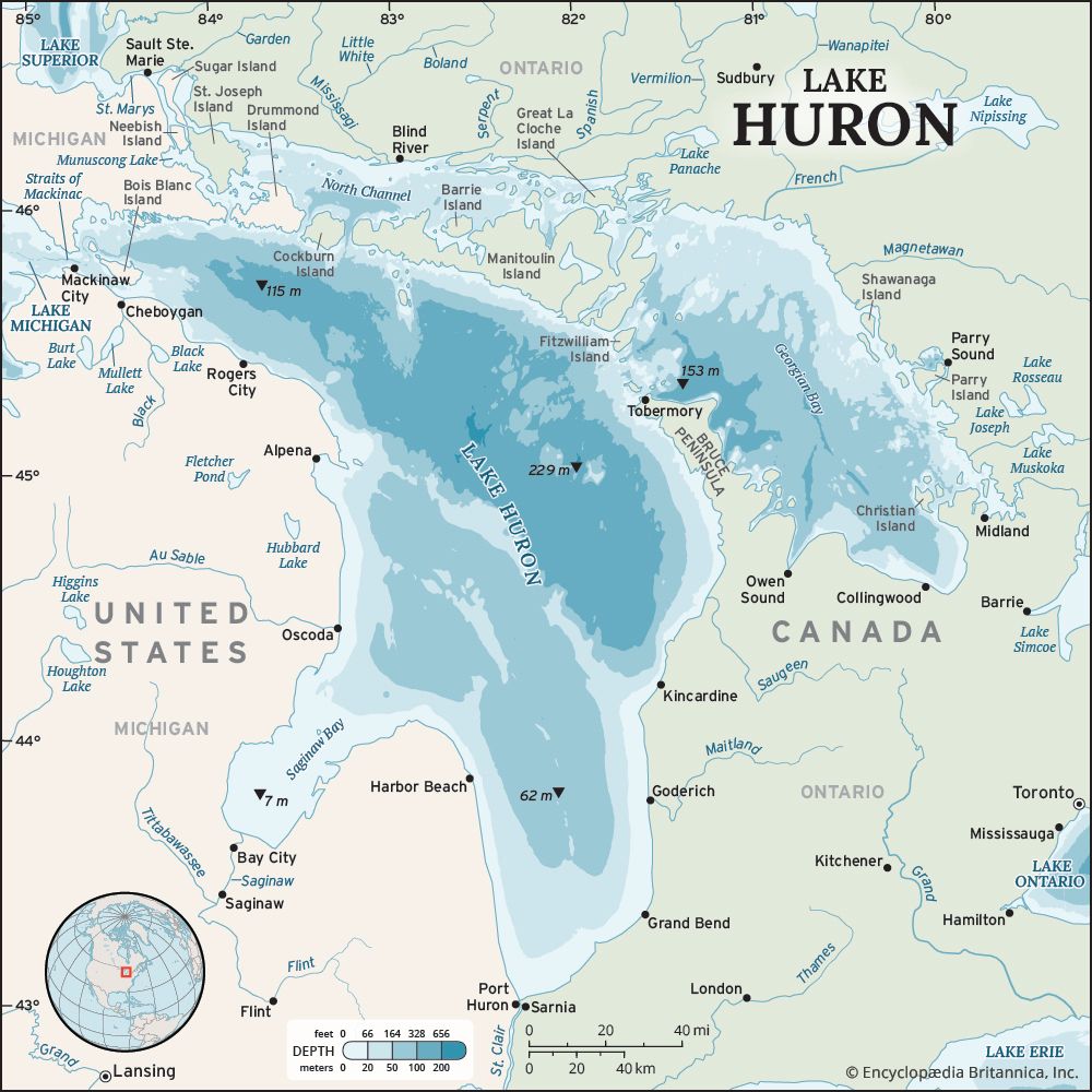
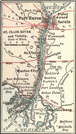
The Saint Clair River is located along the border between Michigan, United States, and Ontario, Canada.1
The river serves as the outlet for Lake Huron and flows southward to connect it with Lake Saint Clair. It functions as a vital link in the St. Lawrence Seaway, facilitating navigation between these bodies of water.1
How is the Saint Clair River used for transportation and commerce?
The Saint Clair River serves as a critical component of the St. Lawrence Seaway, functioning as a vital international trade route that connects Lake Huron to Lake Saint Clair.31
Transportation and Commerce
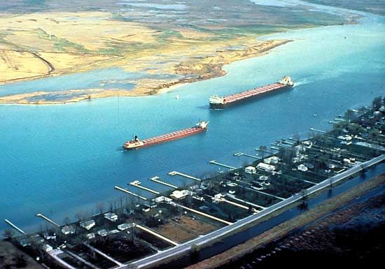
The river facilitates the movement of significant cargo through the Great Lakes system. Its South Channel, which maintains a minimum depth of 27 feet (8 meters), is specifically utilized by deep-drafted vessels to navigate the waterway. Major ports located along the river, such as Port Huron, Michigan, and Sarnia-Clearwater, Ontario, serve as key hubs for this commercial activity.1
As part of the broader Great Lakes–St. Lawrence River system, the river supports the transit of bulk commodities—including grain, iron ore, and coal—which are transported by specialized vessels known as lakers. These operations are essential to the economies of both the United States and Canada, though shipping is restricted to approximately eight and a half months annually due to severe winter conditions.3
How does the Saint Clair River contribute to the Great Lakes water system?
The Saint Clair River plays a fundamental role in the Great Lakes water system by serving as a primary drainage channel for the upper lakes.1
As the outlet for Lake Huron, the river carries a massive volume of water—averaging 183,000 cubic feet per second—southward toward Lake Saint Clair. This flow is a critical link in the hydrological chain that connects the upper Great Lakes to Lake Erie via the Detroit River.521
Beyond its hydrological function, the river is geologically notable for its large, silty delta at the entrance to Lake Saint Clair, which is the world’s largest delta entering a freshwater lake. By facilitating this continuous eastward discharge, the Saint Clair River helps maintain the flow of water through the system toward the St. Lawrence River and eventually the Atlantic Ocean.561
Sources
- Saint Clair River — Encyclopædia Britannica
- Lake Saint Clair — Encyclopædia Britannica
- St. Lawrence River - The economy — Encyclopædia Britannica
- Detroit River — Encyclopædia Britannica
- Saint Clair, Lake — Merriam-Webster
- Great Lakes - Physiography of Great Lakes — Encyclopædia Britannica
Published on · 2 min read