Sandomierz Basin
The Sandomierz Basin is a lowland region situated in southeastern Poland. It is defined as a structural depression positioned south of the Lublin Uplands and…
What is Sandomierz Basin?
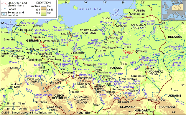
The Sandomierz Basin is a lowland region situated in southeastern Poland. It is defined as a structural depression positioned south of the Lublin Uplands and north of the Western Carpathian foothills.1
The region is primarily drained by the Vistula River and its tributary, the San River. Geographically, it serves as a natural transportation corridor, linking the upper Dniester River valley in the east with the Oświęcim Basin near Kraków in the west. The landscape is characterized by sandy tracts in the north and marshy terrain near the confluence of the Vistula and San rivers.1
Economically, the basin is significant for its natural resources, including deposits of sulfur, natural gas, and petroleum. The primary industrial and commercial hubs within the region are Rzeszów and Tarnów.1
What role does the Vistula River play in Poland’s geography?
The Vistula River is the largest river in Poland and a vital geographic feature of Eastern Europe. Spanning 651 miles, it originates in the Beskid range and flows northward across the North European Plain to the Baltic Sea at Gdańsk.3
The river serves several critical roles:
- Hydrological Hub: It drains approximately 85 percent of Polish territory and connects to broader European waterway systems via the Bydgoszcz Canal and links to the Narew and Bug rivers.3
- Urban Development: Many of Poland’s most significant cities, including the capital Warsaw, Kraków, Sandomierz, Płock, Toruń, and Gdańsk, are situated along its banks, serving as centers for industry, tourism, and history.34
- Historical Trade Route: Since the Stone Age, the Vistula has functioned as a primary trade artery, facilitating the movement of goods like salt, timber, and grain, and remains a focus for hydroelectric power and modern freight transport.5
How did the Carpathian Mountains influence the region’s landscape?
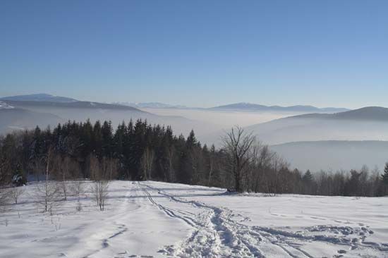
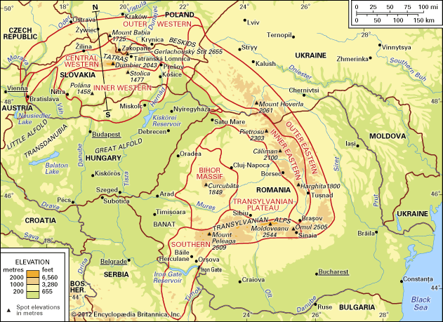
The Carpathian Mountains have profoundly shaped the landscape of the region through their geological formation, influence on drainage patterns, and impact on local climate.
Geological Influence
Dating from the Paleogene and Neogene periods, the Carpathians dominate the topography of southern Poland and surrounding areas. Their formation created a series of structural basins along their northern rim, which separate the mountain belt from older structural masses like the Bohemian Massif and the Little Poland Uplands. Unlike the Alps, where glaciation shaped most valleys, the relief of the Carpathians has been primarily sculpted by the action of running water.67
Drainage and Hydrology
The mountains act as a major drainage divide. While most runoff flows toward the Black Sea, the northern slopes feed the Vistula and Oder rivers, linking the region to the Baltic Sea. The high-water periods in spring and summer often lead to significant flooding due to poor ground retention, necessitating the construction of numerous storage basins throughout the range.8
Climatic Impact
The Carpathians function as an “island” of distinct climate amidst surrounding plains. They sit on the boundary between western and eastern Europe, creating a continental climate characterized by temperature inversions in deep depressions and varying precipitation levels based on altitude.9
What are some key historical events in the city of Sandomierz?
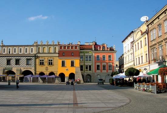
Sandomierz, a historic city in southeastern Poland, has played a significant role in the nation’s development since it was first mentioned in 1097. Its strategic location on the Vistula River made it a vital trade hub between the Baltic and Black seas.
Key historical milestones include:
- 12th–14th Century: Sandomierz served as the capital of the Sandomierz principality in the 12th century and received municipal rights in 1286. After suffering devastation from Tatar invasions in the late 13th century, the city was rebuilt by King Casimir III (the Great) in the 14th century.
- 16th–17th Century: The city reached an economic peak in the 16th century, becoming one of Poland’s largest towns. In 1570, it hosted the Sandomierz Agreement, a landmark accord where Polish Lutherans and Calvinists pledged cooperation to defend religious freedom. However, the 17th century brought decline due to plague, fires, and prolonged warfare.
- Modern Era: The city passed to Austrian control in 1772 before being returned to Poland in 1918.
Sources
- Sandomierz Basin — Encyclopædia Britannica
- Sandomierz — Encyclopædia Britannica
- Vistula River — Encyclopædia Britannica
- Vistula River - History — Encyclopædia Britannica
- Poland - Urban settlement — Encyclopædia Britannica
- Carpathian Mountains - Drainage of the Carpathian Mountains — Encyclopædia Britannica
- Poland - Relief — Encyclopædia Britannica
- Carpathian Mountains - Climate — Encyclopædia Britannica
- Carpathian Mountains — Encyclopædia Britannica
- Carpathian Mountains - Geology — Encyclopædia Britannica
- Carpathian Mountains - Physiography of the Carpathian Mountains — Encyclopædia Britannica
- Compact of Warsaw — Encyclopædia Britannica
- Poland - Władysław I — Encyclopædia Britannica
- Poland - Cultural institutions — Encyclopædia Britannica
- Poland - Social and cultural developments — Encyclopædia Britannica
Published on · 3 min read