Sierra Madre De Chiapas
The Sierra Madre de Chiapas is a crystalline block mountain range located in the state of Chiapas, southern Mexico. It serves as the westernmost section of…
What is the geographical location and extent of the Sierra Madre de Chiapas mountain range?
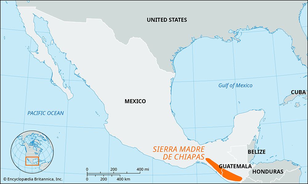
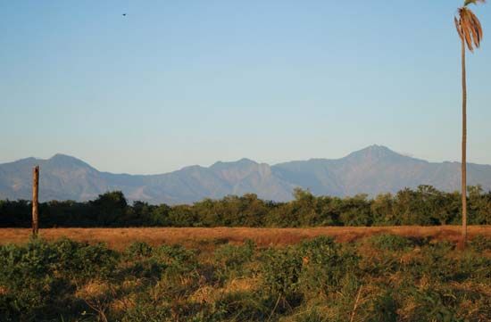
The Sierra Madre de Chiapas is a crystalline block mountain range located in the state of Chiapas, southern Mexico. It serves as the westernmost section of the Chiapas Highlands and runs parallel to the Pacific Ocean.12
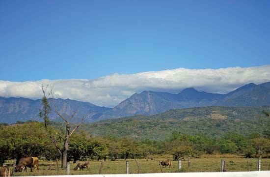
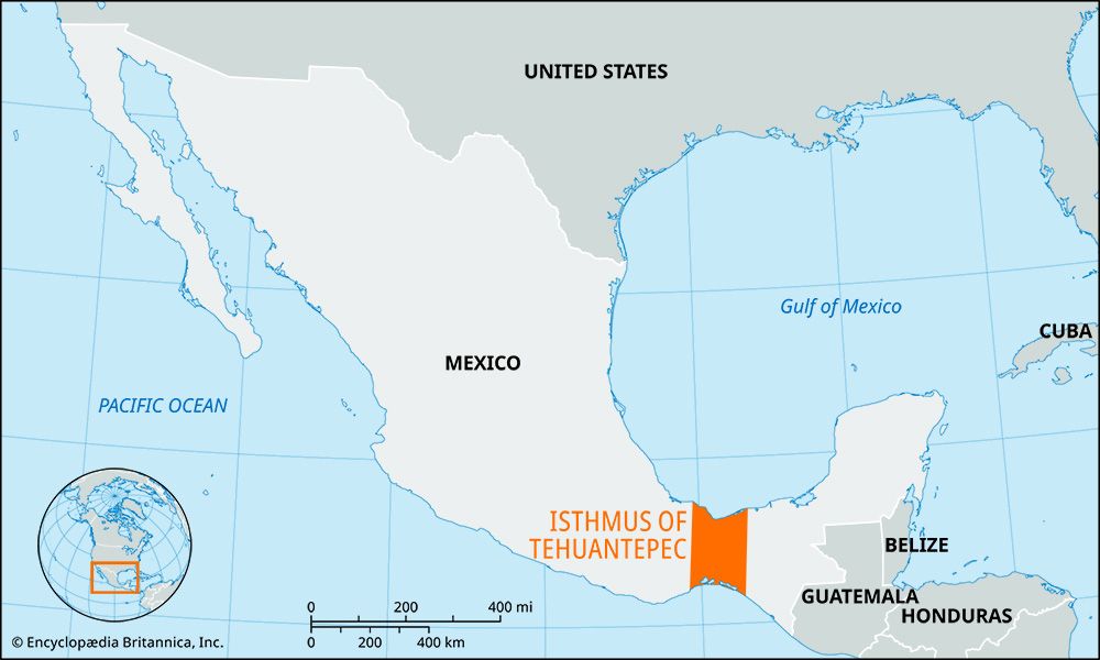
The range extends southeast from the Isthmus of Tehuantepec into western Guatemala, where it is known simply as the Sierra Madre. Geographically, the mountains rise sharply from the western coastal lowlands, reaching elevations exceeding 9,000 feet (2,700 meters) within 20 miles of the coast. To the east, the range slopes down toward the Grijalva River and the Central Valley of Chiapas. The range’s highest point is the Tacaná volcanic cone, which sits on the Mexico-Guatemala border and reaches an elevation of over 13,300 feet (4,050 meters).12
What indigenous communities inhabit the Sierra Madre de Chiapas, and how has the mountain range influenced their cultures?
The Sierra Madre de Chiapas and the broader Chiapas Highlands have long served as a home for indigenous populations, most notably the Maya. Archaeological evidence indicates that small groups of Maya inhabited the coastal slopes and valley regions of these mountains between 300 and 900 CE. Today, the Tzotzil and their close linguistic and cultural relatives, the Tzeltal, are prominent indigenous groups residing in the higher reaches of central Chiapas.
The rugged, mountainous terrain has significantly influenced these cultures in several ways:
- Agricultural Adaptation: The challenging topography necessitated specific agricultural practices. The Tzotzil, for example, utilize traditional methods such as clearing fields with fire and cultivating crops like corn, beans, and squash using hoes and digging sticks.
- Cultural Preservation: The relative isolation provided by the mountains has historically allowed indigenous groups to maintain distinct cultural identities, including unique clothing styles, traditional languages, and specific social structures.
- Syncretism: While many indigenous communities maintain deep-rooted ancestral beliefs, these are often intertwined with Roman Catholic traditions, such as the practice of ritual kinship (compadrazgo).
- Economic Life: The environment dictates local economies, ranging from subsistence farming and weaving to the production of cash crops like coffee and peaches at varying elevations.
How was the Sierra Madre de Chiapas formed geologically, and what are its main physical features?
The Sierra Madre de Chiapas is a crystalline range characterized as a system of block mountains. Geologically, it is distinct from the folded sedimentary structures found in other parts of the Mexican mountain system, as it is composed of crystalline basement rock.1
Physical Features
The range exhibits a dramatic and asymmetrical topography:
- Elevation and Relief: The mountains rise sharply from the Pacific coastal lowlands to heights exceeding 9,000 feet (2,700 meters) within a short distance of the coast.1
- Volcanic Activity: The range features significant volcanic activity, most notably the Tacaná volcanic cone, which stands at over 13,300 feet (4,050 meters) on the border between Mexico and Guatemala.1
- Orientation: The range extends southeast from the Isthmus of Tehuantepec along the Pacific coast, forming the westernmost section of the Chiapas Highlands.1
- Drainage and Slopes: To the east, the mountains slope downward toward the Grijalva River and the Central Valley of Chiapas.1
What types of wildlife can be found in the Sierra Madre de Chiapas?
The Sierra Madre de Chiapas and the surrounding Chiapas Highlands are part of one of the world’s most biologically diverse regions, serving as a critical habitat for a wide array of tropical species.1
The wildlife found in this area includes:
- Mammals: The region’s tropical rainforests and forests provide essential habitats for jaguars, tapirs, anteaters, and various species of monkeys.1
- Birds: The dense, lush environments of the southern selvas support diverse bird populations, including various species of parrots.1
- General Biodiversity: Because Mexico sits at the boundary of the Nearctic and Neotropical biogeographic realms, the area hosts a complex mix of fauna.1
While these species are native to the region, their populations face ongoing challenges due to habitat degradation caused by farming, logging, ranching, and mining activities, which have significantly reduced forest cover in Chiapas since the 1970s.1
Sources
- Sierra Madre de Chiapas — Encyclopædia Britannica
- Chiapas Highlands — Encyclopædia Britannica
- Sierra Madre - People of the Sierra Madre — Encyclopædia Britannica
- Tzotzil — Encyclopædia Britannica
- Middle American Indian - Cultural areas — Encyclopædia Britannica
- Mexico - Cultural milieu — Encyclopædia Britannica
- Sierra Madre - Physiography of the Sierra Madre — Encyclopædia Britannica
- Sierra Madre - Geology — Encyclopædia Britannica
- Sierra Madre - Plant and animal life — Encyclopædia Britannica
- Sierra Madre - Economy — Encyclopædia Britannica
- Mexico - Plant and animal life — Encyclopædia Britannica
Published on · 3 min read