Ulúa River
The Ulúa River is a significant waterway located in northwestern Honduras. Stretching approximately 150 miles (240 km), it originates in the central…
What is Ulúa River?
The Ulúa River is a significant waterway located in northwestern Honduras. Stretching approximately 150 miles (240 km), it originates in the central highlands through the union of the Jicatuyo and Otoro rivers near Santa Bárbara.1
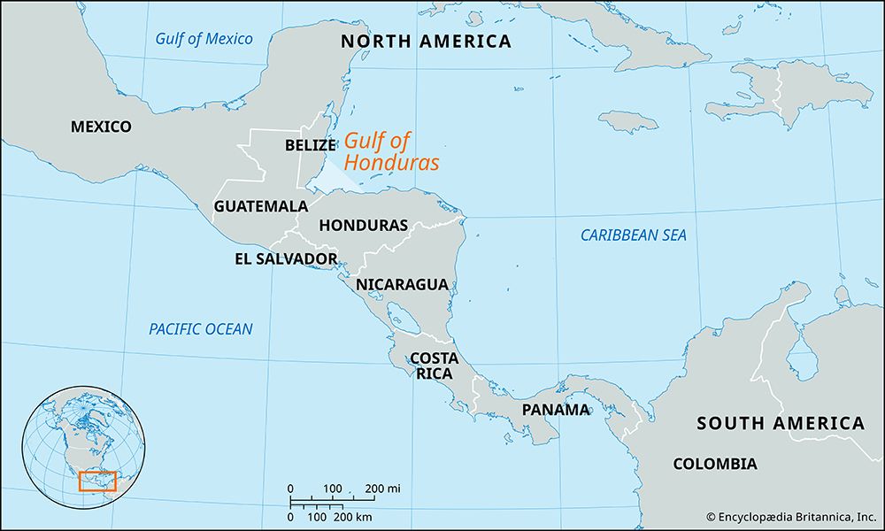
As the river flows northeast, it traverses the Sula Valley—a region renowned for its extensive banana plantations—where it becomes navigable. Ultimately, the river empties into the Gulf of Honduras in the Atlantic Ocean, positioned east-northeast of the port city of Puerto Cortés.1
What is the Sula Valley known for?
The Sula Valley, located in northwestern Honduras, is a vital economic and agricultural region. It is perhaps most famous for its extensive banana plantations, which have historically defined the area’s agricultural output.2
Beyond banana production, the valley serves as a critical hub for the country’s economy, supported by the following:
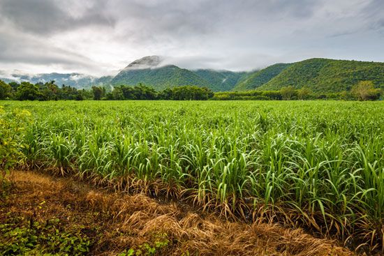
- Agricultural Diversity: In addition to bananas, the region produces sugarcane, rice, corn, sweet potatoes, cassava, and livestock for domestic consumption.1
- Industrial and Financial Center: The city of San Pedro Sula, situated within the valley, acts as the primary financial, manufacturing, and industrial center of Honduras. It hosts a wide range of industries, including textiles, chemicals, paper, and metalware, and features an industrial free trade zone.1
- Logistics and Commerce: The valley is a major transportation hub, connecting the interior of the country to the Gulf of Honduras via highways, railroads, and the Ulúa River, facilitating trade through ports like Puerto Cortés.13
How do rivers shape the geography of Honduras?
Rivers play a fundamental role in shaping the physical and economic landscape of Honduras. Because more than three-fourths of the country is mountainous, lowlands are primarily found along the coasts and within the river valleys that penetrate the interior.4
Geomorphic Impact
Valleys and canyons in Honduras are formed by the incising action of rivers, which lower the level of erosion through degradation as they flow toward a base level, typically the sea. These rivers originate in the rugged central highlands and carve paths through the terrain, creating fertile, flat-floored valleys that sit between 2,000 and 4,000 feet in elevation.546
Economic and Geographic Significance
The alluvial plains created by these river systems are among the most economically productive regions in the country:
- Agricultural Hubs: Rivers like the Ulúa River and the Aguán River deposit fertile soils that support extensive cultivation of bananas, rice, corn, and oil palm.416
- Infrastructure and Trade: These valleys serve as vital corridors for transportation, hosting rail lines and highways that connect the interior to major ports such as Puerto Cortés and La Ceiba.41
What are the major rivers in Central America?
Central America features several significant river systems that serve as vital transportation arteries, agricultural hubs, and sources of hydroelectric power. These rivers are generally categorized by whether they drain into the Pacific Ocean or the Caribbean Sea.
Major River Systems
- Lempa River: Rising in Guatemala and flowing through Honduras and El Salvador, this 200-mile-long river is El Salvador’s largest. It is essential for hydroelectric power and agricultural development in its southern basin.78
- Coco River: Stretching 485 miles, this river forms a significant portion of the border between Nicaragua and Honduras before emptying into the Caribbean.9
- Motagua River: As Guatemala’s longest river (approximately 250 miles), it flows into the Gulf of Honduras. It serves as a major transport route for agricultural exports like bananas and coffee.5
- San Juan River: Flowing 124 miles from Lake Nicaragua to the Caribbean, it has historically been considered for interoceanic canal routes.9
- Aguán River: Located in northern Honduras, this 150-mile river supports diverse agriculture, including citrus, rice, and African palm.10
- Río Grande de Matagalpa: A 267-mile river in Nicaragua that flows eastward across the lowlands to the Caribbean.9
Sources
- Ulúa River — Encyclopædia Britannica
- San Pedro Sula — Encyclopædia Britannica
- El Progreso — Encyclopædia Britannica
- Honduras - Relief — Encyclopædia Britannica
- Aguán River — Encyclopædia Britannica
- valley - Geomorphic characteristics — Encyclopædia Britannica
- El Salvador - Rivers and lakes — Encyclopædia Britannica
- Lempa River — Encyclopædia Britannica
- Nicaragua - Drainage — Encyclopædia Britannica
- Motagua River — Encyclopædia Britannica
Published on · 3 min read