Ungava
The Ungava Peninsula, a rocky, glacial-scoured plateau within the Canadian Shield, features an economy historically defined by its mineral wealth and…
What are the major economic activities and natural resources found in the Ungava Peninsula?
The Ungava Peninsula, a rocky, glacial-scoured plateau within the Canadian Shield, features an economy historically defined by its mineral wealth and traditional indigenous practices.
Mineral Resources and Mining
The region is noted for its immense iron-ore deposits, particularly along the Quebec-Newfoundland border and the western coastal regions of Ungava Bay. Exploitation of these deposits began in the 1950s, leading to the development of towns such as Schefferville. While these resources were once central to the regional economy, production has faced significant volatility, and many deposits are now largely depleted.123
Traditional and Commercial Activities
Beyond mining, the economy of the Ungava region is deeply connected to the Inuit population, who continue to engage in traditional activities. These include:
- Fur Trapping: The fur trade remains an important economic activity, with commercially viable species including mink, beaver, fox, lynx, and otter.4
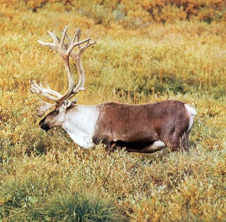
- Subsistence and Commercial Hunting/Fishing: Inuit communities rely on hunting caribou, seals, and whales for sustenance, while also participating in commercial fishing for species like Arctic char.56
What are the main physical features and landscapes of the Ungava Peninsula?
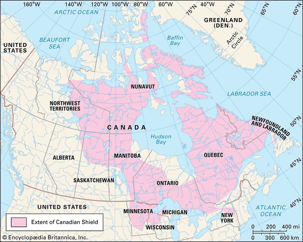
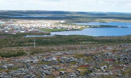
The Ungava Peninsula, located in northern Quebec, is a distinct physical region defined by its rugged, glacial-scoured terrain. As part of the Canadian Shield, the peninsula is characterized by a rocky plateau landscape featuring innumerable lakes and thin, poorly drained soils.1
The region’s physical geography is heavily influenced by its history of glaciation. During the Quaternary period, the area was shaped by the massive Laurentide Ice Sheet, which scoured the bedrock and left behind the characteristic landscape of exposed rock and scattered glacial debris seen today. The peninsula is bounded by the Hudson Strait to the north, Ungava Bay and Labrador to the east, the Eastmain River to the south, and the Hudson Bay to the west.168
The coastal areas, particularly around Ungava Bay, are marked by significant inlets and are fed by several large rivers, including the Feuilles, Arnaud, Baleine, and George. The bay itself contains features such as Akpatok Island, which rises to 930 feet.9
What is the geographical location and size of the Ungava Peninsula?
The Ungava Peninsula is a vast, peninsular region located in northern Quebec, Canada. It is geographically bounded by the Hudson Strait to the north, Ungava Bay and Labrador to the east, the Eastmain River to the south, and the Hudson Bay to the west.16
The peninsula occupies an area of approximately 240,000 square miles (622,000 square km). Physically, it constitutes a portion of the Canadian Shield, characterized by a rocky, glacial-scoured plateau filled with numerous lakes and thin, poorly drained soils.1
What is the origin and meaning of the name ‘Ungava’?
The provided search results do not contain information regarding the etymological origin or the specific meaning of the name “Ungava.” The available data defines the term geographically as a peninsular region of northern Quebec, Canada, bounded by the Hudson Strait, Ungava Bay, Labrador, the Eastmain River, and Hudson Bay.1061
Sorry, the Britannica knowledge base does not contain this information.
Sources
- Ungava — Encyclopædia Britannica
- Quebec - Resources and power — Encyclopædia Britannica
- Nunavut - Fishing and hunting — Encyclopædia Britannica
- Inuit: Top Questions — Encyclopædia Britannica
- Quebec - Agriculture, forestry, and fishing — Encyclopædia Britannica
- Ungava Peninsula — Merriam-Webster
- Ungava Bay — Encyclopædia Britannica
- Quaternary - Glaciation — Encyclopædia Britannica
- Pleistocene Epoch - Glaciation — Encyclopædia Britannica
- Ungava — Merriam-Webster
Published on · 2 min read