Burdekin River
The Burdekin River is a major coastal river located in eastern Queensland, Australia. Rising on the western slopes of the Seaview Range, it flows for 440…
What is Burdekin River?
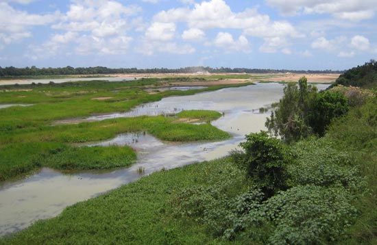
The Burdekin River is a major coastal river located in eastern Queensland, Australia. Rising on the western slopes of the Seaview Range, it flows for 440 miles (710 km) before emptying into the Pacific Ocean at Upstart Bay. The river system drains an expansive area of 50,400 square miles (130,500 square km) and is characterized as an intermittent stream.12
Its upper course passes through Charters Towers, a region primarily used for cattle raising, while the lower course is dominated by sugarcane cultivation. Key tributaries include the Suttor, Star, and Bowen rivers. The river was first explored in 1845 by Friedrich Ludwig Leichhardt and named in honor of the wife of Thomas Burdekin, a financier of the expedition. A notable landmark, a 3,619-foot bridge, spans the river’s mouth to connect the towns of Ayr and Home Hill.1
Who was Friedrich Ludwig Leichhardt?
Ludwig Leichhardt (1813–1848) was a Prussian-born naturalist and explorer who became one of Australia’s earliest national heroes. After studying natural science in Europe, he arrived in Sydney in 1842 with the goal of exploring the Australian interior.3
Leichhardt is best known for his successful 1844–1845 expedition from the Darling Downs to Port Essington, which was initially feared lost but returned to great acclaim. During his explorations, he discovered extensive areas suitable for settlement and identified many important geographical features, including the Burdekin River, which he explored in 1845.31
In 1848, Leichhardt embarked on a third expedition intended to traverse the continent from the Darling Downs to the west coast. He and his party disappeared without a trace after April 4, 1848. His mysterious fate prompted search efforts that continued for nearly a century, and his life and legend have since inspired various works, including Patrick White’s 1957 novel Voss.3
How does sugarcane farming impact the local environment?
Sugarcane farming significantly impacts the local environment through chemical usage, land management practices, and the introduction of non-native species.
Chemical Runoff and Pollution
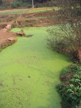
A primary environmental concern is the application of fertilizers containing nitrogen, phosphorus, and potassium. In regions with high rainfall, these nutrients often leach into the soil or wash away as runoff, entering nearby waterways. This process contributes to the development of harmful algae blooms, which can degrade aquatic ecosystems.5
Invasive Species and Pest Control
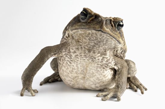
Efforts to manage pests have sometimes resulted in severe ecological consequences. For example, in 1935, the Australian government introduced cane toads to plantations in Queensland to control beetles. The toads failed to manage the beetle population and instead became one of the world’s most destructive invasive species, spreading rapidly across northeastern Australia.6
Burning and Land Management
Traditionally, sugarcane fields were burned before or after harvest to clear leaves, trash, and pests like rodents and snakes. However, due to growing environmental awareness, many areas are shifting toward harvesting unburned cane to reduce air pollution and preserve soil health.7
What are some other major rivers in Queensland?
Queensland features a diverse network of rivers that play a vital role in the state’s geography and economy. Some of the major rivers include:
- Flinders River: As the longest river in Queensland, it flows for 520 miles (837 km) from the Eastern Highlands to the Gulf of Carpentaria.8
- Fitzroy River: Formed by the confluence of the Dawson and Mackenzie rivers, this river flows through eastern Queensland and is navigable from its mouth at Port Alma to Rockhampton.9
- Brisbane River: This river flows through the state’s capital, Brisbane, and is a significant waterway for the southeastern region.10
- Burdekin River: A major intermittent stream that drains the lowlands east of the mountains and is central to large-scale irrigation schemes.211
- Barron River and Burnett River: These are also notable intermittent streams that drain the sedimentary basins of the state’s eastern region.2
Sources
- Burdekin River — Encyclopædia Britannica
- Queensland - Relief and drainage — Encyclopædia Britannica
- Ludwig Leichhardt — Encyclopædia Britannica
- Australia - Culture — Encyclopædia Britannica
- Sugarcane - Culture and cultivation — Encyclopædia Britannica
- sugar - Cane harvesting and delivery — Encyclopædia Britannica
- Sugarcane - Pests — Encyclopædia Britannica
- Fitzroy River — Encyclopædia Britannica
- Brisbane River — Encyclopædia Britannica
- Flinders River — Encyclopædia Britannica
- Queensland - Federation and the state of Queensland — Encyclopædia Britannica
- New South Wales - Drainage — Encyclopædia Britannica
Published on · 3 min read