Cape Hatteras National Seashore
Cape Hatteras National Seashore is a unique coastal environment located on the Outer Banks of North Carolina. It features a diverse range of ecosystems…
What unique wildlife and ecosystems can be found at Cape Hatteras National Seashore?
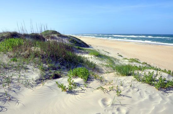
Cape Hatteras National Seashore is a unique coastal environment located on the Outer Banks of North Carolina. It features a diverse range of ecosystems, including expansive beaches, dynamic sand dunes, salt marshes, and inland woodlands.1
Ecosystems and Wildlife
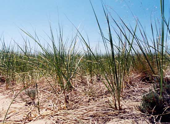
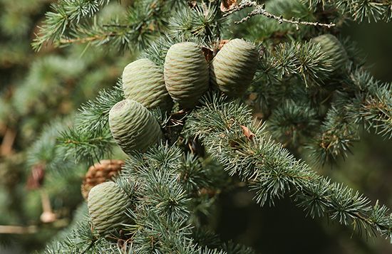
The landscape is characterized by a variety of vegetation adapted to coastal conditions. Near the shoreline, you will find various beach grasses, while further inland, the terrain transitions into forests composed of oak, cedar, and holly.1
The area serves as a critical habitat for wildlife, particularly for aquatic birds. Hundreds of species utilize the seashore as a nesting ground or as a vital stopover point during their annual migrations. When combined with the adjacent Pea Island National Wildlife Refuge, the region forms a continuous, protected corridor that supports these diverse avian populations.1
How do the strong currents and shifting sandbars impact navigation around Cape Hatteras?
The waters surrounding Cape Hatteras have long been recognized as a significant hazard to maritime navigation. The primary danger stems from treacherous shallows located to the southeast of the cape, most notably the area known as Diamond Shoals.
These shifting sandbars and shallow depths create a perilous environment for vessels, contributing to a history of numerous shipwrecks in the region. The navigational challenges are further complicated by the complex nature of the Gulf Stream. Off the coast of North Carolina, the path of this powerful current becomes twisted, often developing large swirls and eddies that shift over time.341
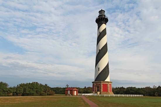
To mitigate these risks, the area has historically relied on navigation aids, including the iconic Cape Hatteras Lighthouse. Although these structures are no longer used for active navigation, they stand as a testament to the long-standing efforts to guide mariners safely past the cape’s volatile coastal geography.3
How does the Outer Banks culture influence the Cape Hatteras National Seashore?
The culture of the Outer Banks is deeply woven into the identity of Cape Hatteras National Seashore, reflecting a long history of maritime life and isolation. For centuries, the islands were inhabited primarily by small communities of fishermen and farmers, whose legacy remains visible in the villages that dot the landscape and the unique local traditions that persist today.26
Cultural influences on the seashore include:
- Maritime Heritage and Folklore: The region is famous for its “Graveyard of the Atlantic” reputation, with a history defined by over 2,000 shipwrecks. This maritime past is immortalized in local legends, including tales of pirate lore—most notably the story of Blackbeard, who is said to have met his end near the fishing village of Ocracoke.526
- Linguistic Traditions: On Ocracoke Island, residents have historically maintained a distinct, Elizabethan-sounding dialect, a cultural marker that fascinates visitors and highlights the relative isolation the islands experienced for generations.5
- Historic Preservation: The national seashore preserves significant structures that anchor the area’s cultural narrative, such as its three historic lighthouses. These sites serve as monuments to the generations of mariners and local residents who navigated the treacherous Diamond Shoals.6
Where is Cape Hatteras National Seashore located, and what are its geographical features?
Cape Hatteras National Seashore is located along the Outer Banks of eastern North Carolina, U.S. It encompasses a 47-square-mile area spread across three narrow barrier islands: Bodie, Hatteras, and Ocracoke.1
Geographically, these islands are situated between the Atlantic Ocean to the east and Pamlico Sound to the west. The landscape is characterized by a continuous 70-mile stretch of beaches, salt marshes, sand dunes, and woodlands. The vegetation varies from beach grasses near the shoreline to inland forests of oak, cedar, and holly.1
The area is also defined by its dynamic coastal environment, including shifting sandbars like the Diamond Shoals and a history of significant beach erosion. The islands serve as a vital habitat for numerous species of migratory aquatic birds.1
Sources
- Cape Hatteras National Seashore — Encyclopædia Britannica
- Cape Lookout National Seashore — Encyclopædia Britannica
- Cape Hatteras — Encyclopædia Britannica
- Gulf Stream — Encyclopædia Britannica
- Outer Banks — Encyclopædia Britannica
- North Carolina - Cultural life — Encyclopædia Britannica
- lagoon - Waves , tides, and surf — Encyclopædia Britannica
Published on · 3 min read