Cottian Alps
The Cottian Alps are a segment of the Western Alps that stretch along the border between France and Italy. The range is situated between the Maddalena Pass…
What is Cottian Alps?
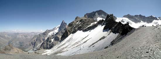
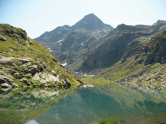
The Cottian Alps are a segment of the Western Alps that stretch along the border between France and Italy. The range is situated between the Maddalena Pass and the Maritime Alps to the south, and the Mont Cenis pass and the Graian Alps to the north.12
The highest point in the range is Mount Viso, which reaches an elevation of 12,602 feet (3,841 meters). The western spurs of this region are known as the Dauphiné Alps, and the area is a popular destination for climbing and skiing.1
Historically, the region takes its name from Cottius, a 1st-century BCE king and Roman prefect who governed the local Ligurian tribes. Under the Roman Empire, the area was eventually organized into the province of Alpes Cottiae.3
Who was King Cottius and how did he influence the region?
Cottius (flourished 1st century BCE) was a Ligurian leader who served as a king and later a Roman prefect over tribes in the region now known as the Cottian Alps.3
His influence on the region was defined by his strategic transition from an independent ruler to a Roman ally:
- Diplomatic Integration: After succeeding his father, King Donnus, Cottius maintained independence while the emperor Augustus conquered surrounding areas. Augustus eventually secured his submission by appointing him prefect over approximately 12 tribes.34
- Infrastructure Development: Cottius significantly improved the road over the Montgenèvre Pass, a vital route connecting Italy and France.34
- Cultural Legacy: Around 8 BCE, he erected a triumphal arch in Susa (ancient Segusio) to honor Augustus; the structure remains standing today.3
Following his death, his son was granted the title of king by the emperor Claudius, but the territory was eventually annexed by Nero as the Roman province of Alpes Cottiae.34
What are the main differences between the Western and Eastern Alps?
The Alps are divided into Western, Central, and Eastern segments, each characterized by distinct geographical and physical features.
Western Alps
The Western Alps extend from the Mediterranean coast through southeastern France and northwestern Italy to Lake Geneva and the Rhône valley in Switzerland.5
- Topography: This region contains the highest peaks in the entire Alpine system, including the glacier-covered dome of Mont Blanc, which reaches 15,771 feet (4,807 meters).5
- Drainage: Rivers in this segment generally flow west into the Rhône or east into the Po.5
- Features: The landscape ranges from the low-lying, arid limestones of the Maritime Alps near the Mediterranean to the crystalline massifs of the inner Alps.5
Eastern Alps
The Eastern Alps stretch from the Brenner Pass eastward toward Trieste and the Balkan Peninsula.56
- Topography: Generally lower in elevation than the Western Alps, the highest peak in the Austrian section, the Grossglockner, reaches 12,460 feet (3,798 meters).5
- Drainage: These ranges exhibit a northerly and southeasterly drainage pattern, with many rivers, such as the Inn, Lech, and Drau, eventually discharging into the Danube River.5
- Features: This segment includes the Dolomite Alps, the Bavarian Alps, and the Julian Alps. Valleys in the east are often at lower elevations, sometimes as low as 300 feet.5
How do mountain passes like Montgenèvre shape travel in the Alps?
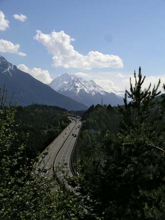
Mountain passes have served as vital conduits for travel and communication across the Alps for millennia, transforming the region’s rugged terrain from an impassable barrier into a network of interconnected valleys.11
Historical Significance
Beginning with Celtic tribes, these high-altitude routes were initially developed as trade paths. The Romans later expanded these trails into narrow roads to facilitate military expansion and administrative control. For example, the Montgenèvre Pass was opened in 77 BCE by Pompey the Great, becoming a principal route into Gallia Comata. Similarly, the Brenner Pass has functioned as a major entrance to Italy since Roman times, evolving into one of Europe’s great trade routes by the 14th century.121314
Modern Evolution
The nature of Alpine travel has shifted significantly due to technological advancements:
- Infrastructure: Passes have evolved from simple paths to paved, multilane highways. Napoleon, for instance, commissioned a road across the Montgenèvre Pass in the early 19th century.1113
- Tunnels: The construction of rail and road tunnels has had the most profound impact, allowing year-round passage beneath the massifs. The Albula Pass tunnel, opened in 1903, exemplifies how such infrastructure increases accessibility, allowing vehicles to bypass high-altitude routes often closed by snow.114
- Economic Impact: While these developments ended the isolation of Alpine communities and fueled 20th-century tourism, they have also contributed to environmental degradation in the region.11
Sources
- Cottian Alps — Encyclopædia Britannica
- Cottian Alps — Merriam-Webster
- Cottius — Encyclopædia Britannica
- Alpes — Encyclopædia Britannica
- Alps - Physiography — Encyclopædia Britannica
- Italy - Mountain ranges — Encyclopædia Britannica
- Alps — Encyclopædia Britannica
- Alps - Climate of the Alps — Encyclopædia Britannica
- Alps - Geology — Encyclopædia Britannica
- Alps - Settlement — Encyclopædia Britannica
- Montgenèvre Pass — Encyclopædia Britannica
- Alps - Transportation — Encyclopædia Britannica
- Albula Pass — Encyclopædia Britannica
- Brenner Pass — Encyclopædia Britannica
Published on · 3 min read